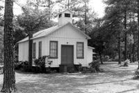
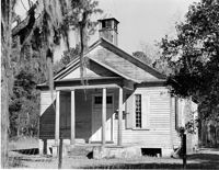
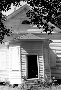
Guild Hall (Church of the Holy Family) - Barrows Historic District. View of Front. Moncks Corner, S.C.;6.5" x 9.5" B/W photo. Box 2, Folder 1-1-1. Three copies.
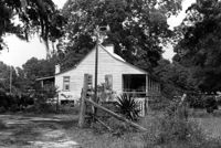
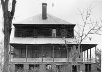
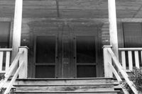
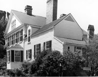
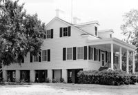
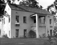
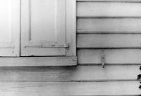
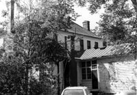
1920 Residence of Charley Jones - Barrows Historic District. View of West side. Moncks Corner, S.C.;6.5" x 9.5" B/W photo. Box 2, Folder 1-1-1. Three copies.
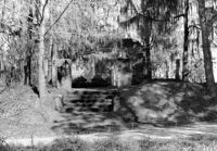
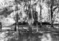
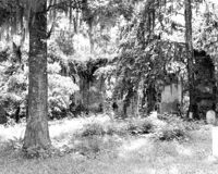
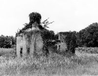
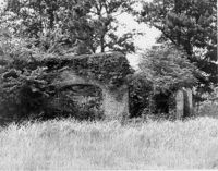
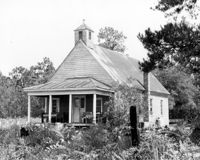
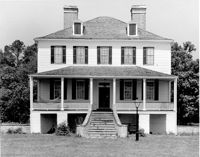
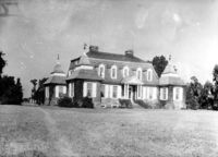
North Chachan Plantation, Chachan Drive. Pavilion - View of Side and Front elevation. Moncks Corner, SC.;8" x 10" B/W photo. Box 2, Folder 1-3-2. One copy.
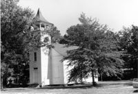
Tavou Church (Taveau Church), Strawberry Ferry Road (S.C. State Road 44). View of Front elevation. Moncks Corner, SC.;8" x 10" B/W photo. Box 2, Folder 1-3-12. One copy.
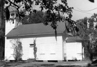
Tavou Church (Taveau Church), Strawberry Ferry Road (S.C. State Road 44). View of Side elevation. Moncks Corner, SC.;6.5" x 9.5" B/W photo. Box 2, Folder 1-3-12. One copy.
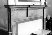
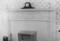
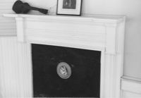
Lawson's Pond Plantation, Lawson Pond Lane. Interior View - Detail of mantle in East Front Room. NW elevation. Cross, SC.;6.5" x 9.5" B/W photo. Box 2, Folder 1-4-3. One copy.
Lawson's Pond Plantation, Lawson Pond Lane. Interior View - Detail of door frame in East Front Room. West elevation. Cross, SC.;6.5" x 9.5" B/W photo. Box 2, Folder 1-4-3. One copy.
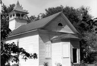
St. James Church, Goose Creek; Vestry Lane (off of Snake River Road, S.C. State Road 208). View of Front and Side elevation. Goose Creek, SC.;6.5" x 9.5" B/W photo. Box 2, Folder 1-5-1. One copy.
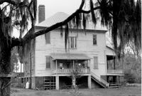
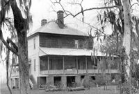
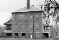
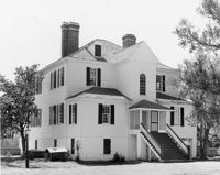
Stony Landing Plantation, East of U.S. Hwy. 52 and Riverwood Drive, along the Cooper River. View of Front elevation. Moncks Corner, SC.;6.5" x 9.5" B/W photo. Box 2, Folder 1-8-5. One copy.
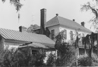
Stony Landing Plantation, East of U.S. Hwy. 52 and Riverwood Drive, along the Cooper River. View of Side and Front elevation. Moncks Corner, SC.;6.5" x 9.5" B/W photo. Box 2, Folder 1-8-5. One copy.
Dean Hall Plantation - Main House. View of NW (Front) elevation. Oakley, SC. NOTE: Property relocated to Beaufort County in 1971.;8" x 10" B/W photo. Box 2, Folder 1-8-8. One copy.
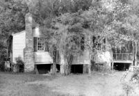
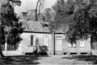
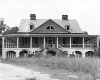
Dean Hall Plantation - Overseers House. View of East (Front) elevation. Oakley, SC. NOTE: Property relocated to Moncks Corner, S.C.;8" x 10" B/W photo. Box 2, Folder 1-8-9. One copy.
Dean Hall Plantation - Overseers House. View of North (Side) elevation. Oakley, SC. NOTE: Property relocated to Moncks Corner, S.C.;8" x 10" B/W photo. Box 2, Folder 1-8-9. One copy.
Dean Hall Plantation - Overseers House. View of NNW (Rear and Side) elevation. Oakley, SC. NOTE: Property relocated to Moncks Corner, S.C.;8" x 10" B/W photo. Box 2, Folder 1-8-9. One copy.
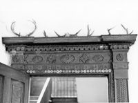
Dean Hall Plantation - Overseers House. Detail View of chimney. Oakley, SC. NOTE: Property relocated to Moncks Corner, S.C.;10" x 8" B/W photo. Box 2, Folder 1-8-9. One copy.
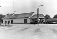
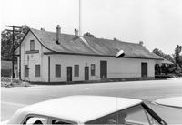
Moncks Corner Railroad Station. View of West (Front) elevation - taken from the NE. Moncks Corner, SC.;6.5" x 9.5" B/W photo. Box 2, Folder 1-8-15. Three copies.
Moncks Corner Railroad Station. View of West (Front) elevation - taken from the SE. Moncks Corner, SC.;6.5" x 9.5" B/W photo. Box 2, Folder 1-8-15. Three copies.
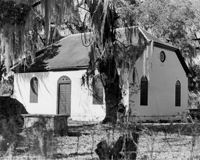
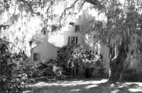
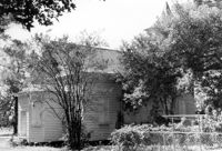
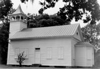
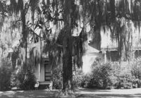
Church of the Redeemer (Pineville Chapel), Matilda Circle. View of SW (Front and Side) elevation. Pineville Historic District. Pineville, SC.;6.5" x 9.5" B/W photo. Box 3, Folder 1-9-1 (I). One copy.
Church of the Redeemer (Pineville Chapel), Matilda Circle. View of SE (Side and Rear) elevation. Pineville Historic District. Pineville, SC.;6.5" x 9.5" B/W photo. Box 3, Folder 1-9-1 (I). One copy.
Church of the Redeemer (Pineville Chapel), Matilda Circle. View of SE (Rear and Side) elevation. Pineville Historic District. Pineville, SC.;6.5" x 9.5" B/W photo. Box 3, Folder 1-9-1 (I). One copy.
Church of the Redeemer (Pineville Chapel), Matilda Circle. View of SE (Side and Rear) elevation. Pineville Historic District. Pineville, SC.;6.5" x 9.5" B/W photo. Box 3, Folder 1-9-1 (I). One copy.
Church of the Redeemer (Pineville Chapel, Matilda Circle). Detail View of Rear Entry - East (Rear) elevation. Pineville Historic District. Pineville, SC.;9.5" x 6.5" B/W photo. Box 3, Folder 1-9-1 (I). One copy.
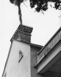
Church of the Redeemer (Pineville Chapel), Matilda Circle. Detail View of Roof and Belfry - SE (Side and Rear) elevation. Pineville Historic District. Pineville, SC.;6.5" x 9.5" B/W photo. Box 3, Folder 1-9-1 (I). One copy.
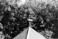
Church of the Redeemer (Pineville Chapel), Matilda Circle. Detail View of fish-shaped Weathervane - SE (Side and Front) elevation. Pineville Historic District. Pineville, SC.;6.5" x 9.5" B/W photo. Box 3, Folder 1-9-1 (I). One copy.
Church of the Redeemer (Pineville Chapel), Matilda Circle. Detail View of fish-shaped Weathervane - West (Front) elevation. Pineville Historic District. Pineville, SC.;6.5" x 9.5" B/W photo. Box 3, Folder 1-9-1 (I). One copy.
Church of the Redeemer (Pineville Chapel), Matilda Circle. View of SE (Front and Side) elevation. Pineville Historic District. Pineville, SC.;6.5" x 9.5" B/W photo. Box 3, Folder 1-9-1 (I). One copy.
Church of the Redeemer (Pineville Chapel), Matilda Circle. Detail View of Window Sash and Shutter Dog - SE (Front) elevation. Pineville Historic District. Pineville, SC.;6.5" x 9.5" B/W photo. Box 3, Folder 1-9-1 (I). One copy.
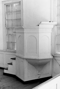
Church of the Redeemer (Pineville Chapel), Matilda Circle. Interior View - Detail of Pulpit. SSE (Front and Side) elevation. Pineville Historic District. Pineville, SC.;9.5" x 6.5" B/W photo. Box 3, Folder 1-9-1 (I). One copy.
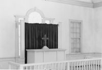
Church of the Redeemer (Pineville Chapel), Matilda Circle. Interior View - Detail of Chancel. SSE (Front and Side) elevation. Pineville Historic District. Pineville, SC.;6.5" x 9.5" B/W photo. Box 3, Folder 1-9-1 (I). One copy.
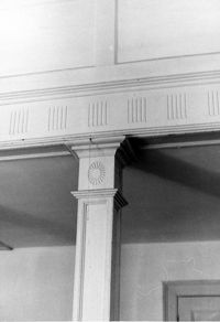
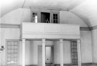
Church of the Redeemer (Pineville Chapel), Matilda Circle. Interior View - Detail of Column and Molding on Balcony. West (Rear) elevation. Pineville Historic District. Pineville, SC.;9.5" x 6.5" B/W photo. Box 3, Folder 1-9-1 (I). One copy.
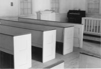
Church of the Redeemer (Pineville Chapel), Matilda Circle. Interior View - Detail of Pews. NNE (Side and Rear) elevation. Pineville Historic District. Pineville, SC.;6.5" x 9.5" B/W photo. Box 3, Folder 1-9-1 (I). One copy.
Church of the Redeemer (Pineville Chapel), Matilda Circle. Interior View - Detail of Front Entrance. NW (Front) elevation. Pineville Historic District. Pineville, SC.;6.5" x 9.5" B/W photo. Box 3, Folder 1-9-1 (I). One copy.
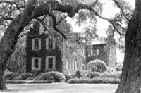
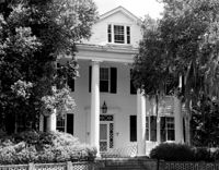
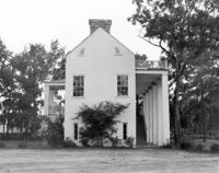
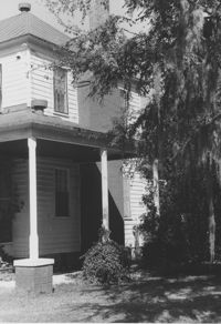
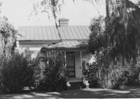
Old Rectory (Gourdin House). View of North (Front and Side) elevation. Pineville Historic District. St. Stephen, SC.;6.5" x 9.5" B/W photo. Box 3, Folder 1-9-1 (I). One copy.
Old Rectory (Gourdin House). View of NNE (Front and Side) elevation. Pineville Historic District. St. Stephen, SC.;6.5" x 9.5" B/W photo. Box 3, Folder 1-9-1 (I). One copy.
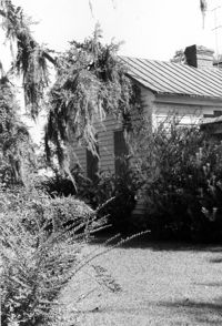
Old Rectory (Gourdin House). View of SW (Rear and Side) elevation. Pineville Historic District. St. Stephen, SC.;6.5" x 9.5" B/W photo. Box 3, Folder 1-9-1 (I). One copy.
Old Rectory (Gourdin House). View of NNE (Side and Front) elevation. Pineville Historic District. St. Stephen, SC.;6.5" x 9.5" B/W photo. Box 3, Folder 1-9-1 (I). One copy.
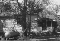
Old Rectory (Gourdin House). View of Kitchen Addition - West (Side) elevation. Pineville Historic District. St. Stephen, SC.;6.5" x 9.5" B/W photo. Box 3, Folder 1-9-1 (I). One copy.
Old Rectory (Gourdin House). View of NW (Rear and Side) elevation. Pineville Historic District. St. Stephen, SC.;9.5" x 6.5" B/W photo. Box 3, Folder 1-9-1 (I). One copy.
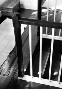
Old Rectory (Gourdin House). Interior View - Detail of Newel Post. WSW elevation. Pineville Historic District. St. Stephen, SC.;9.5" x 6.5" B/W photo. Box 3, Folder 1-9-1 (I). One copy.
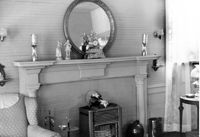
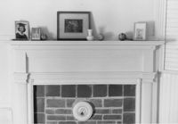
Old Rectory (Gourdin House). Interior View - Detail of Mantle on West Side. WNW elevation. Pineville Historic District. St. Stephen, SC.;6.5" x 9.5" B/W photo. Box 3, Folder 1-9-1 (I). Three copies.
Old Rectory (Gourdin House). Interior View - Detail of Newel Post. WSW elevation. Pineville Historic District. St. Stephen, SC.;6.5" x 9.5" B/W photo. Box 3, Folder 1-9-1 (I). One copy.
Old Rectory (Gourdin House). Interior View - Detail of Newel Post. WSW elevation. Pineville Historic District. St. Stephen, SC.;6.5" x 9.5" B/W photo. Box 3, Folder 1-9-1 (I). One copy.
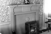
Old Rectory (Gourdin House). Interior View - Detail of Mantle on East Side, 2nd Floor. ENE elevation. Pineville Historic District. St. Stephen, SC.;6.5" x 9.5" B/W photo. Box 3, Folder 1-9-1 (I). One copy.
Old Rectory (Gourdin House). Interior View - Detail of Mantle on West Side, 2nd Floor. WNW elevation. Pineville Historic District. St. Stephen, SC.;6.5" x 9.5" B/W photo. Box 3, Folder 1-9-1 (I). One copy.
Old Rectory (Gourdin House). Interior View - Detail of Mantle on East Side. ENE elevation. Pineville Historic District. St. Stephen, SC.;6.5" x 9.5" B/W photo. Box 3, Folder 1-9-1 (I). One copy.
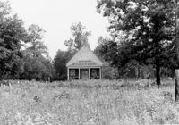
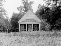
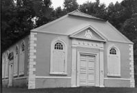
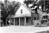
Library Society Building. View of North (Front) elevation. Pineville Historic District. St. Stephen, SC.;6.5" x 9.5" B/W photo. Box 3, Folder 1-9-1 (I). One copy.
Library Society Building. View of NE (Side and Front) elevation. Pineville Historic District. St. Stephen, SC.;9.5" x 6.5" B/W photo. Box 3, Folder 1-9-1 (I). One copy.
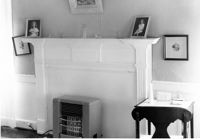
Library Society Building. Interior View - Detail of Mantel on East Side. WNW elevation. Pineville Historic District. St. Stephen, SC.;6.5" x 9.5" B/W photo. Box 3, Folder 1-9-1 (I). One copy.
Library Society Building. Interior View - Detail of Mantel on West Side. WNW elevation. Pineville Historic District. St. Stephen, SC.;6.5" x 9.5" B/W photo. Box 3, Folder 1-9-1 (I). One copy.
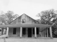
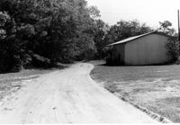
Old Post Office. View of North (Front) elevation. Pineville Historic District. St. Stephen, SC.;6.5" x 9.5" B/W photo. Box 3, Folder 1-9-1 (I). One copy.
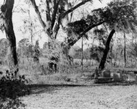
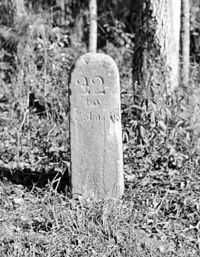
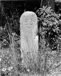
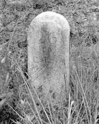
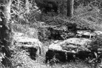
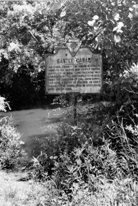
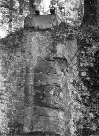
White Oak Lock. Lock #1 - View of nearby remains of Steam Engine used to pump water from the Santee River to canal. Tailrace Canal, Old Santee Canal Park. Berkeley, SC.;9.5" x 6.5" B/W photo. Box 3, Folder 1-9-2. One copy.
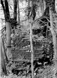
White Oak Lock. Lock #2 - View of flood gate pintel. Tailrace Canal, Old Santee Canal Park. Berkeley, SC.;6.5" x 9.5" B/W photo. Box 3, Folder 1-9-2. One copy.
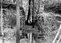
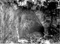
White Oak Lock. Lock #2 - Interior View of gate position. Tailrace Canal, Old Santee Canal Park. Berkeley, SC.;6.5" x 9.5" B/W photo. Box 3, Folder 1-9-2. One copy.
White Oak Lock. Lock #2 - Detail View of floodgate pintel. Tailrace Canal, Old Santee Canal Park. Berkeley, SC.;9.5" x 6.5" B/W photo. Box 3, Folder 1-9-2. One copy.
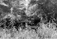
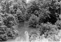
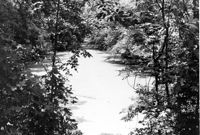
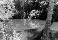
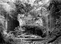
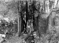
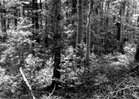
White Oak Lock. Santee Canal Section - General View; Trees in foreground are on Tow path. Tailrace Canal, Old Santee Canal Park. Berkeley, SC.;6.5" x 9.5" B/W photo. Box 3, Folder 1-9-2. One copy.
White Oak Lock. Lock #2 - View of water sluice. Tailrace Canal, Old Santee Canal Park. Berkeley, SC.;6.5" x 9.5" B/W photo. Box 3, Folder 1-9-2. One copy.
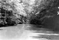
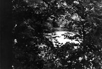
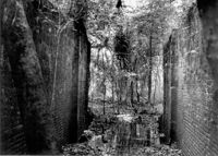
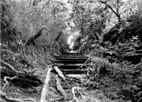
White Oak Lock. View down canal from White Oak lock showing cypress planking to retain water. Tailrace Canal, Old Santee Canal Park. Berkeley, SC.;6.5" x 9.5" B/W photo. Box 3, Folder 1-9-2. One copy.
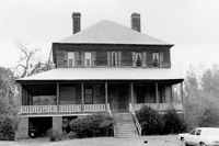
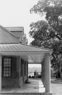
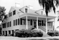
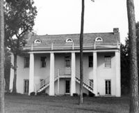
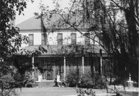
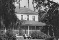
Samuel Porcher Stoney House, ca. 1890 - Pivotal to Historic District. View of Front and Side elevations. Pinopolis, S.C.;5" x 7" B/W photo. Box 3, Folder 1-10-1 (II). Three copies.