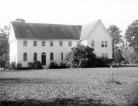
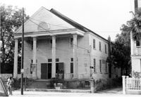
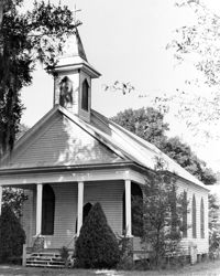
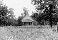
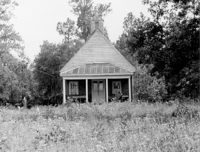
Johns Island Presbyterian Church, 2550 Bohicket Road. Church - View of Front elevation. Johns Island, S.C.;8" x 10" B/W photo. Box 12, Folder 2-5-4. Two copies.
Johns Island Presbyterian Church, 2550 Bohicket Road. Church - View of Front elevation. Johns Island, S.C.;8" x 10" B/W photo. Box 12, Folder 2-5-4. One copy.
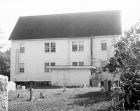
Johns Island Presbyterian Church, 2550 Bohicket Road. Church - View of Rear elevation. Johns Island, S.C.;8" x 10" B/W photo. Box 12, Folder 2-5-4. One copy.
Johns Island Presbyterian Church, 2550 Bohicket Road. Church - View of Front elevation. Johns Island, S.C.;8" x 10" B/W photo. Box 12, Folder 2-5-4. One copy.
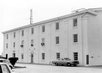
U.S. Coast Guard Historical District, I'on Avenue. Bunker - View of NW (Side and Front) elevation. Sullivans Island, S.C.;6.5" x 10" (and 3.5" x 5") B/W photo. Box 16, Folder 2-13-1. Two copies.
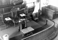
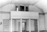
Old Bethel Methodist Church, 222 Calhoun Street. Interior View - Detail of Chancel. NE (Front and Side) elevation. Charleston, S.C.;6.5" x 10" B/W photo. Box 7, Folder 2-1-43. One copy.
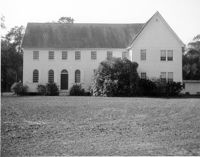
Johns Island Presbyterian Church, 2550 Bohicket Road. Church - View of Front and Side elevation. Johns Island, S.C.;8" x 10" B/W photo. Box 12, Folder 2-5-4. One copy.
Johns Island Presbyterian Church, 2550 Bohicket Road. Church - View of Front and Side elevation. Johns Island, S.C.;8" x 10" B/W photo. Box 12, Folder 2-5-4. One copy.
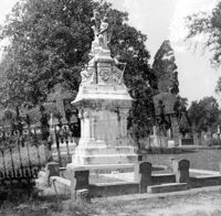
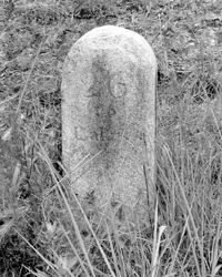
Magnolia Cemetery, Huguenin Avenue and Algonquin Road. Tombstone of Birt family. View of Front elevation. NOTE: Print has superimposed second image. Charleston, S.C.;8" x 8" B/W photo. Box 5, Folder 2-1-3. Two copies.
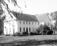
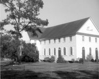
Rockville Historic District - Grace Episcopal Chapel (Grace Epsicopal Church), Grace Chapel Road. View of Front and Side elevation. Wadmalaw, S.C.;10" x 6.5" (and 10" x 8") B/W photo. Box 17, Folder 2-14-18. Two copies.
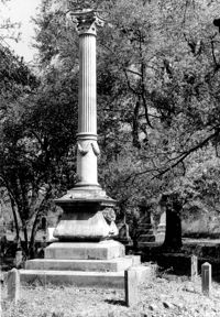
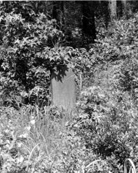
Magnolia Cemetery, Huguenin Avenue and Algonquin Road. Monument of Hugh Swinton Legare. View of Front and Side elevation. Charleston, S.C.;10" x 6.5" B/W photo. Box 5, Folder 2-1-3. One copy.
Tavou Church (Taveau Church), Strawberry Ferry Road (S.C. State Road 44). View of Side elevation. Moncks Corner, SC.;6.5" x 9.5" B/W photo. Box 2, Folder 1-3-12. One copy.
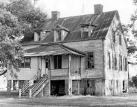
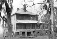
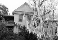
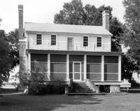
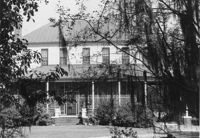
Rockville Historic District - Hagood House (Micah Jenkins House), Grace Chapel Road. View of South (Front) elevation. Wadmalaw Island, S.C.;6.5" x 10" B/W photo. Box 17, Folder 2-14-16. One copy.
Rockville Historic District - Hagood House (Micah Jenkins House), Grace Chapel Road. View of South (Front) elevation. Wadmalaw Island, S.C.;8" x 10" B/W photo. Box 17, Folder 2-14-16. One copy.
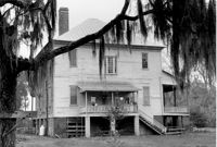
Rockville Historic District - Old Episcopal Rectory, Maybank Highway. View of SE (Side and Front) elevation. Wadmalaw Island, S.C.;6.5" x 10" B/W photo. Box 17, Folder 2-14-13. One copy.
Rockville Historic District - Mary A. Whaley House, Maybank Highway. View of West (Side) elevation. Wadmalaw Island, S.C.;6.5" x 10" B/W photo. Box 17, Folder 2-14-12. One copy.
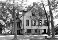
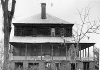
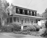
Rockville Historic District - Perry House, Maybank Highway. View of South (Front) elevation. Wadmalaw Island, S.C.;6.5" x 10" B/W photo. Box 17, Folder 2-14-14. One copy.
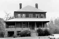
Rockville Historic District - W.E. Jenkins House (James LaRoche House). View of South (Front) elevation. Wadmalaw Island, S.C.;6.5" x 10" B/W photo. Box 17, Folder 2-14-15. One copy.
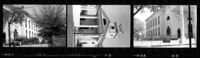
Cathedral of St. Luke and St. Paul, 126 Coming Street. Contact Sheet 7 - Views of Front and Sides elevations. Charleston, S.C.;1" x 4.5" B/W photo. Box 20, Folder: Miscellaneous Photos: Scanned Contact Sheets. One copy.
Cathedral of St. Luke and St. Paul, 126 Coming Street. Contact Sheet 7 - Views of Rear and Sides elevations. Charleston, S.C.;1" x 9" B/W photo. Box 20, Folder: Miscellaneous Photos: Scanned Contact Sheets. One copy.
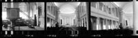
Cathedral of St. Luke and St. Paul, 126 Coming Street. Contact Sheet 7 - Views of Interior. Charleston, S.C.;1" x 4.5" B/W photo. Box 20, Folder: Miscellaneous Photos: Scanned Contact Sheets. One copy.
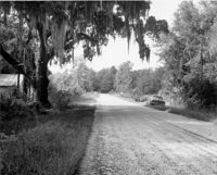
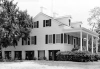
Stony Landing Plantation, East of U.S. Hwy. 52 and Riverwood Drive, along the Cooper River. View of Side and Front elevation. Moncks Corner, SC.;6.5" x 9.5" B/W photo. Box 2, Folder 1-8-5. One copy.
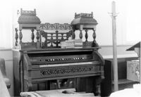
Church of the Redeemer (Pineville Chapel), Matilda Circle. Interior View - Detail of Front Entrance. NW (Front) elevation. Pineville Historic District. Pineville, SC.;6.5" x 9.5" B/W photo. Box 3, Folder 1-9-1 (I). One copy.
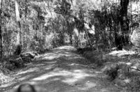
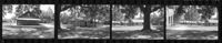
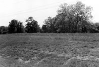
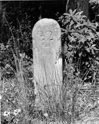
Stono River Rebellion Site (Cato's Rebellion Site), North Side of U.S. Highway 17, west of the Wallace River. View looking West. Hollywood, S.C.;6.5" x 10" B/W photo. Box 16, Folder 2-11-16. One copy.
Old Rectory (Gourdin House). View of North (Front and Side) elevation. Pineville Historic District. St. Stephen, SC.;6.5" x 9.5" B/W photo. Box 3, Folder 1-9-1 (I). One copy.