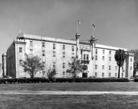
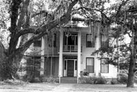
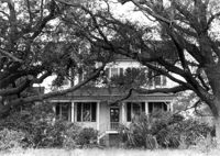
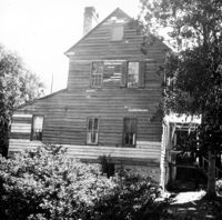
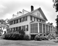
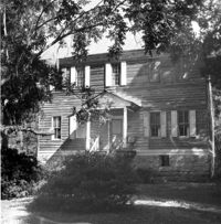
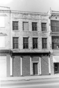
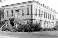
Old Citadel (South Carolina State Arsenal, Embassy Suites Hotel), 337 Meeting Street. View of SW (Front and Side) elevation. Charleston, S.C.;3.5" x 5" B/W photo. Box 5, Folder 2-1-5. Two copies.
Old Citadel (South Carolina State Arsenal, Embassy Suites Hotel), 337 Meeting Street. View of SW (Front and Side) elevation. Charleston, S.C.;8" x 10" B/W photo. Box 5, Folder 2-1-5. Three copies.
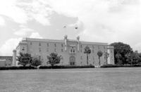
Old Citadel (South Carolina State Arsenal, Embassy Suites Hotel), 337 Meeting Street. View of NE (Rear and Side) elevation. Charleston, S.C.;8" x 10" B/W photo. Box 5, Folder 2-1-5. Two copies.
Old Citadel (South Carolina State Arsenal, Embassy Suites Hotel), 337 Meeting Street. View of NE (Rear and Side) elevation. Charleston, S.C.;8" x 10" B/W photo. Box 5, Folder 2-1-5. One copy.
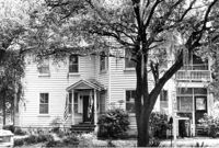
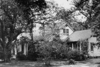
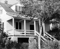
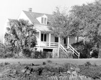
Kate Vincent Waring House (ca. 1913), S. Pinckney Street. View of Front elevation. McClellanville Historic District. McClellanville, S.C.;6.5" x 10" B/W photo. Box 14, Folder 2-10-5. One copy.
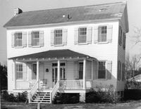
James A. Lofton House (ca. 1907), S. Pinckney Street. View of Front elevation. McClellanville Historic District. McClellanville, S.C.;6.5" x 10" B/W photo. Box 14, Folder 2-10-5. One copy.
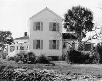
M.F. Skipper House (ca. 1904), S. Pinckney Street. View of Front elevation. McClellanville Historic District. McClellanville, S.C.;6.5" x 10" B/W photo. Box 14, Folder 2-10-5. One copy.
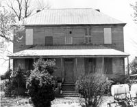
Old Carroll House (Carroll Place), Junction of Quaker and Wire Roads. View of North (Front) elevation. St. George, S.C.;8" x 10" B/W photo. Box 20, Folder: Miscellaneous Photos: Unidentified Images. One copy.
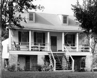
Rockville Historic District - Hagood House (Micah Jenkins House), Grace Chapel Road. View of South (Front) elevation. Wadmalaw Island, S.C.;8" x 10" B/W photo. Box 17, Folder 2-14-16. One copy.
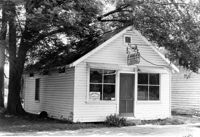
Unidentified Commercial Building (ca. 1930) - Contributory to Historic District. View of Front elevation. McClellanville Historic District. McClellanville, S.C.;6.5" x 10" B/W photo. Box 14, Folder 2-10-5. One copy.
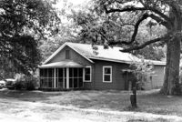
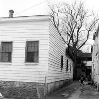
Unidentified House (ca. 1937) - Contributory to Historic District. View of Side and Front elevation. McClellanville Historic District. McClellanville, S.C.;6.5" x 10" B/W photo. Box 14, Folder 2-10-5. One copy.
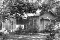
Unidentified House (ca. 1943) - Contributory to Historic District. View of Side and Front elevation. McClellanville Historic District. McClellanville, S.C.;6.5" x 10" B/W photo. Box 14, Folder 2-10-5. One copy.
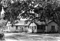
Unidentified House (ca. 1945) - Contributory to Historic District. View of Front and Side elevation. McClellanville Historic District. McClellanville, S.C.;6.5" x 10" B/W photo. Box 14, Folder 2-10-5. One copy.
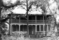
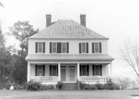
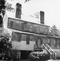
Seaside Plantation (Locksley Hall), off of Cypress Bottom Road. View of South (Front) elevation. Edisto Island, S.C.;8" x 10" B/W photo. Box 11, Folder 2-3-12. One copy.
Unidentified House (ca. post-1922) - Contributory to Historic District. View of Front elevation. McClellanville Historic District. McClellanville, S.C.;6.5" x 10" B/W photo. Box 14, Folder 2-10-5. One copy.
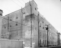
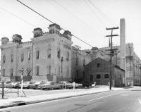
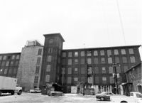
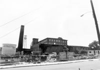
Cigar Factory, 701 East Bay Street. General View of North (Side) elevation (Blake Street in foreground). Charleston, S.C.;7" x 10" B/W photo. Box 9, Folder 2-1-221. One copy.
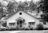
Unidentified House (ca. 1948) - Contributory to Historic District. View of Front elevation. McClellanville Historic District. McClellanville, S.C.;6.5" x 10" B/W photo. Box 14, Folder 2-10-5. One copy.
Unidentified House (ca. 1947) - Contributory to Historic District. View of Front elevation. McClellanville Historic District. McClellanville, S.C.;6.5" x 10" B/W photo. Box 14, Folder 2-10-5. One copy.
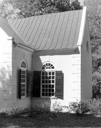
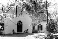
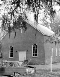
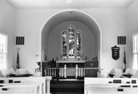
St. Andrews Episcopal Church (Old St. Andrews Parish Church), 2604 Ashley River Road. Detail View of South (Side) elevation. Charleston, S.C.;10" x 8" B/W photo. Box 14, Folder 2-9-7. One copy.
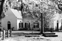
St. Andrews Episcopal Church (Old St. Andrews Parish Church), 2604 Ashley River Road. View of North (Side) elevation. Charleston, S.C.;6.5" x 10" B/W photo. Box 14, Folder 2-9-7. One copy.
St. Andrews Episcopal Church (Old St. Andrews Parish Church), 2604 Ashley River Road. View of North (Side) elevation. Charleston, S.C.;6.5" x 10" B/W photo. Box 14, Folder 2-9-7. One copy.
Magnolia Cemetery, Huguenin Avenue and Algonquin Road. Monument of Emma Heyward Haskell. Charleston, S.C.;8" x 8" B/W photo. Box 5, Folder 2-1-3. One copy.
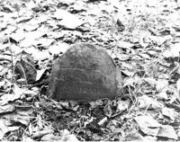
Colonel William Washington Cemetery. Tombstone of William Washington Ancrum (1854). Ravenel, S.C.;10" x 8" B/W photo. Box 16, Folder 2-11-11. One copy.
Rockville Historic District - John F. Townsend House, Sea Island Yacht Club Road. Detail View of Front Porch, NE (Front and Side) elevation.. Wadmalaw Island, S.C.;8" x 10" B/W photo. Box 17, Folder 2-14-7. One copy.
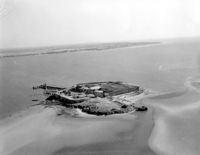
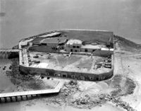
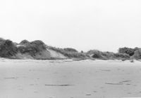
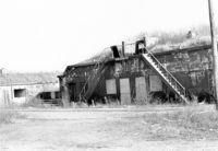
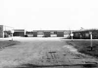
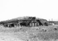
Folly Island Staging Area (Battery Green, U.S. Coast Guard Loran Station, Folly North Site), Address restricted. View facing NNW. Folly Beach, S.C.;8" x 10" B/W photo. Box 17, Folder 2-16-1. One copy.
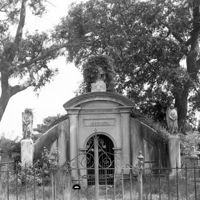
Magnolia Cemetery, Huguenin Avenue and Algonquin Road. Gibbes Mausoleum. View of Front elevation. Charleston, S.C.;8" x 8" B/W photo. Box 5, Folder 2-1-3. One copy.
Rockville Historic District - John F. Townsend House, Sea Island Yacht Club Road. View of NE (Front and Side) elevation. Wadmalaw Island, S.C.;8" x 10" B/W photo. Box 17, Folder 2-14-7. One copy.
Rockville Historic District - Joseph LaRoche House, Sea Island Yacht Club Road. View of North (Front) elevation. Wadmalaw Island, S.C.;8" x 10" B/W photo. Box 17, Folder 2-14-6. One copy.
Rockville Historic District - Joseph LaRoche House, Sea Island Yacht Club Road. View of West (Side) elevation. Wadmalaw Island, S.C.;8" x 10" B/W photo. Box 17, Folder 2-14-6. One copy.
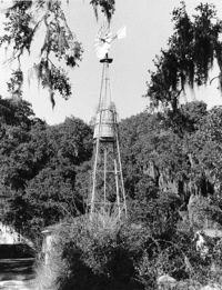
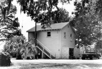
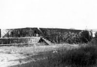
Rockville Historic District - Wilson's Windmill, Sea Island Yacht Club Road. South elevation. Wadmalaw Island, S.C.;10" x 8" B/W photo. Box 17, Folder 2-14-9. One copy.
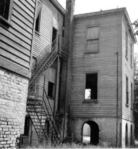
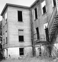
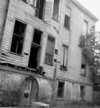
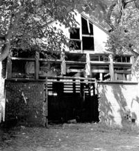
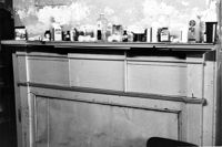
Shaw Community Center, 22 Mary Street. Main Building - View of SE (Side and Rear) elevation. Charleston, S.C. (NOTE: Structure demolished in 1974);8.25" x 7.5" B/W photo. Box 6, Folder 2-1-13. One copy.
Shaw Community Center, 22 Mary Street. Main Building - View of SW (Rear and Side) elevation. Charleston, S.C. (NOTE: Structure demolished in 1974);8.25" x 7.5" B/W photo. Box 6, Folder 2-1-13. One copy.
Shaw Community Center, 22 Mary Street. Main Building - View of North (Front) elevation. Charleston, S.C. (NOTE: Structure demolished in 1974);8.25" x 7.5" B/W photo. Box 6, Folder 2-1-13. One copy.
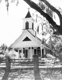
St. James Bethel Church (Zion Chapel, St. James Bethel AME Church), 5305 Maybank Highway. View of NW (Front and Side) elevation. Wadmalaw Island, S.C.;10" x 8" B/W photo. Box 17, Folder 2-14-25. One copy.
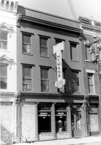
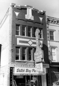
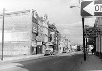
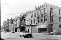
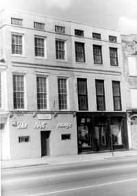
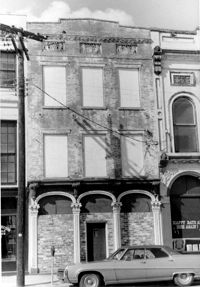
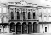
Cast Iron District, 207-235 Meeting Street - Detail of 213. View of NW (Front) elevation, looking North. Charleston, S.C.;10" x 6.5" B/W photo. Box 9, Folder 2-1-159. Three copies.
Cast Iron District, 207-235 Meeting Street - Detail of 207. View of NW (Front and Side) elevation. Charleston, S.C.;10" x 6.5" B/W photo. Box 9, Folder 2-1-159. Three copies.
Cast Iron District, 207-235 Meeting Street - Detail of 223. View of NW (Front) elevation, looking North. Charleston, S.C.;10" x 6.5" B/W photo. Box 9, Folder 2-1-159. Three copies.
Cast Iron District, 207-235 Meeting Street - Detail of 227. View of NW (Front) elevation, looking North. Charleston, S.C.;10" x 6.5" B/W photo. Box 9, Folder 2-1-159. Three copies.
Cast Iron District, 207-235 Meeting Street - Detail of 229. View of NW (Front) elevation, looking North. Charleston, S.C.;6.5" x 10" B/W photo. Box 9, Folder 2-1-159. Three copies.
Cast Iron District, 207-235 Meeting Street - Detail of 233. View of NW (Front) elevation, looking North. Charleston, S.C.;10" x 6.5" B/W photo. Box 9, Folder 2-1-159. Three copies.
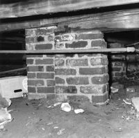
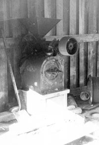
Fairlawn Plantation (Hugh Rose Plantation), Off of Guerins Bridge Road, adjacent to the Francis Marion National Forest. View of Corn Sheller.;10" x 6.5" B/W photo. Box 19, Folder: Charleston County: Christ Church: Fairlawn Plantation. One copy.
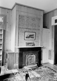
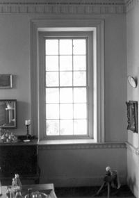
Seaside Plantation (Locksley Hall), off of Cypress Bottom Road. Interior View - 1st Floor, Dining Room. Detail of molding, window and chair rail. North elevation. Edisto Island, S.C.;5" x 7" B/W photo. Box 11, Folder 2-3-12. One copy.
Seaside Plantation (Locksley Hall), off of Cypress Bottom Road. Interior View - 1st Floor, Dining Room. Detail of chair rail and wainscot. North elevation. Edisto Island, S.C.;7" x 5" B/W photo. Box 11, Folder 2-3-12. One copy.
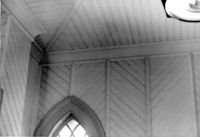
Central Baptist Church, 26 Radcliffe Street. Interior View - Detail of Vestibule Ceiling. NE (Rear and Side) elevation. Charleston, S.C.;6.5" x 10" B/W photo. Box 9, Folder 2-1-156. One copy.
Central Baptist Church, 26 Radcliffe Street. Interior View - Detail of Balcony Mural. NE (Rear and Side) elevation. Charleston, S.C.;10" x 6.5" B/W photo. Box 9, Folder 2-1-156. One copy.
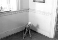
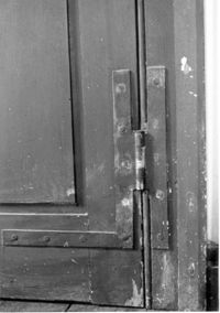
Seaside Plantation (Locksley Hall), off of Cypress Bottom Road. Interior View - 3rd Floor, West Bedroom. Detail of door hinge, East elevation. Edisto Island, S.C.;5" x 7" B/W photo. Box 11, Folder 2-3-12. One copy.
Battery Gadsden (Charleston County Public Library, Edgar Allen Poe Branch), 1921 I'on Avenue. View of West Wing, North (Front) elevation - looking East. Sullivans Island, S.C.;6.5" x 10" B/W photo. Box 16, Folder 2-13-6. One copy.
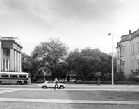
Washington Square Park, NE corner of Broad and Meeting Streets. View of West (Meeting Street) elevation. Charleston, S.C.;8" x 10" B/W photo. Box 5, Folder 2-1-8. One copy.
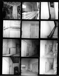
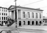
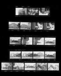
Charleston County Courthouse, 77 Meeting Street. Contact Sheet - Views of the Courthouse and Washington Square Park. Charleston, S.C.;10" x 8" B/W photo. Box 5, Folder 2-1-8. One copy.
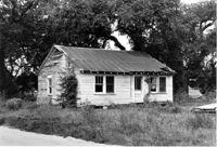
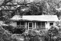
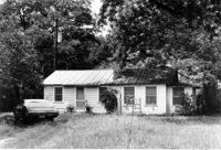
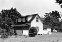
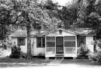
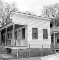
Unidentified House (ca. 20th century) - Non-contributory to Historic District. View of Side and Front elevation. McClellanville Historic District. McClellanville, S.C.;6.5" x 10" B/W photo. Box 14, Folder 2-10-5. Three copies.
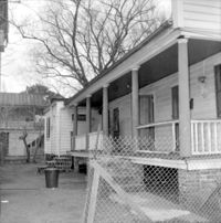
Unidentified House (ca. 20th century) - Non-contributory to Historic District. View of Front and Side elevation. McClellanville Historic District. McClellanville, S.C.;6.5" x 10" B/W photo. Box 14, Folder 2-10-5. One copy.
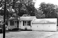
Unidentified House (ca. 20th century) - Non-contributory to Historic District. View of Front elevation. McClellanville Historic District. McClellanville, S.C.;6.5" x 10" B/W photo. Box 14, Folder 2-10-5. One copy.
Battery Gadsden (Charleston County Public Library, Edgar Allen Poe Branch), 1921 I'on Avenue. View of Edge of 1st Gun Platform from East end (visible on right side of image), North (Front) elevation. Central building unidentified. Sullivans Island, S.C.;6.5" x 10" B/W photo. Box 16, Folder 2-13-6. One copy.
Battery Gadsden (Charleston County Public Library, Edgar Allen Poe Branch), 1921 I'on Avenue. View of West Wing and 4th Gun Platform from East end, NE (Side and Front) elevation. Sullivans Island, S.C.;6.5" x 10" B/W photo. Box 16, Folder 2-13-6. One copy.
Battery Gadsden (Charleston County Public Library, Edgar Allen Poe Branch), 1921 I'on Avenue. View of West Wing and 4th Gun Platform from East end, NE (Side and Front) elevation. Sullivans Island, S.C.;6.5" x 10" B/W photo. Box 16, Folder 2-13-6. One copy.
Battery Gadsden (Charleston County Public Library, Edgar Allen Poe Branch), 1921 I'on Avenue. View of 4th Gun Platform from East end, NE (Front and Side) elevation. Sullivans Island, S.C.;6.5" x 10" B/W photo. Box 16, Folder 2-13-6. One copy.
Battery Gadsden (Charleston County Public Library, Edgar Allen Poe Branch), 1921 I'on Avenue. View of 1st Gun Platform from East end, SE (Side and Rear) elevation. Sullivans Island, S.C.;6.5" x 10" B/W photo. Box 16, Folder 2-13-6. One copy.
Battery Gadsden (Charleston County Public Library, Edgar Allen Poe Branch), 1921 I'on Avenue. View of 4th Gun Platform from East end, North (Front) elevation. Sullivans Island, S.C.;6.5" x 10" B/W photo. Box 16, Folder 2-13-6. One copy.
Battery Gadsden (Charleston County Public Library, Edgar Allen Poe Branch), 1921 I'on Avenue. View of 1st Gun Platform and East Wing, South (Rear) elevation. Sullivans Island, S.C.;6.5" x 10" B/W photo. Box 16, Folder 2-13-6. One copy.
Boone Hall Plantation, Oak Avenue. Old Commissary - View of SW (Front and Side) elevation. Mount Pleasant, S.C.;6.5" x 10" B/W photo. Box 10, Folder 2-2-5. One copy.
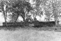
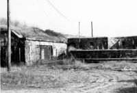
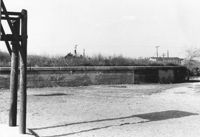
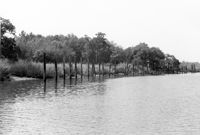
Paul Pritchard Shipyard Site, Address Restricted. General View, facing West. Mount Pleasant, S.C.;6.5" x 10" B/W photo. Box 10, Folder 2-2-8. One copy.
Paul Pritchard Shipyard Site, Address Restricted. General View, facing West. Mount Pleasant, S.C.;6.5" x 10" B/W photo. Box 10, Folder 2-2-8. One copy.
Shaw Community Center, 22 Mary Street. Main Building - View of South (Rear) elevation. Charleston, S.C. (NOTE: Structure demolished in 1974);8.25" x 7.5" B/W photo. Box 6, Folder 2-1-13. One copy.
Shaw Community Center, 22 Mary Street. Coach House - View of NW elevation. Charleston, S.C. (NOTE: Structure demolished in 1974);8.25" x 7.5" B/W photo. Box 6, Folder 2-1-13. One copy.
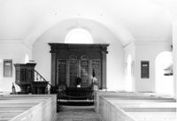
St. Andrews Episcopal Church (Old St. Andrews Parish Church), 2604 Ashley River Road. Interior View - Chancel. East elevation. Charleston, S.C.;6.5" x 10" B/W photo. Box 14, Folder 2-9-7. One copy.
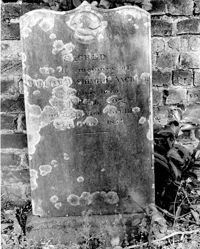
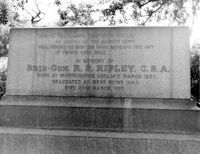
Magnolia Cemetery, Huguenin Avenue and Algonquin Road. Tombstone of R.S. Ripley. View of South elevation. Charleston, S.C.;8" x 10" B/W photo. Box 5, Folder 2-1-3. One copy.
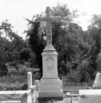
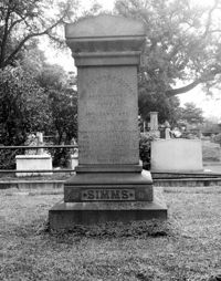
Magnolia Cemetery, Huguenin Avenue and Algonquin Road. Tombstone of William Gilmore Simms. Charleston, S.C.;10" x 8" B/W photo. Box 5, Folder 2-1-3. One copy.
Christ Church Episcopal - Adams Run, State Highway 174. View of Interior. West (Front) elevation. Hollywood, S.C.;6.5" x 10" B/W photo. Box 16, Folder 2-11-12. Three copies.