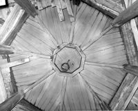
S.C. Railroad Car Shop (AAA Downtown Storage), 44 Line Street. Interior View - Unidentified Detail. Charleston, S.C.;8" x 10" B/W photo. Box 18, Folder: Charleston: 44 Line Street, South Carolina Car Shop. One copy.
S.C. Railroad Car Shop (AAA Downtown Storage), 44 Line Street. Interior View. Charleston, S.C.;8" x 10" B/W photo. Box 18, Folder: Charleston: 44 Line Street, South Carolina Car Shop. One copy.
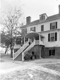
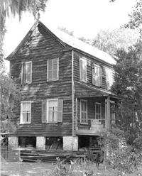
Marshlands Plantation, Fort Sumter Drive. Main House - View of NW (Rear and Side) elevation. James Island, S.C.;3" x 5" B/W photo. Box 11, Folder 2-4-3. One copy.
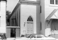
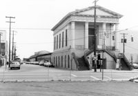
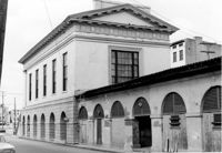
Central Baptist Church, 26 Radcliffe Street. View of SE (Side and Front) elevation. Charleston, S.C.;6.5" x 10" B/W photo. Box 9, Folder 2-1-156. One copy.
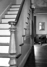
Seaside Plantation (Locksley Hall), off of Cypress Bottom Road. Interior View - 1st Floor, Front Hall. South elevation. Edisto Island, S.C.;5" x 7" B/W photo. Box 11, Folder 2-3-12. One copy.
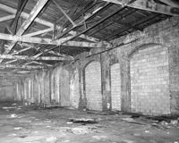
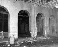
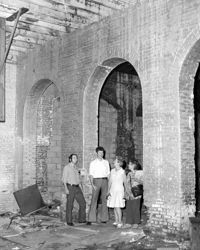
S.C. Railroad Car Shop (AAA Downtown Storage), 44 Line Street. Interior View showing damage to brick arches. Charleston, S.C.;8" x 10" B/W photo. Box 18, Folder: Charleston: 44 Line Street, South Carolina Car Shop. One copy.
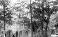
Marshlands Plantation, Fort Sumter Drive. Main House - View of NW (Rear) elevation. James Island, S.C.;10" x 8" B/W photo. Box 11, Folder 2-4-3. One copy.
S.C. Railroad Car Shop (AAA Downtown Storage), 44 Line Street. Interior View. Charleston, S.C.;10" x 8" B/W photo. Box 18, Folder: Charleston: 44 Line Street, South Carolina Car Shop. Two copies.
Rockville Historic District - Julia Evelina Whaley House (Marc Tolbert House), Grace Chapel Road. View of SE (Side and Front) elevation. House destroyed by fire in 1984. Wadmalaw Island, S.C.;10" x 8" B/W photo. Box 20, Folder: Charleston County: Wadmalaw Island: Julia Evelina Whaley House. Five copies.
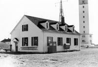
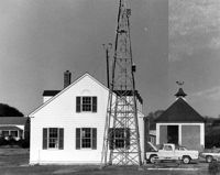
U.S. Coast Guard Historical District, I'on Avenue. Garage - View of NE (Side and Rear) elevation. Sullivans Island, S.C.;6.5" x 10" (and 3.5" x 5") B/W photo. Box 16, Folder 2-13-1. Two copies.
U.S. Coast Guard Historical District, I'on Avenue. Garage - View of South (Side) elevation. Sullivans Island, S.C.;6.5" x 10" (and 3.5" x 5") B/W photo. Box 16, Folder 2-13-1. Two copies.
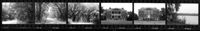
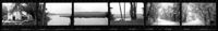
Ashley River Historic District (Highway 61 Historical District). Contact Sheet 6 - Views of Ashley Hall Plantation, Old St. Andrews Parish Church, and Ashley River Road. Charleston, S.C.;1" x 9" B/W photo. Box 20, Folder: Miscellaneous Photos: Scanned Contact Sheets. One copy.
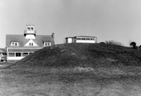
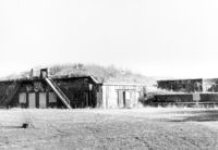
U.S. Coast Guard Historical District, I'on Avenue. Bunker - View of South (Rear) elevation. Sullivans Island, S.C.;6.5" x 10" (and 3.5" x 5") B/W photo. Box 16, Folder 2-13-1. Two copies.
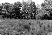
Stono River Rebellion Site (Cato's Rebellion Site), North Side of U.S. Highway 17, west of the Wallace River. View looking North. Hollywood, S.C.;6.5" x 10" B/W photo. Box 16, Folder 2-11-16. One copy.
Ashley River Historic District (Highway 61 Historical District). Contact Sheet 6 - Views of Drayton Hall and Ashley River Road. Charleston, S.C.;1" x 9" B/W photo. Box 20, Folder: Miscellaneous Photos: Scanned Contact Sheets. One copy.
Battery Gadsden (Charleston County Public Library, Edgar Allen Poe Branch), 1921 I'on Avenue. View of East Wing and 2nd Gun Platform from East end, NW (Front and Side) elevation. Sullivans Island, S.C.;6.5" x 10" B/W photo. Box 16, Folder 2-13-6. One copy.