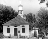
Magnolia Cemetery, Huguenin Avenue and Algonquin Road. Chapel - View of Side and Rear elevation. Charleston, S.C.;10" x 8" B/W photo. Box 5, Folder 2-1-3. One copy.
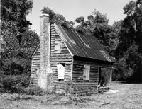
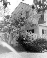
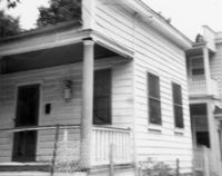
Old House Plantation, Clark Road. Slave Cabin - View of North (Side and Front) elevation. Edisto Island, S.C.;8" x 10" B/W photo. Box 11, Folder 2-3-10. One copy.
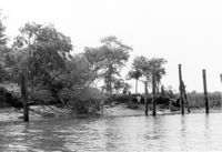
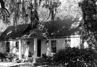
Middleton's Plantation (Chisolm's Plantation; The Launch), S.C. Hwy. 174. View of North (Rear) elevation. Edisto Island, S.C.;8" x 10" B/W photo. Box 11, Folder 2-3-9. One copy.
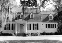
Middleton's Plantation (Chisolm's Plantation; The Launch), S.C. Hwy. 174. View of South (Front) elevation. Edisto Island, S.C.;8" x 10" B/W photo. Box 11, Folder 2-3-9. Two copies.
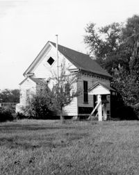
Old Lincolnville Town Hall (Williams Graded School), near intersection of East Randolph Street and East Pinckney Street. View of SE (Front and Side) elevation. Lincolnville, S.C.;6.5" x 10" B/W photo. Box 17, Folder 2-15-2. Three copies.
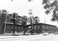
Cigar Factory, 701 East Bay Street. View of single story addition to main building, NW (Rear) elevation, looking South. Charleston, S.C.;7" x 10" B/W photo. Box 9, Folder 2-1-221. One copy.
Cigar Factory, 701 East Bay Street. General View of Main Entrance (from Columbus Street), South (Side) elevation. Charleston, S.C.;7" x 10" B/W photo. Box 9, Folder 2-1-221. One copy.
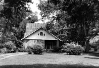
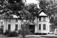
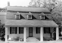
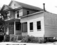
C.M. Loftan House (ca. 1911), Oak Street. View of Front elevation. McClellanville Historic District. McClellanville, S.C.;6.5" x 10" B/W photo. Box 14, Folder 2-10-5. One copy.
How Tavern. View of North (Front) elevation. Cainhoy (Huger vicinity, Lewisville, Louisville), S.C.;8" x 10" B/W photo. Box 4, Folder 1-12-3. One copy.
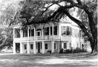
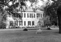
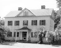
The Grove Plantation (Ernest F. Hollings ACE Basin National Wildlife Refuge). View of SE (Front and Side) elevation. Adams Run, S.C.;6.5" x 10" (and 8" x 10") B/W photo. Box 15, Folder 2-11-1. Two copies.
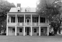
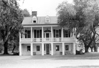
The Grove Plantation (Ernest F. Hollings ACE Basin National Wildlife Refuge). View of South (Front) elevation. Adams Run, S.C.;6.5" x 10" B/W photo. Box 15, Folder 2-11-1. Three copies.
The Grove Plantation (Ernest F. Hollings ACE Basin National Wildlife Refuge). View of South (Front) elevation. Adams Run, S.C.;6.5" x 10" B/W photo. Box 15, Folder 2-11-1. One copy.
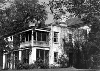
Lowndes Grove Plantation, 260 St. Margaret Street. Main House - View of East (Side) elevation. Charleston, S.C.;6.5" x 10" B/W photo. Box 8, Folder 2-1-148. One copy.
Lowndes Grove Plantation, 260 St. Margaret Street. View of Ashley River, West elevation. Charleston, S.C.;6.5" x 10" B/W photo. Box 8, Folder 2-1-148. One copy.
Lowndes Grove Plantation, 260 St. Margaret Street. View of Ashley River, West elevation. Charleston, S.C.;6.5" x 10" B/W photo. Box 8, Folder 2-1-148. One copy.
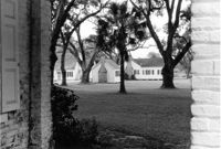
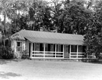
The Grove Plantation (Ernest F. Hollings ACE Basin National Wildlife Refuge). View of Outbuildings. Adams Run, S.C.;6.5" x 10" B/W photo. Box 15, Folder 2-11-1. One copy.
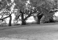
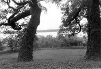
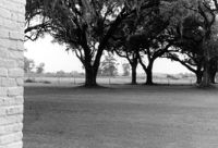
The Grove Plantation (Ernest F. Hollings ACE Basin National Wildlife Refuge). View of Property. Adams Run, S.C.;6.5" x 10" B/W photo. Box 15, Folder 2-11-1. Two copies.
Barnwell House (Prospect Hill Plantation), Sugar Hill Road. View of NW (Side and Rear) elevation. Hollywood, S.C.;10" x 8" B/W photo. Box 16, Folder 2-11-5. One copy.
Barnwell House (Prospect Hill Plantation), Sugar Hill Road. View of NW (Rear and Side) elevation. Hollywood, S.C.;8" x 10" B/W photo. Box 16, Folder 2-11-5. One copy.
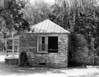
Wedge Plantation (William Lucas House), Wedge Plantation Road. Outbuilding #2 - View of Rear and Side elevation. McClellanville, S.C.;8" x 10" B/W photo. Box 15, Folder 2-10-6. One copy.
Henry M. Loftan, Jr. House (ca. 1901). View of Front elevation. McClellanville Historic District. McClellanville, S.C.;6.5" x 10" B/W photo. Box 14, Folder 2-10-5. One copy.
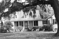
Barnwell House (Prospect Hill Plantation), Sugar Hill Road. View of South (Front) elevation. Hollywood, S.C.;8" x 10" B/W photo. Box 16, Folder 2-11-5. One copy.
Wedge Plantation (William Lucas House), Wedge Plantation Road. Main House - View of Front addition. McClellanville, S.C.;10" x 8" B/W photo. Box 15, Folder 2-10-6. One copy.
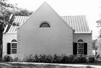
St. Andrews Episcopal Church (Old St. Andrews Parish Church), 2604 Ashley River Road. View of West (Rear) elevation. Charleston, S.C.;6.5" x 10" B/W photo. Box 14, Folder 2-9-7. One copy.
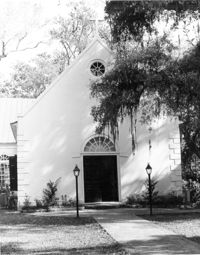
St. Andrews Episcopal Church (Old St. Andrews Parish Church), 2604 Ashley River Road. View of East (Front) elevation. Charleston, S.C.;10" x 8" B/W photo. Box 14, Folder 2-9-7. One copy.
St. Andrews Episcopal Church (Old St. Andrews Parish Church), 2604 Ashley River Road. Interior View - North Entrance. North elevation. Charleston, S.C.;10" x 6.5" B/W photo. Box 14, Folder 2-9-7. One copy.
Christ Church (Christ Episcopal Church), 2304 U.S. Highway 17. View of North (Front) elevation. Mount Pleasant, S.C.;8" x 10" B/W photo. Box 10, Folder 2-2-6. One copy.
Oakland Plantation (Youghall Plantation), 1164 Porcher Bluff Road. Main House - View of SW (Side and Rear) elevation. Mount Pleasant, S.C.;10" x 8" B/W photo. Box 10, Folder 2-2-10. One copy.
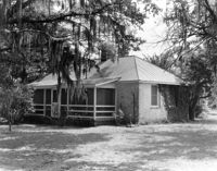
Oakland Plantation (Youghall Plantation), 1164 Porcher Bluff Road. Kitchen House - View of NE (Front) elevation. Mount Pleasant, S.C.;6.5" x 10" B/W photo. Box 10, Folder 2-2-10. One copy.
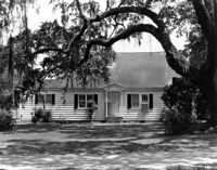
Oakland Plantation (Youghall Plantation), 1164 Porcher Bluff Road. Main House - View of North (Front) elevation. Mount Pleasant, S.C.;6.5" x 10" B/W photo. Box 10, Folder 2-2-10. One copy.
Oakland Plantation (Youghall Plantation), 1164 Porcher Bluff Road. Main House - View of South (Rear) elevation. Mount Pleasant, S.C.;6.5" x 10" B/W photo. Box 10, Folder 2-2-10. One copy.
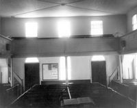
Johns Island Presbyterian Church, 2550 Bohicket Road. Church - Interior View. Pews and Entrance Doors, Rear elevation. Johns Island, S.C.;8" x 10" B/W photo. Box 12, Folder 2-5-4. Two copies.
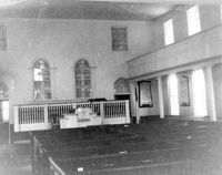
Johns Island Presbyterian Church, 2550 Bohicket Road. Church - Interior View. Sanctuary, Front elevation. Johns Island, S.C.;6.5" x 10" B/W photo. Box 12, Folder 2-5-4. One copy.