St. James Church, Goose Creek; Vestry Lane (off of Snake River Road, S.C. State Road 208). View of Front and Side elevation. Goose Creek, SC.;6.5" x 9.5" B/W photo. Box 2, Folder 1-5-1. One copy.
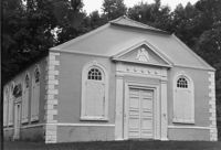
St. Stephen's Episcopal Church, Church Road. View of Front and Side elevations. St. Stephen, S.C.;6.5" x 9.5" B/W photo. Box 4, Folder 1-11-3. One copy.
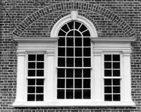
St. Stephen's Episcopal Church, 196 Brick Church Circle. Detail View of Rear window. St. Stephen, S.C.;8" x 10" B/W photo. Box 4, Folder 1-11-3. One copy.
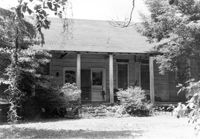
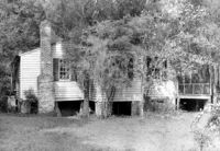
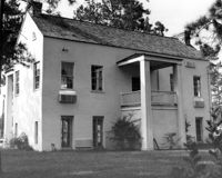
1920 Residence of Charley Jones - Barrows Historic District. View of West side. Moncks Corner, S.C.;6.5" x 9.5" B/W photo. Box 2, Folder 1-1-1. Three copies.
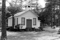
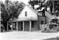
Guild Hall (Church of the Holy Family) - Barrows Historic District. View of Front. Moncks Corner, S.C.;6.5" x 9.5" B/W photo. Box 2, Folder 1-1-1. Three copies.
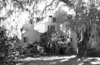
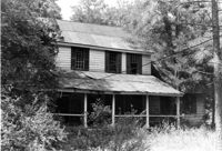
Charles Stevens House (Northampton Plantation House), 2008 Pinopolis Road. View of Front (?) elevation. Pinopolis, S.C.;6.5" x 9.5" B/W photo. Box 3, Folder 1-9-1 (I). One copy.
Robert Marion, Sr. House. View of Front elevation. Pinville Historic District. St. Stephen, S.C.;8" x 10" B/W photo. Box 3, Folder 1-9-1 (I). One copy.
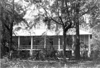
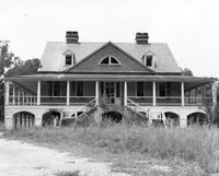
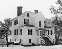
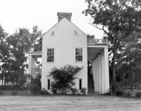
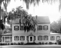
Dr. Morton Waring House - Main House. View of North (Front) elevation. Pinopolis Historic District South. Pinopolis, S.C.;6.5" x 9.5" B/W photo. Box 4, Folder 1-10-1 (III). One copy.
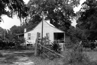
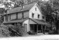
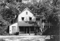
Harlock Webb Harvey Store and Home. View of Side and Front elevations. Pinopolis, S.C.;6.5" x 9.5" B/W photo. Box 4, Folder 1-10-1 (III). Three copies.
Dean Hall Plantation - Main House. View of NW (Front) elevation. Oakley, SC. NOTE: Property relocated to Beaufort County in 1971.;8" x 10" B/W photo. Box 2, Folder 1-8-8. One copy.
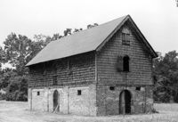
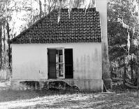
Middleburg Plantation, Middleburg Lane. Commissary - View of Front and Side elevation. Huger, S.C.;6.5" x 9.5" B/W photo. Box 4, Folder 1-12-4. One copy.
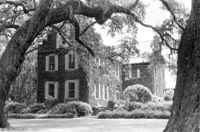
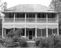
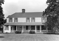
William Cain House - Main House. View of East (Side) elevation. Pinopolis Historic District North. Pinopolis, S.C.;6.5" x 9.5" B/W photo. Box 4, Folder 1-10-1 (III). One copy.
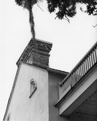
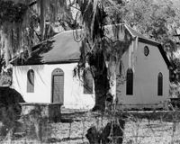
White Church (St. Thomas Church, The Brick Church), Off of Cainhoy Road. Vestry - View of Side elevation. Cainhoy, S.C.;8" x 10" B/W photo. Box 4, Folder 1-12-2. One copy.
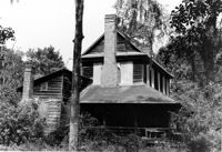
Dean Hall Plantation - Overseers House. View of East (Front) elevation. Oakley, SC. NOTE: Property relocated to Moncks Corner, S.C.;8" x 10" B/W photo. Box 2, Folder 1-8-9. One copy.
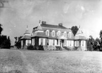
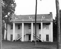
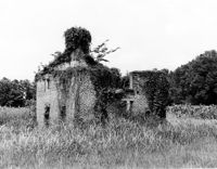
Halidon Hill Plantation (Quinby Plantation), Approximately 0.5 mile SE from Halidon Hill Lane and Cainhoy Road (S.C. Hwy 98). Main House - View of SW (Side and Front) elevation. Huger, S.C.;8" x 10" B/W photo. Box 4, Folder 1-12-6. One copy.
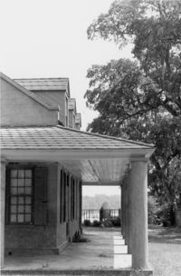
North Chachan Plantation, Chachan Drive. Pavilion - View of Side and Front elevation. Moncks Corner, SC.;8" x 10" B/W photo. Box 2, Folder 1-3-2. One copy.
Dean Hall Plantation - Overseers House. View of North (Side) elevation. Oakley, SC. NOTE: Property relocated to Moncks Corner, S.C.;8" x 10" B/W photo. Box 2, Folder 1-8-9. One copy.
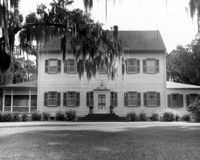
Stony Landing Plantation, East of U.S. Hwy. 52 and Riverwood Drive, along the Cooper River. View of Front elevation. Moncks Corner, SC.;6.5" x 9.5" B/W photo. Box 2, Folder 1-8-5. One copy.
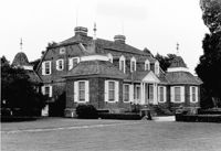
Halidon Hill Plantation (Quinby Plantation), Approximately 0.5 mile SE from Halidon Hill Lane and Cainhoy Road (S.C. Hwy 98). Main House - View of West (Rear) elevation. Huger, S.C.;8" x 10" B/W photo. Box 4, Folder 1-12-6. One copy.
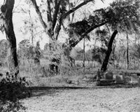
Dean Hall Plantation - Overseers House. Detail View of chimney. Oakley, SC. NOTE: Property relocated to Moncks Corner, S.C.;10" x 8" B/W photo. Box 2, Folder 1-8-9. One copy.
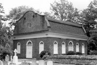
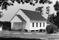
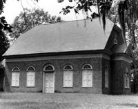
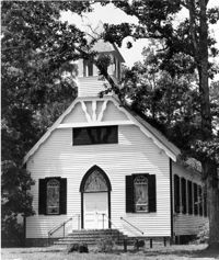
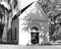
White Church (St. Thomas Church, The Brick Church), Off of Cainhoy Road. Main Building - View of Front and Side elevation. Cainhoy, S.C.;8" x 10" B/W photo. Box 4, Folder 1-12-2. One copy.
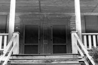
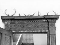
Lawson's Pond Plantation, Lawson Pond Lane. Interior View - Detail of door frame in East Front Room. West elevation. Cross, SC.;6.5" x 9.5" B/W photo. Box 2, Folder 1-4-3. One copy.
Dean Hall Plantation - Overseers House. View of NNW (Rear and Side) elevation. Oakley, SC. NOTE: Property relocated to Moncks Corner, S.C.;8" x 10" B/W photo. Box 2, Folder 1-8-9. One copy.
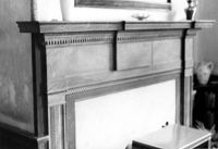
Lawson's Pond Plantation, Lawson Pond Lane. Interior View - Detail of mantle in East Front Room. NW elevation. Cross, SC.;6.5" x 9.5" B/W photo. Box 2, Folder 1-4-3. One copy.
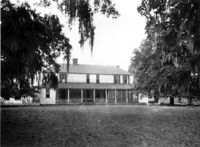
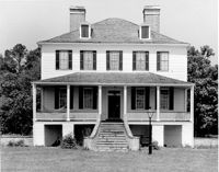
Halidon Hill Plantation (Quinby Plantation), Approximately 0.5 mile SE from Halidon Hill Lane and Cainhoy Road (S.C. Hwy 98). Main House - View of East (Front) elevation. Huger, S.C.;8" x 10" B/W photo. Box 4, Folder 1-12-6. One copy.
Halidon Hill Plantation (Quinby Plantation), Approximately 0.5 mile SE from Halidon Hill Lane and Cainhoy Road (S.C. Hwy 98). Main House - View of East (Front) elevation. Huger, S.C.;8" x 10" B/W photo. Box 4, Folder 1-12-6. One copy.