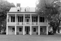
The Grove Plantation (Ernest F. Hollings ACE Basin National Wildlife Refuge). View of South (Front) elevation. Adams Run, S.C.;6.5" x 10" B/W photo. Box 15, Folder 2-11-1. Three copies.
The Grove Plantation (Ernest F. Hollings ACE Basin National Wildlife Refuge). View of South (Front) elevation. Adams Run, S.C.;6.5" x 10" B/W photo. Box 15, Folder 2-11-1. One copy.
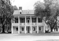
Lowndes Grove Plantation, 260 St. Margaret Street. Main House - View of East (Side) elevation. Charleston, S.C.;6.5" x 10" B/W photo. Box 8, Folder 2-1-148. One copy.
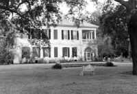
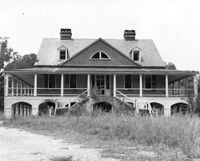
Lowndes Grove Plantation, 260 St. Margaret Street. View of Ashley River, West elevation. Charleston, S.C.;6.5" x 10" B/W photo. Box 8, Folder 2-1-148. One copy.
Lowndes Grove Plantation, 260 St. Margaret Street. View of Ashley River, West elevation. Charleston, S.C.;6.5" x 10" B/W photo. Box 8, Folder 2-1-148. One copy.
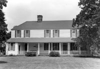
Dean Hall Plantation - Main House. View of NW (Front) elevation. Oakley, SC. NOTE: Property relocated to Beaufort County in 1971.;8" x 10" B/W photo. Box 2, Folder 1-8-8. One copy.
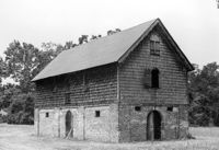
Middleburg Plantation, Middleburg Lane. Commissary - View of Front and Side elevation. Huger, S.C.;6.5" x 9.5" B/W photo. Box 4, Folder 1-12-4. One copy.
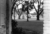
The Grove Plantation (Ernest F. Hollings ACE Basin National Wildlife Refuge). View of Outbuildings. Adams Run, S.C.;6.5" x 10" B/W photo. Box 15, Folder 2-11-1. One copy.
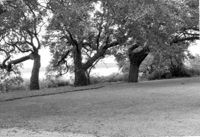
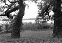
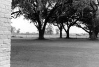
The Grove Plantation (Ernest F. Hollings ACE Basin National Wildlife Refuge). View of Property. Adams Run, S.C.;6.5" x 10" B/W photo. Box 15, Folder 2-11-1. Two copies.