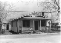
House on site affected by the construction of Interstate 26 (I-26). Building address number 2215. [2215 Delano.] Surveyor notations on back of photo: "Dkt.: 10.490. Property owner: Cath. Mason Lewis. Tract: 84. Station: 5824+00 Rt. Date: March 22, 1962. In R/W - Bought." [See collection description for explanation of surveyor notations.]
House (rear view) on site affected by the construction of Interstate 26 (I-26). [Building address number 2215. 2215 Delano.] Surveyor notations on back of photo: "Dkt.: 10.490. Property owner: Cath. Mason Lewis. Tract: 84. Station: 5824+00 Rt. Date: March 22, 1962. In R/W - Bought." [See collection description for explanation of surveyor notations.]
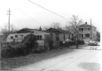
House, trailer, and street on site affected by the construction of Interstate 26 (I-26). Surveyor notations on back of photo: "Dkt.: 10.490. Property owner: Jacob Myers, et al. Tract: 86-A. Station: 5823+90 Rt. Date: March 22, 1962. Proximity to house. Owner to move trailer." [See collection description for explanation of surveyor notations.]
House on site affected by the construction of Interstate 26 (I-26). Surveyor notations on back of photo: "Dkt.: 10.490. Property owner: Jacob Myers, et al. Tract: 86-A. Station: 5823+90 Rt. Date: March 22, 1962. Proximity to house." [See collection description for explanation of surveyor notations.]
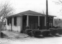
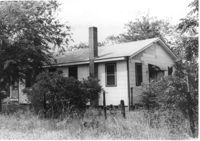
House on site affected by the construction of Interstate 26 (I-26). Surveyor notations on back of photo: "Dkt.: 10.490. Property owner: Geo. L. Robertson [George L. Robertson]. Tract: 87. Station: 5825+30 Rt. Date: March 22, 1962. In R/W - Bought." [See collection description for explanation of surveyor notations.]
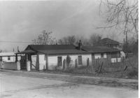
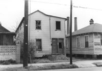
House on site affected by the construction of the Crosstown. Address: 118 America Street. Surveyor notations on back of photo: "Dkt.: 10.518. Property owner: Thelma Brown. Tract: 61. Station: 50+75 Rt. N.B. lane Route 17. Date: Mar. 7, 1963. In R/W - Bought." [See collection description for explanation of surveyor notations.]
House (rear view) on site affected by the construction of Interstate 26 (I-26). Surveyor notations on back of photo: "Dkt.: 10.490. Property owner: Geo. L. Robertson [George L. Robertson]. Tract: 87. Station: 5825+30 Rt. Date: March 22, 1962. In R/W - Bought." [See collection description for explanation of surveyor notations.]
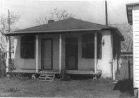
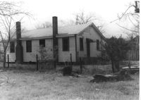
House on site affected by the construction of Interstate 26 (I-26). Surveyor notations on back of photo: "Dkt.: 10.490. Property owner: Geo. L. Robertson [George L. Robertson]. Tract: 87. Station: 5825+30 Rt. Date: May 15, 1962. In R/W - Bought." [See collection description for explanation of surveyor notations.]
House (rear view) on site affected by the construction of Interstate 26 (I-26). Surveyor notations on back of photo: "Dkt.: 10.490. Property owner: Geo. L. Robertson [George L. Robertson]. Tract: 87. Station: 5825+30 Rt. Date: May 15, 1962. In R/W - Bought." [See collection description for explanation of surveyor notations.]
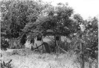
House and portion of lot, on site affected by the construction of Interstate 26 (I-26). View partially obscured by trees. Surveyor notations on back of photo: "Dkt.: 10.490. Property owner: Geo. L. Robertson [George L. Robertson]. Tract: 87. Station: 5824+80 Rt. Date: May 15, 1962. In R/W - Bought." [See collection description for explanation of surveyor notations.]