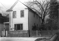
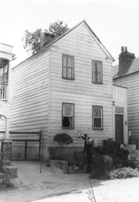
House on site affected by the construction of the Crosstown. Address: 162 Line Street. Surveyor notations on back of photo: "Dkt.: 10.524. Property owner: James Washington. Tract: 100. Station: 82+85 Lt. Date: Dec. 1, 1964. In R/W - Bought." [See collection description for explanation of surveyor notations.]
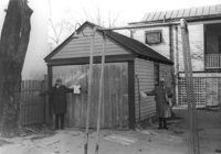
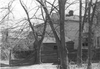
Storage shed or garage on site affected by the construction of the Crosstown. Address: 160 Line Street. Surveyor notations on back of photo: "Dkt.: 10.524. Property owner: John Meyer, Est. Tract: 101. Station: 83+25 Lt. Date: Dec. 1, 1964. In R/W - Bought." [See collection description for explanation of surveyor notations.]
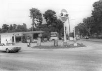
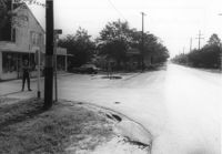
Gulf gas Station [Berkeley Gulf Service], on site affected by the widening of State Road 13 (Remount Road), with directional signs for Yeaman's Hall and Hanahan Baptist Church. Surveyor notations on back of photo: "Dkt.: 10.562. Property owner: C.D. Hoffecker Estate. Tract: 24. Date: Jul. 12, 1967." [See collection description for explanation of surveyor notations.]
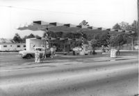
Kayo gas station, on site affected by the widening of State Road 13 (Remount Road). Surveyor notations on back of photo: "Dkt.: 10.562. Property owner: S.R. Hill - K.O. Station. Tract: 66. Date: Jul. 19, 1967." [See collection description for explanation of surveyor notations.]
Bowers Hardware, on site affected by the widening of State Road 13 (Remount Road). Surveyor notations on back of photo: "Dkt.: 10.562. Property owner: J.R. Herrin. Tract: 82. Date: Jul. 19, 1967." [See collection description for explanation of surveyor notations.]
House (rear view) on site affected by the construction of the Crosstown. Address: 176 Nassau Street. Surveyor notations on back of photo: "Dkt.: 10.518. Property owner: Carole B. Priester. Tract: 32. Station: 42+35 Lt. N.B. lane Route 17. Date: Mar. 6, 1963. In R/W - Bought. [See collection description for explanation of surveyor notations.]
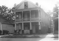
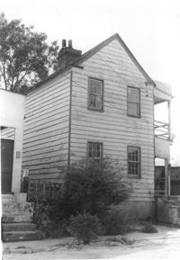
House on site affected by the construction of the Crosstown. Address: 147 President Street. Surveyor notations on back of photo: "Dkt.: 10.524. Property owner: Frank Chinners. Tract: 31. Station: 67+60 Rt. Date: Oct. 13, 1964. Partially In R/W - Bought." [See collection description for explanation of surveyor notations.]
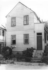
House on site affected by the construction of the Crosstown. Address: 9 Presidents Place. Surveyor notations on back of photo: "Dkt.: 10.524. Property owner: Mary Robinson, Est. Tract: 8. Station: 63+40 Rt. Date: Oct. 13, 1964. In R/W - Bought." [See collection description for explanation of surveyor notations.]
House on site affected by the construction of the Crosstown. Address: 9 Presidents Place. Surveyor notations on back of photo: "Dkt.: 10.524. Property owner: Mary Robinson, Est. Tract: 8. Station: 63+40 Rt. Date: Oct. 13, 1964. In R/W - Bought." [See collection description for explanation of surveyor notations.]
House on site affected by the construction of the Crosstown. Address: 11 Presidents Place. Surveyor notations on back of photo: "Dkt.: 10.524. Property owner: Lucille Smalls. Tract: 9. Station: 63+10 Rt. Date: Oct. 13, 1964. In R/W - Bought." [See collection description for explanation of surveyor notations.]
Limit your search
SCDOT Photographs: Properties in the Right-of-Way✖[remove]2,276