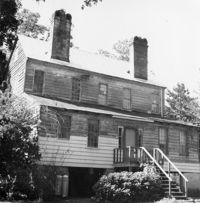
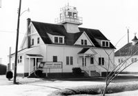
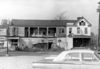
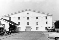
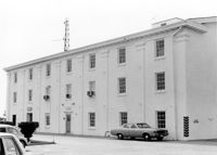
U.S. Coast Guard Historical District, I'on Avenue. Administration Building - View of North (Front) elevation. Sullivans Island, S.C.;6.5" x 10" (and 3.5" x 5") B/W photo. Box 16, Folder 2-13-1. Two copies.
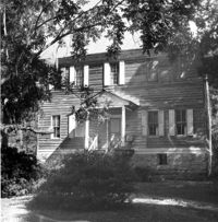
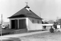
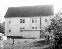
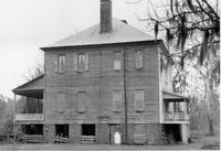
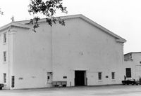
U.S. Coast Guard Historical District, I'on Avenue. Boat House - View of NW (Side and Front) elevation. Sullivans Island, S.C.;6.5" x 10" (and 3.5" x 5") B/W photo. Box 16, Folder 2-13-1. Two copies.
U.S. Coast Guard Historical District, I'on Avenue. Boat House - View of SE (Side and Rear) elevation. Sullivans Island, S.C.;6.5" x 10" (and 3.5" x 5") B/W photo. Box 16, Folder 2-13-1. Two copies.
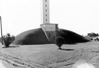
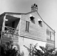
U.S. Coast Guard Historical District, I'on Avenue. Bunker - View of North (Front) elevation. Sullivans Island, S.C.;6.5" x 10" (and 3.5" x 5") B/W photo. Box 16, Folder 2-13-1. Two copies.
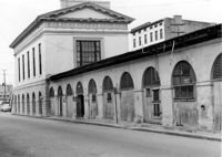
City Market - Market Hall and First Section of Sheds. View of SE (Side and Rear) elevation. Charleston, S.C.;8" x 10" B/W photo. Box 6, Folder 2-1-14. One copy.
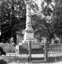
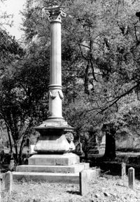
Magnolia Cemetery, Huguenin Avenue and Algonquin Road. Monument of Colonel William Washington. View of South elevation. Charleston, S.C.;8" x 8" B/W photo. Box 5, Folder 2-1-3. One copy.
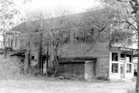
Firetag's Store (Mappus' Store, Six Mile Store), Success Street (between Meeting Street Road and Rivers Avenue). View of SW (Rear and Side) elevation. North Charleston, S.C.;6.5" x 10" B/W photo. Box 5, Folder 2-1-7. One copy.
Firetag's Store (Mappus' Store, Six Mile Store), Success Street (between Meeting Street Road and Rivers Avenue). View of West (Side) elevation. North Charleston, S.C.;6.5" x 10" B/W photo. Box 5, Folder 2-1-7. One copy.
Firetag's Store (Mappus' Store, Six Mile Store), Success Street (between Meeting Street Road and Rivers Avenue). View of East (Side) elevation. North Charleston, S.C.;6.5" x 10" B/W photo. Box 5, Folder 2-1-7. One copy.
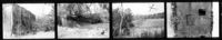
Comingtee Rice Barn (Mill), Located along the Western branch of the Cooper River. Contact Sheet 9 - Multiple Views. Berkeley County, S.C.;6" x 1" B/W photo. Box 20, Folder: Miscellaneous Photos: Scanned Contact Sheets. One copy.
Old Rectory (Gourdin House). Interior View - Detail of Mantle on East Side, 2nd Floor. ENE elevation. Pineville Historic District. St. Stephen, SC.;6.5" x 9.5" B/W photo. Box 3, Folder 1-9-1 (I). One copy.
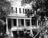
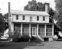
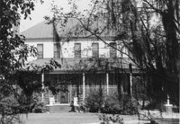
Rockville Historic District - Stevens House (Major Daniel Jenkins House), Maybank Highway. View of South (Front) elevation. Wadmalaw, S.C.;6.5" x 10" (and 8" x 10") B/W photo. Box 17, Folder 2-14-17. Two copies.
Magnolia Cemetery, Huguenin Avenue and Algonquin Road. William B. Smith Mausoleum. View of Side and Front elevation. Charleston, S.C.;8" x 8" B/W photo. Box 5, Folder 2-1-3. One copy.
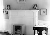
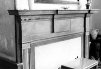
Lawson's Pond Plantation, Lawson Pond Lane. Interior View - Detail of mantle in East Front Room. NW elevation. Cross, SC.;6.5" x 9.5" B/W photo. Box 2, Folder 1-4-3. One copy.
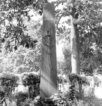
Magnolia Cemetery, Huguenin Avenue and Algonquin Road. Tombstone of Micah Jenkins. View of Front elevation. Charleston, S.C.;8" x 8" B/W photo. Box 5, Folder 2-1-3. One copy.
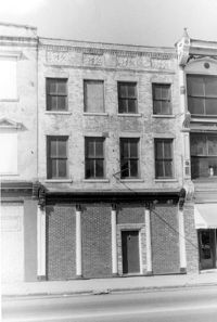
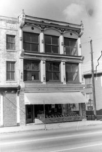
Cast Iron District, 207-235 Meeting Street - Detail of 231. View of NW (Front) elevation, looking North. Charleston, S.C.;10" x 6.5" B/W photo. Box 9, Folder 2-1-159. Three copies.
Firetag's Store (Mappus' Store, Six Mile Store) - View of NE (Front and Side) elevation. North Charleston, S.C.;6.5" x 10" B/W photo. Box 5, Folder 2-1-7. One copy.
William Cain House - Main House. Detail View of Rear Door and Windows, South (Rear) elevation, looking East. Pinopolis Historic District North. Pinopolis, S.C.;6.5" x 9.5" B/W photo. Box 4, Folder 1-10-1 (III). Two copies.
Old Rectory (Gourdin House). Interior View - Detail of Mantle on West Side, 2nd Floor. WNW elevation. Pineville Historic District. St. Stephen, SC.;6.5" x 9.5" B/W photo. Box 3, Folder 1-9-1 (I). One copy.
Cast Iron District, 207-235 Meeting Street - Detail of 223. View of NW (Front) elevation, looking North. Charleston, S.C.;10" x 6.5" B/W photo. Box 9, Folder 2-1-159. Three copies.
Cast Iron District, 207-235 Meeting Street - Detail of 227. View of NW (Front) elevation, looking North. Charleston, S.C.;10" x 6.5" B/W photo. Box 9, Folder 2-1-159. Three copies.
Cast Iron District, 207-235 Meeting Street - Detail of 229. View of NW (Front) elevation, looking North. Charleston, S.C.;6.5" x 10" B/W photo. Box 9, Folder 2-1-159. Three copies.
Cast Iron District, 207-235 Meeting Street - Detail of 233. View of NW (Front) elevation, looking North. Charleston, S.C.;10" x 6.5" B/W photo. Box 9, Folder 2-1-159. Three copies.
Cast Iron District, 207-235 Meeting Street - Detail of 235. View of NW (Front) elevation, looking North. Charleston, S.C.;10" x 6.5" B/W photo. Box 9, Folder 2-1-159. Three copies.
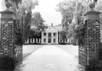
Boone Hall Plantation, Oak Avenue. Main House - View of North (Front) elevation. Mount Pleasant, S.C.;6.5" x 10" B/W photo. Box 10, Folder 2-2-5. One copy.
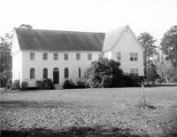
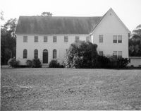
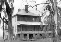
Halidon Hill Plantation (Quinby Plantation), Approximately 0.5 mile SE from Halidon Hill Lane and Cainhoy Road (S.C. Hwy 98). Main House - View of East (Front) elevation. Huger, S.C.;8" x 10" B/W photo. Box 4, Folder 1-12-6. One copy.
Halidon Hill Plantation (Quinby Plantation), Approximately 0.5 mile SE from Halidon Hill Lane and Cainhoy Road (S.C. Hwy 98). Main House - View of East (Front) elevation. Huger, S.C.;8" x 10" B/W photo. Box 4, Folder 1-12-6. One copy.
Stiles Point Plantation (Stiles-Hinson-Thompson House), 940 Paul Revere Drive. View of South (Rear) elevation. Charleston S.C.;6.5" x 10" B/W photo. Box 12, Folder 2-4-7. One copy.
Harrietta Plantation, 7 Mile Road. View of Garden (from Front Porch). North elevation. McClellanville, S.C.;6.5" x 10" B/W photo. Box 14, Folder 2-10-2. One copy.
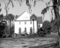
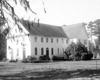
Tavou Church (Taveau Church), Strawberry Ferry Road (S.C. State Road 44). View of Front elevation. Moncks Corner, SC.;8" x 10" B/W photo. Box 2, Folder 1-3-12. One copy.
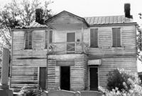
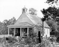
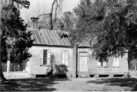
1920 Residence of Charley Jones - Barrows Historic District. View of West side. Moncks Corner, S.C.;6.5" x 9.5" B/W photo. Box 2, Folder 1-1-1. Three copies.
U.S. Coast Guard Historical District, I'on Avenue. Administration Building - View of South (Rear) elevation. Sullivans Island, S.C.;6.5" x 10" (and 3.5" x 5") B/W photo. Box 16, Folder 2-13-1. Two copies.
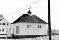
U.S. Coast Guard Historical District, I'on Avenue. Garage - View of East (Front) elevation. Sullivans Island, S.C.;6.5" x 10" (and 3.5" x 5") B/W photo. Box 16, Folder 2-13-1. Two copies.
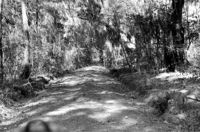
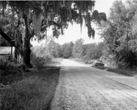
Stono River Rebellion Site (Cato's Rebellion Site), North Side of U.S. Highway 17, west of the Wallace River. View looking NW. Hollywood, S.C.;6.5" x 10" B/W photo. Box 16, Folder 2-11-16. One copy.
Johns Island Presbyterian Church, 2550 Bohicket Road. Church - Detail View of door and lamppost, Front elevation. Johns Island, S.C.;8" x 10" B/W photo. Box 12, Folder 2-5-4. One copy.
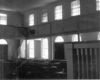
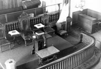
Johns Island Presbyterian Church, 2550 Bohicket Road. Church - Interior View. Sanctuary, Front elevation. Johns Island, S.C.;8" x 10" B/W photo. Box 12, Folder 2-5-4. One copy.
Johns Island Presbyterian Church, 2550 Bohicket Road. Church - View of Front elevation. Johns Island, S.C.;8" x 10" B/W photo. Box 12, Folder 2-5-4. Two copies.
Johns Island Presbyterian Church, 2550 Bohicket Road. Church - View of Front elevation. Johns Island, S.C.;8" x 10" B/W photo. Box 12, Folder 2-5-4. One copy.
Johns Island Presbyterian Church, 2550 Bohicket Road. Church - View of Rear elevation. Johns Island, S.C.;8" x 10" B/W photo. Box 12, Folder 2-5-4. One copy.
Johns Island Presbyterian Church, 2550 Bohicket Road. Church - View of Front elevation. Johns Island, S.C.;8" x 10" B/W photo. Box 12, Folder 2-5-4. One copy.
U.S. Coast Guard Historical District, I'on Avenue. Bunker - View of NW (Side and Front) elevation. Sullivans Island, S.C.;6.5" x 10" (and 3.5" x 5") B/W photo. Box 16, Folder 2-13-1. Two copies.
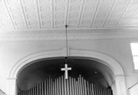
Old Bethel Methodist Church, 222 Calhoun Street. Interior View - Detail of Chancel. NE (Front and Side) elevation. Charleston, S.C.;6.5" x 10" B/W photo. Box 7, Folder 2-1-43. One copy.
Johns Island Presbyterian Church, 2550 Bohicket Road. Church - View of Front and Side elevation. Johns Island, S.C.;8" x 10" B/W photo. Box 12, Folder 2-5-4. One copy.
Johns Island Presbyterian Church, 2550 Bohicket Road. Church - View of Front and Side elevation. Johns Island, S.C.;8" x 10" B/W photo. Box 12, Folder 2-5-4. One copy.
Magnolia Cemetery, Huguenin Avenue and Algonquin Road. Tombstone of Birt family. View of Front elevation. NOTE: Print has superimposed second image. Charleston, S.C.;8" x 8" B/W photo. Box 5, Folder 2-1-3. Two copies.
Rockville Historic District - Grace Episcopal Chapel (Grace Epsicopal Church), Grace Chapel Road. View of Front and Side elevation. Wadmalaw, S.C.;10" x 6.5" (and 10" x 8") B/W photo. Box 17, Folder 2-14-18. Two copies.
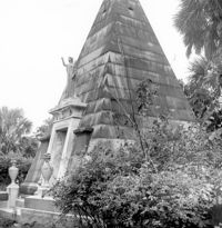
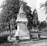
Magnolia Cemetery, Huguenin Avenue and Algonquin Road. Monument of Hugh Swinton Legare. View of Front and Side elevation. Charleston, S.C.;10" x 6.5" B/W photo. Box 5, Folder 2-1-3. One copy.
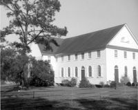
Tavou Church (Taveau Church), Strawberry Ferry Road (S.C. State Road 44). View of Side elevation. Moncks Corner, SC.;6.5" x 9.5" B/W photo. Box 2, Folder 1-3-12. One copy.
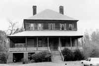
Rockville Historic District - Hagood House (Micah Jenkins House), Grace Chapel Road. View of South (Front) elevation. Wadmalaw Island, S.C.;6.5" x 10" B/W photo. Box 17, Folder 2-14-16. One copy.
Rockville Historic District - Hagood House (Micah Jenkins House), Grace Chapel Road. View of South (Front) elevation. Wadmalaw Island, S.C.;8" x 10" B/W photo. Box 17, Folder 2-14-16. One copy.
Rockville Historic District - Old Episcopal Rectory, Maybank Highway. View of SE (Side and Front) elevation. Wadmalaw Island, S.C.;6.5" x 10" B/W photo. Box 17, Folder 2-14-13. One copy.
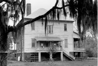
Rockville Historic District - Mary A. Whaley House, Maybank Highway. View of West (Side) elevation. Wadmalaw Island, S.C.;6.5" x 10" B/W photo. Box 17, Folder 2-14-12. One copy.
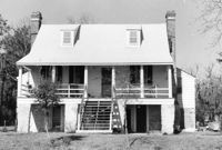
Rockville Historic District - Perry House, Maybank Highway. View of South (Front) elevation. Wadmalaw Island, S.C.;6.5" x 10" B/W photo. Box 17, Folder 2-14-14. One copy.
Rockville Historic District - W.E. Jenkins House (James LaRoche House). View of South (Front) elevation. Wadmalaw Island, S.C.;6.5" x 10" B/W photo. Box 17, Folder 2-14-15. One copy.
Cathedral of St. Luke and St. Paul, 126 Coming Street. Contact Sheet 7 - Views of Front and Sides elevations. Charleston, S.C.;1" x 4.5" B/W photo. Box 20, Folder: Miscellaneous Photos: Scanned Contact Sheets. One copy.
Cathedral of St. Luke and St. Paul, 126 Coming Street. Contact Sheet 7 - Views of Rear and Sides elevations. Charleston, S.C.;1" x 9" B/W photo. Box 20, Folder: Miscellaneous Photos: Scanned Contact Sheets. One copy.
Cathedral of St. Luke and St. Paul, 126 Coming Street. Contact Sheet 7 - Views of Interior. Charleston, S.C.;1" x 4.5" B/W photo. Box 20, Folder: Miscellaneous Photos: Scanned Contact Sheets. One copy.
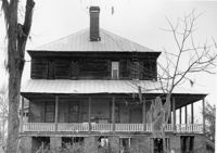
Stony Landing Plantation, East of U.S. Hwy. 52 and Riverwood Drive, along the Cooper River. View of Side and Front elevation. Moncks Corner, SC.;6.5" x 9.5" B/W photo. Box 2, Folder 1-8-5. One copy.
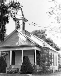
Church of the Redeemer (Pineville Chapel), Matilda Circle. Interior View - Detail of Front Entrance. NW (Front) elevation. Pineville Historic District. Pineville, SC.;6.5" x 9.5" B/W photo. Box 3, Folder 1-9-1 (I). One copy.
Stono River Rebellion Site (Cato's Rebellion Site), North Side of U.S. Highway 17, west of the Wallace River. View looking West. Hollywood, S.C.;6.5" x 10" B/W photo. Box 16, Folder 2-11-16. One copy.
Old Rectory (Gourdin House). View of North (Front and Side) elevation. Pineville Historic District. St. Stephen, SC.;6.5" x 9.5" B/W photo. Box 3, Folder 1-9-1 (I). One copy.
Limit your search
Photos from the Records of The Historic Preservation Planner, BCD-COG✖[remove]985