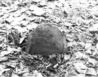
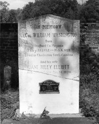
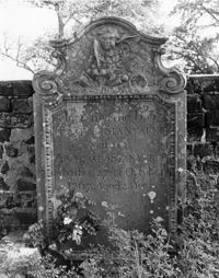
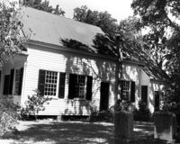
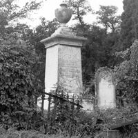
Colonel William Washington Cemetery. Tombstone of William Washington Ancrum (1854). Ravenel, S.C.;10" x 8" B/W photo. Box 16, Folder 2-11-11. One copy.
Magnolia Cemetery, Huguenin Avenue and Algonquin Road. Monument of Emma Heyward Haskell. Charleston, S.C.;8" x 8" B/W photo. Box 5, Folder 2-1-3. One copy.
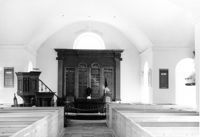
St. Andrews Episcopal Church (Old St. Andrews Parish Church), 2604 Ashley River Road. Interior View - North Entrance. North elevation. Charleston, S.C.;10" x 6.5" B/W photo. Box 14, Folder 2-9-7. One copy.
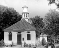
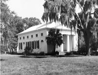
Christ Church (Christ Episcopal Church), 2304 U.S. Highway 17. View of North (Front) elevation. Mount Pleasant, S.C.;8" x 10" B/W photo. Box 10, Folder 2-2-6. One copy.
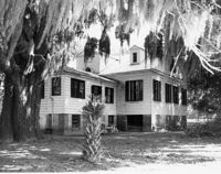
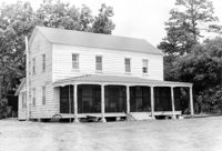
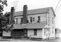
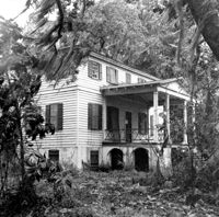
Old House Plantation, Clark Road. Main House - View of SE (Side and Rear) elevation. Edisto Island, S.C.;8" x 10" B/W photo. Box 11, Folder 2-3-10. One copy.
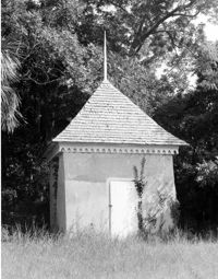
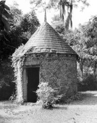
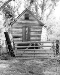
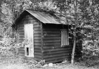
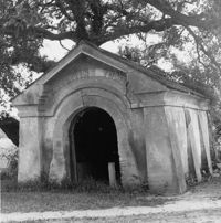
Bleak Hall Plantation, S.C. Hwy. 174. Smoke House - View of SW (Front) elevation. Edisto Island, S.C.;10" x 8" B/W photo. Box 10, Folder 2-3-2. One copy.
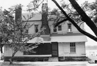
Old House Plantation, Clark Road. Main House - View of North (Front) elevation. Edisto Island, S.C.;8" x 10" B/W photo. Box 11, Folder 2-3-10. One copy.
Edisto Island Presbyterian Church, S.C. Hwy. 174. View of NE (Front and Side) elevation. Edisto Island, S.C.;8" x 10" B/W photo. Box 10, Folder 2-3-7. One copy.
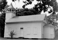
Edisto Island Baptist Church, S.C. Hwy. 174. View of NW (Rear and Side) elevation. Edisto Island, S.C.;8" x 10" B/W photo. Box 10, Folder 2-3-6. One copy.
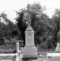
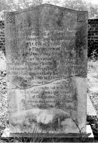
Colonel William Washington Cemetery. Tombstone of Colonel William Washington (1810) and Jane Riley Elliott - View of Rear. Ravenel, S.C.;10" x 6.5" B/W photo. Box 16, Folder 2-11-11. Two copies.
Boone Hall Plantation, Oak Avenue. Gin House - View of NE (Front) elevation, looking East. Mount Pleasant, S.C.;6.5" x 10" B/W photo. Box 10, Folder 2-2-5. One copy.
Colonel William Washington Cemetery. Tombstone of Colonel William Washington (1810) and Jane Riley Elliott - View of Front. Ravenel, S.C.;10" x 8" B/W photo. Box 16, Folder 2-11-11. Two copies.
Boone Hall Plantation, Oak Avenue. Smoke House - View of NW (Front and Side) elevation. Mount Pleasant, S.C.;10" x 8" B/W photo. Box 10, Folder 2-2-5. One copy.
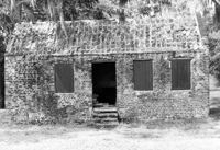
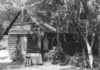
Boone Hall Plantation, Oak Avenue. Slave Cabin - View of North (Front) elevation. Mount Pleasant, S.C.;6.5" x 10" B/W photo. Box 10, Folder 2-2-5. One copy.
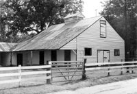
Boone Hall Plantation, Oak Avenue. Rat Proof Barn - View of South (Front) elevation. Mount Pleasant, S.C.;10" x 8" B/W photo. Box 10, Folder 2-2-5. One copy.
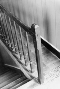
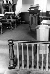
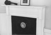
Old Rectory (Gourdin House). Interior View - Detail of Newel Post. WSW elevation. Pineville Historic District. St. Stephen, SC.;6.5" x 9.5" B/W photo. Box 3, Folder 1-9-1 (I). One copy.
St. Andrews Episcopal Church (Old St. Andrews Parish Church), 2604 Ashley River Road. Interior View - Chancel. East elevation. Charleston, S.C.;6.5" x 10" B/W photo. Box 14, Folder 2-9-7. One copy.
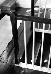
Mary Lesesne House (B.C. Cox House), ca. 1790. Interior View - 1st Floor. Detail of Newel Post. Cainhoy, S.C.;9.5" x 6.5" B/W photo. Box 4, Folder 1-12-3. One copy.
Old Rectory (Gourdin House). Interior View - Detail of Newel Post. WSW elevation. Pineville Historic District. St. Stephen, SC.;9.5" x 6.5" B/W photo. Box 3, Folder 1-9-1 (I). One copy.
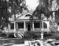
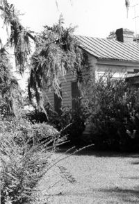
Mary Lesesne House (B.C. Cox House), ca. 1790. View of NW (Front and Side) elevation. Cainhoy, S.C.;6.5" x 9.5" B/W photo. Box 4, Folder 1-12-3. One copy.
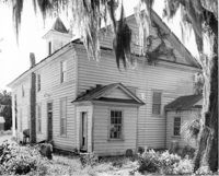
Old Rectory (Gourdin House). View of NW (Rear and Side) elevation. Pineville Historic District. St. Stephen, SC.;9.5" x 6.5" B/W photo. Box 3, Folder 1-9-1 (I). One copy.
White Oak Lock. View down canal from White Oak lock showing cypress planking to retain water. Tailrace Canal, Old Santee Canal Park. Berkeley, SC.;6.5" x 9.5" B/W photo. Box 3, Folder 1-9-2. One copy.
White Oak Lock. Santee Canal Section - General View; Trees in foreground are on Tow path. Tailrace Canal, Old Santee Canal Park. Berkeley, SC.;6.5" x 9.5" B/W photo. Box 3, Folder 1-9-2. One copy.
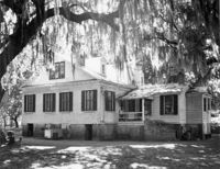
Mary Lesesne House (B.C. Cox House), ca. 1790. View of SE (Side and Rear) elevation. Cainhoy, S.C.;6.5" x 9.5" B/W photo. Box 4, Folder 1-12-3. One copy.
White Church (St. Thomas Church, The Brick Church), Off of Cainhoy Road. Vestry - View of Side elevation. Cainhoy, S.C.;8" x 10" B/W photo. Box 4, Folder 1-12-2. One copy.
Mary Lesesne House (B.C. Cox House), ca. 1790. View of NW (Front and Side) elevation. Cainhoy, S.C.;6.5" x 9.5" B/W photo. Box 4, Folder 1-12-3. One copy.
Mary Lesesne House (B.C. Cox House), ca. 1790. View of SE (Rear and Side) elevation. Cainhoy, S.C.;6.5" x 10" B/W photo. Box 4, Folder 1-12-3. One copy.
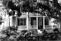
Rockville Historic District - John F. Townsend House, Sea Island Yacht Club Road. Detail View of Front Porch, NE (Front and Side) elevation.. Wadmalaw Island, S.C.;8" x 10" B/W photo. Box 17, Folder 2-14-7. One copy.
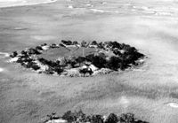
Folly Island Staging Area (Battery Green, U.S. Coast Guard Loran Station, Folly North Site), Address restricted. View facing NNW. Folly Beach, S.C.;8" x 10" B/W photo. Box 17, Folder 2-16-1. One copy.
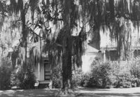
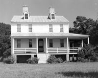
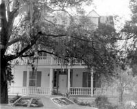
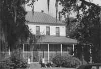
Oakland Plantation (Youghall Plantation), 1164 Porcher Bluff Road. Main House - View of SW (Side and Rear) elevation. Mount Pleasant, S.C.;10" x 8" B/W photo. Box 10, Folder 2-2-10. One copy.
Oakland Plantation (Youghall Plantation), 1164 Porcher Bluff Road. Kitchen House - View of NE (Front) elevation. Mount Pleasant, S.C.;6.5" x 10" B/W photo. Box 10, Folder 2-2-10. One copy.
Oakland Plantation (Youghall Plantation), 1164 Porcher Bluff Road. Main House - View of North (Front) elevation. Mount Pleasant, S.C.;6.5" x 10" B/W photo. Box 10, Folder 2-2-10. One copy.
Oakland Plantation (Youghall Plantation), 1164 Porcher Bluff Road. Main House - View of South (Rear) elevation. Mount Pleasant, S.C.;6.5" x 10" B/W photo. Box 10, Folder 2-2-10. One copy.
Magnolia Cemetery, Huguenin Avenue and Algonquin Road. Monument of Sarah F., Charles F., and Elbert P. Jones. View of North elevation. Charleston, S.C.;10" x 8" B/W photo. Box 5, Folder 2-1-3. One copy.
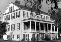
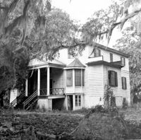
Peter's Point Plantation, off S.C. Hwy 174 on County Road 764 (Peters Point Road). View of North (Side and Front) elevation. Edisto Island, S.C.;6.5" x 10" B/W photo. Box 11, Folder 2-3-17. Two copies.
Peter's Point Plantation, off S.C. Hwy 174 on County Road 764 (Peters Point Road). View of West (Side and Rear) elevation. Edisto Island, S.C.;10" x 6.5" B/W photo. Box 11, Folder 2-3-17. One copy.
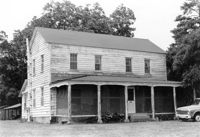
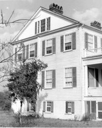
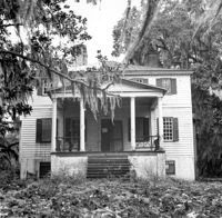
Windsor Plantation (Little Edisto Plantation, Ashwood Plantation), S.C. Hwy. 174. View of NE (Front and Side) elevation. Edisto Island, S.C.;6.5" x 10" B/W photo. Box 11, Folder 2-3-18. One copy.
Windsor Plantation (Little Edisto Plantation, Ashwood Plantation), S.C. Hwy. 174. View of NE (Side and Front) elevation. Edisto Island, S.C.;10" x 8" B/W photo. Box 11, Folder 2-3-18. One copy.
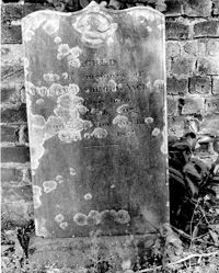
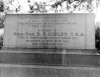
Magnolia Cemetery, Huguenin Avenue and Algonquin Road. Tombstone of R.S. Ripley. View of South elevation. Charleston, S.C.;8" x 10" B/W photo. Box 5, Folder 2-1-3. One copy.
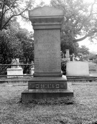
Magnolia Cemetery, Huguenin Avenue and Algonquin Road. Tombstone of William Gilmore Simms. Charleston, S.C.;10" x 8" B/W photo. Box 5, Folder 2-1-3. One copy.
Church of the Redeemer (Pineville Chapel), Matilda Circle. View of SE (Front and Side) elevation. Pineville Historic District. Pineville, SC.;6.5" x 9.5" B/W photo. Box 3, Folder 1-9-1 (I). One copy.
William Robertson House - Office (Wampee Plantation Summer House). View of SW (Front and Side) elevation. Pinopolis, S.C.;9.5" x 6.5" B/W photo. Box 4, Folder 1-10-1 (III). Two copies.
Dr. Morton Waring House - Lodge. Detail View of Front Porch, East (Front) elevation. Pinopolis Historic District South. Pinopolis, S.C.;6.5" x 9.5" B/W photo. Box 4, Folder 1-10-1 (III). Two copies.
Dr. Morton Waring House - Outbuilding. View of NE (Side and Front) elevation. Pinopolis Historic District South. Pinopolis, S.C.;6.5" x 9.5" B/W photo. Box 4, Folder 1-10-1 (III). Two copies.
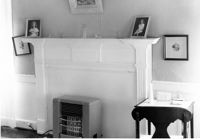
Library Society Building. Interior View - Detail of Mantel on West Side. WNW elevation. Pineville Historic District. St. Stephen, SC.;6.5" x 9.5" B/W photo. Box 3, Folder 1-9-1 (I). One copy.
Library Society Building. View of NE (Side and Front) elevation. Pineville Historic District. St. Stephen, SC.;9.5" x 6.5" B/W photo. Box 3, Folder 1-9-1 (I). One copy.
Old Post Office. View of North (Front) elevation. Pineville Historic District. St. Stephen, SC.;6.5" x 9.5" B/W photo. Box 3, Folder 1-9-1 (I). One copy.
Old Rectory (Gourdin House). Interior View - Detail of Mantle on West Side. WNW elevation. Pineville Historic District. St. Stephen, SC.;6.5" x 9.5" B/W photo. Box 3, Folder 1-9-1 (I). Three copies.
Christ Church Episcopal - Adams Run, State Highway 174. View of Interior. West (Front) elevation. Hollywood, S.C.;6.5" x 10" B/W photo. Box 16, Folder 2-11-12. Three copies.
Christ Church Episcopal - Adams Run, State Highway 174. View of North (Side) elevation. Hollywood, S.C.;6.5" x 10" B/W photo. Box 16, Folder 2-11-12. Three copies.
Christ Church Episcopal - Adams Run, State Highway 174. View of West (Front) elevation. Hollywood, S.C.;10" x 6.5" B/W photo. Box 16, Folder 2-11-12. Three copies.
Christ Church Episcopal - Adams Run, State Highway 174. View of South (Side) elevation. Hollywood, S.C.;8" x 10" B/W photo. Box 16, Folder 2-11-12. One copy.
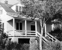
Rockville Historic District - Cornelia J. Whaley House, Grace Chapel Road. View of South (Front) elevation. Wadmalaw Island, S.C.;8" x 6.5" (and 6.5" x 10") B/W photo. Box 17, Folder 2-14-19. Three copies.
Magnolia Cemetery, Huguenin Avenue and Algonquin Road. Monument of Sarah F., Charles F., and Elbert P. Jones. View of East elevation. Charleston, S.C.;10" x 8" B/W photo. Box 5, Folder 2-1-3. One copy.
Magnolia Cemetery, Huguenin Avenue and Algonquin Road. Monument of Sarah F., Charles F., and Elbert P. Jones. View of West elevation. Charleston, S.C.;10" x 8" B/W photo. Box 5, Folder 2-1-3. One copy.
Cast Iron District, 207-235 Meeting Street - Detail of 211. View of NW (Front) elevation, looking North. Charleston, S.C.;10" x 6.5" B/W photo. Box 9, Folder 2-1-159. Three copies.
Magnolia Cemetery, Huguenin Avenue and Algonquin Road. Tombstone of Thomas Bennett. View of Front and Side elevation. Charleston, S.C.;8" x 8" B/W photo. Box 5, Folder 2-1-3. One copy.
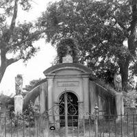
Magnolia Cemetery, Huguenin Avenue and Algonquin Road. Trapier-Jervey Gate. View of Front elevation. Charleston, S.C.;8" x 8" B/W photo. Box 5, Folder 2-1-3. One copy.
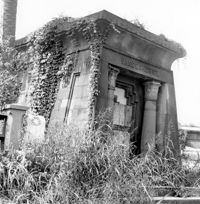
Magnolia Cemetery, Huguenin Avenue and Algonquin Road. Vanderhorst Mausoleum. View of Front and Side elevation. Charleston, S.C.;8" x 8" B/W photo. Box 5, Folder 2-1-3. One copy.
Magnolia Cemetery, Huguenin Avenue and Algonquin Road. Gibbes Mausoleum. View of Front elevation. Charleston, S.C.;8" x 8" B/W photo. Box 5, Folder 2-1-3. One copy.
Boone Hall Plantation, Oak Avenue. Stable - View of SW (Front and Side) elevation. Mount Pleasant, S.C.;6.5" x 10" B/W photo. Box 10, Folder 2-2-5. One copy.
William Robertson House - Slave Cabin (Wampee Plantation Summer House). View of NW (Front and Side) elevation. Pinopolis, S.C.;6.5" x 9.5" B/W photo. Box 4, Folder 1-10-1 (III). Two copies.
William Cain House - Main House. Detail View of Rear Door and Windows, South (Rear) elevation. Pinopolis Historic District North. Pinopolis, S.C.;6.5" x 9.5" B/W photo. Box 4, Folder 1-10-1 (III). Two copies.
Mary Lesesne House (B.C. Cox House), ca. 1790. Interior View - 1st Floor, Central Room. Detail of Mantel. Cainhoy, S.C.;6.5" x 9.5" B/W photo. Box 4, Folder 1-12-3. One copy.
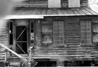
William Cain House - Slave Cabin. View of NE (Side and Front) elevation. Pinopolis Historic District North. Pinopolis, S.C.;6.5" x 9.5" B/W photo. Box 4, Folder 1-10-1 (III). Two copies.
William Robertson House - Main House (Wampee Plantation Summer House). View of West (Rear) elevation. Pinopolis, S.C.;6.5" x 9.5" B/W photo. Box 4, Folder 1-10-1 (III). Two copies.
William Cain House - Main House. View of SE (Side and Rear) elevation. Pinopolis Historic District North. Pinopolis, S.C.;6.5" x 9.5" B/W photo. Box 4, Folder 1-10-1 (III). Two copies.
William Cain House - Main House. View of West (Side) elevation. Pinopolis Historic District North. Pinopolis, S.C.;6.5" x 9.5" B/W photo. Box 4, Folder 1-10-1 (III). Two copies.
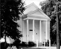
Mount Pleasant Presbyterian Church, 302 Hibben Street (NE corner of Hibben and Church Street). View of SE (Front) elevation. Mount Pleasant, S.C.;6.5" x 10" (and 8" x 10") B/W photo. Box 13, Folder 2-8-6. Two copies.
Captain Peter Lewis House, 206 Live Oak Drive. View of South (Front) elevation. Mount Pleasant, S.C.;6.5" x 10" B/W photo. Box 13, Folder 2-8-12. One copy.
Captain Peter Lewis House, 206 Live Oak Drive. View of South (Front) elevation. Mount Pleasant, S.C.;8" x 10" B/W photo. Box 13, Folder 2-8-12. Three copies.
Old Rectory (Gourdin House). View of NNE (Front and Side) elevation. Pineville Historic District. St. Stephen, SC.;6.5" x 9.5" B/W photo. Box 3, Folder 1-9-1 (I). One copy.
Limit your search
Photos from the Records of The Historic Preservation Planner, BCD-COG✖[remove]985