Search
« Previous |
1 - 10 of 76
|
Next »
Search Results
Description:
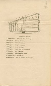
Map of area bounded by Archdale, Market, King and Beaufain Streets.
Description:
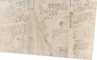
Map (not color-coded) of area around Reid Street and Meeting Street
Description:
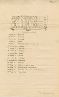
Map of area bounded by Jacob's Alley, Queen, King, and Archdale Street.
Description:
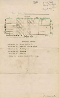
Map of area bounded by Burns Lane, Meeting, Calhoun, and King Street.
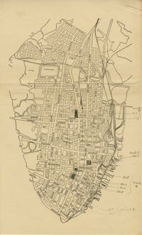
Description:
Map of peninsula.
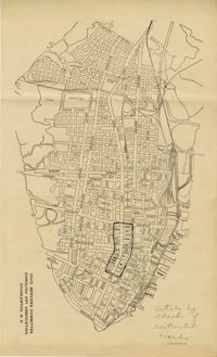
Description:
Map of peninsula.
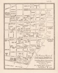
Description:
Map entitled "The Historic Heart of Charleston ... Compliments of the Old Slave Mart Museum," with advertisements on back of "The Historic Heart of Charleston."
Date:
1945
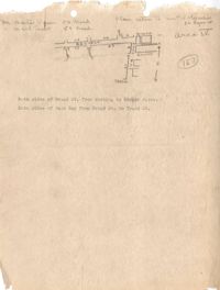
Description:
Map of Area 4 bounded by Broad Street, East Bay Street, and Tradd Street assigned to Mr. Martin Powers and Maier Triest.
Description:
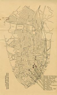
Map of the Charleston peninsula showing churches in congested areas.
Description:
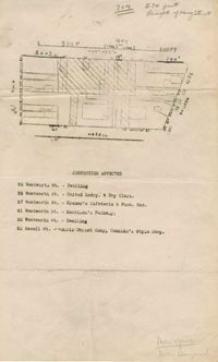
Map of area bounded by Wentworth, Meeting, and Hasell Street.