Search
« Previous |
101 - 150 of 231
|
Next »
Search Results
Date:
1960
Description:
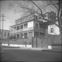
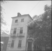
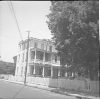
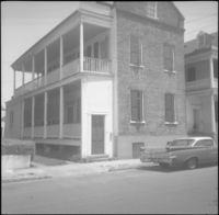
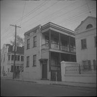
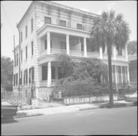
46 Society Street (Jonah M. Venning House).
Date:
1960
Description:
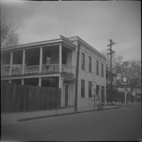
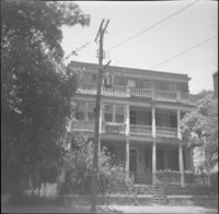
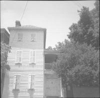
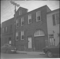
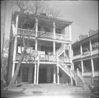
48 Society Street (Susan Robinson Tenements).
Date:
1960
Description:
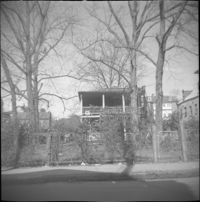
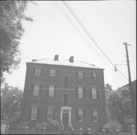
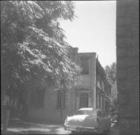
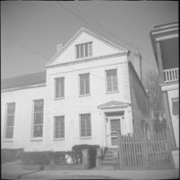
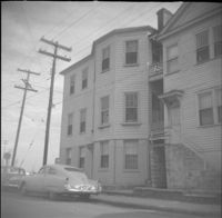
44 Society Street.
Date:
1960
Description:
32 Anson Street, which had been located at the northeast corner of Anson and Hasell Streets, later demolished.
Date:
1960
Description:
45 Anson Street, later demolished.
Date:
1960
Description:
Right to left: 48-50 Anson Street and 52 Anson Street (Thomas Wallace and Martin Dowd Tenements).
Date:
1960
Description:
35 Wentworth Street
Date:
1960
Description:
Wentworth Street elevation of 52 Anson Street, located at the southeast corner of Anson and Wentworth Streets.
Date:
1960
Description:
Right to left: 42 Anson Street and 44 Anson Street (Galloway's Grocery).
Date:
1960
Description:
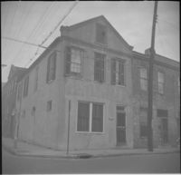
52 Anson Street, located at the southeast corner of Anson and Wentworth Streets.
Date:
1960
Description:
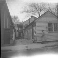
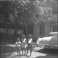
51 Laurens Street. Three children stand by a car in the driveway.
Date:
1960
Description:
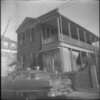
46 Anson Street (Thomas Wallace House).
Date:
1960
Description:
49 Laurens Street (William Monies House).
Date:
1960
Description:
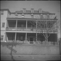
50 Laurens Street (Adams-Ingraham House)
Date:
1960
Description:
55 Laurens Street (James Jervey House).
Date:
1960
Description:
53 Laurens Street (James Marsh House).
Date:
1960
Description:
47 Laurens Street.
Date:
1960
Description:
51 Laurens Street.
Date:
1960
Description:
52 Laurens Street.
Description:
48 Laurens Street (Simon Jude Chancognie House).
Date:
1960
Description:
31 Hasell Street.
Date:
1960
Description:
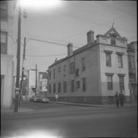
48 Hasell Street (St. Johannes Lutheran Church), located at the northwest corner of Hasell Street and Anson Street.
Date:
1960
Description:
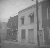
45 Hasell Street (Charles W. Seignious Building),Lucky Dollar Market, located at the southeast corner of Hasell Street and Anson Street.
Date:
1960
Description:
Northeast corner of Hasell Street and Anson Street, the site where 46 Anson Street once stood. Now a parking lot
Date:
1960
Description:
Left to right: 32 Wentworth Street and 30 Wentworth Street (William Thompson Houses).
Date:
1960
Description:
34-36 Wentworth Street (St. Peter's Roman Catholic Church and Rectory)
Date:
1960
Description:
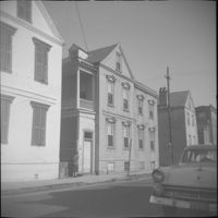
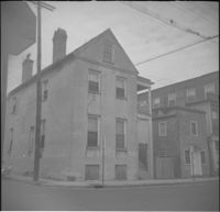
37 Hasell Street (Jones-Howell House).
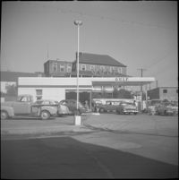
Description:
Gas station at the northwest corner of Wentworth Street and East Bay Street.
Date:
1960
Description:
34 Hasell Street.
Date:
1960
Description:
32 Hasell Street.
Date:
1960
Description:
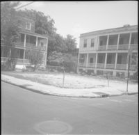
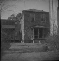
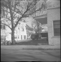
Unidentified house on East Bay Street, east side of street, likely within the 320 block, since demolished.
Date:
1960
Description:
322 East Bay Street (right), 324 East Bay Street (middle), partial view of 326 East Bay Street (left), since demolished.
Date:
1960
Description:
The original house at 82 Anson Street, later demolished to clear the lot for the relocation of the house at 86 Anson Street (Mary Smith House).
Date:
1960
Description:
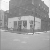
Gulf gas station located at 299 East Bay Street, northwest corner of East Bay Street and Society Street.
Date:
1960
Description:
Right to left: 84 Anson Street before demolition and 86 Anson Street (Mary Smith House) before its relocation to its current address (82 Anson Street).
Date:
1960
Description:
311 East Bay Street (Stephen Shrewsbury House), located at the corner of East Bay Street and Laurens Street. Laurens Street elevation.
Date:
1960
Description:
28 Wentworth Street. 26 Wentworth also in view (right).
Date:
1960
Description:
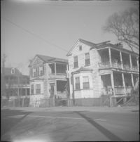
27 Wentworth Street flanked by 25 Wentworth (left).
Date:
1960
Description:
Left to right: 23 Society Street and 25 Society Street, later demolished. The houses were at the southwest corner of Society Street and East Bay Street.
Date:
1960
Description:
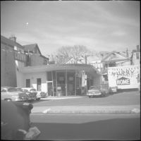
Humble Oil gas station (288 Meeting Street), located at the southeast corner of Meeting Street and George Street. Later demolished.
Date:
1960
Description:
Left to right: 23 Society Street, 25 Society Street, and partial view of 27 Society Street. All were later demolished.
Date:
1960
Description:
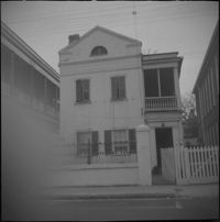
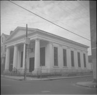
270 Meeting Street (Daniel Hart House), located at the southeast corner of Meeting Street and Society Street.
Date:
1960
Description:
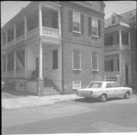
33 Wentworth Street (William Proctor House), flanked by 31 Wentworth Street (left) and 35 Wentworth Street (right).
Date:
1960
Description:
12 Wentworth Street (William C. Armstrong House), before removal of front piazza.
Date:
1960
Description:
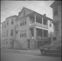
22-24 Wentworth Street (Francis Q. McHugh Tenements).
Date:
1960
Description:
29 Society Street (John W. Robinson Tenement).
Date:
1960
Description:
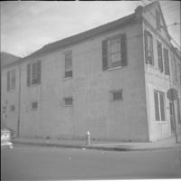
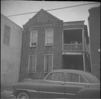
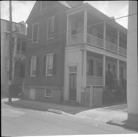
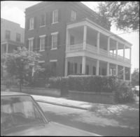
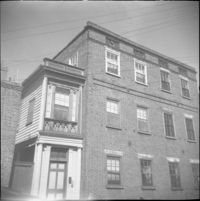
64 Hasell Street (Benjamin Smith House).
Date:
1960
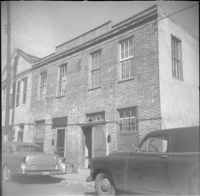
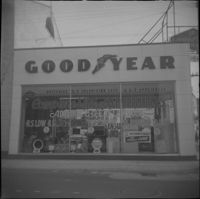
Description:
256 Meeting Street (William Gayer Carriage Factory) as a Goodyear Tire service center, before rehabilitation with a reconstructed façade. Located at the southeast corner of Meeting Street and Wentworth Street.
Date:
1960
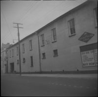
Description:
Wentworth Street façade of 256 Meeting Street (William Gayer Carriage Factory) when it was a Goodyear Tire service center. Located at the southeast corner of Meeting Street and Wentworth Street.
Date:
1960
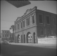
Description:
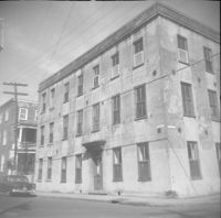
Wentworth Street elevation of the Central Fire Station (260-264 Meeting Street), located at the northeast corner of Meeting Street and Wentworth Street.