Search
« Previous |
1 - 50 of 231
|
Next »
Search Results
Date:
1960
Description:
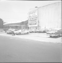
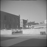
Northeast corner of Hasell Street and Meeting Street. Parking lot and building with billboards advertising "Hartnett for House" and Paul Motor Co.
Date:
1960
Description:
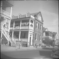
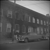
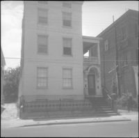
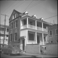
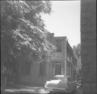
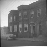
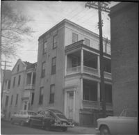
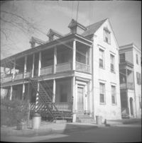
10 Wentworth Street (Charles W. Seignious House), with partial view of 12 Wentworth Street (left edge) and 8 Wentworth Street and 6 Wentworth Street (far right).
Date:
1960
Description:
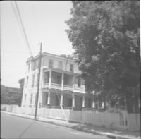
23 Wentworth Street (James J. Jeffords House), flanked by 21 Wentworth Street (left) and partial view of 25 Wentworth Street.
Date:
1960
Description:
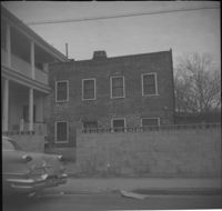
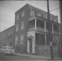
1 Wall Street, located at the northwest corner of Wall Street and Laurens Street.
Date:
1960
Description:
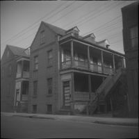
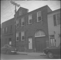
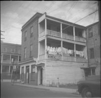
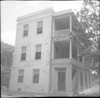
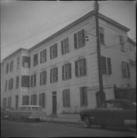
7-11 Wentworth Street (Edward Winslow Tenements).
Date:
1960
Description:
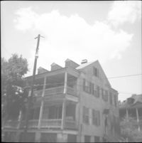
66 Society Street (Hieronymous-Roper House).
Date:
1960
Description:
56 Laurens Street.
Date:
1960
Description:
58 Laurens Street.
Description:
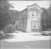
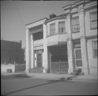
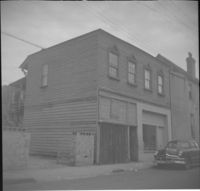
Parking lot of the Central Fire Station (260-264 Meeting Street), at circa 48 Wentworth Street.
Date:
1960
Description:
Unidentified house on East Bay Street, east side of street, likely within the 320 block, since demolished.
Date:
1960
Description:
28 Wentworth Street. 26 Wentworth also in view (right).
Date:
1960
Description:
27 Wentworth Street flanked by 25 Wentworth (left).
Date:
1960
Description:
35 Hasell Street (John McNellage House).
Date:
1960
Description:
4 George Street (James W. Brown House).
Date:
1960
Description:
6 George Street.
Date:
1960
Description:
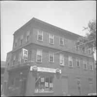
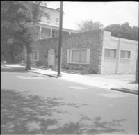
78 Anson Street (Royal Food Market), corner store located at the northeast corner of Anson and Laurens Streets, before its demolition.
Date:
1960
Description:
Right to left: 64 Anson Street (later demolished), 66 Anson Street (Chazal House), and 72 Anson Street (Kohne-Leslie House).
Date:
1960
Description:
Right to left: 64 Anson Street (later demolished) and 66 Anson Street (Chazal House).
Date:
1960
Description:
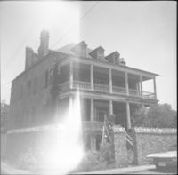
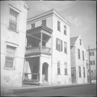
60 Anson Street (Robert M. Venning House), located at the southeast corner of Anson and Society Streets.
Date:
1960
Description:
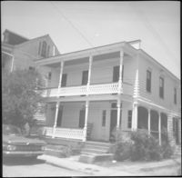
58 Anson Street (Robert M. Venning House).
Date:
1960
Description:
58 Anson Street (Robert M. Venning House).
Date:
1960
Description:
57 Hasell Street.
Date:
1960
Description:
58 Hasell Street.
Date:
1960
Description:
53 Hasell Street.
Date:
1960
Description:
51 Laurens Street.
Date:
1960
Description:
52 Laurens Street.
Description:
48 Laurens Street (Simon Jude Chancognie House).
Date:
1960
Description:
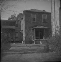
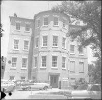
14 George Street (Middleton-Pinckney House), when it was the Commissioner of Public Works [Water Works] building.
Date:
1960
Description:
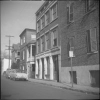
3-5 Wentworth Street. Partial view of 289 East Bay Street at left edge.
Date:
1960
Description:
34 Anson Street (Mary Lanneau House), flanked by 36-40 Anson Street which was later demolished.
Date:
1960
Description:
66 Society Street (Hieronymous-Roper House), flanked by 66½ Society Street (left) and 64 Society Street (right).
Date:
1960
Description:
47 Hasell Street, located at the southwest corner of Hasell Street and Anson Street.
Date:
1960
Description:
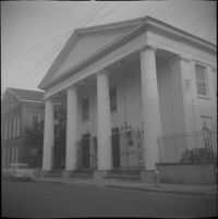
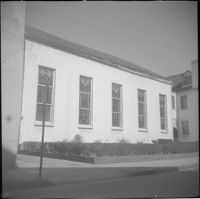
43 Wentworth Street (St. Andrew's Lutheran Church).
Date:
1960
Description:
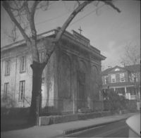
67 Anson Street (St. Stephen's Episcopal Church.
Date:
1960
Description:
35 Wentworth Street
Date:
1960
Description:
30 Society Street.
Date:
1960
Description:
Left to right: 46 Wentworth Street and 44 Wentworth Street. Partial view of the Central Fire Station parking lot also in view at left.
Date:
1960
Description:
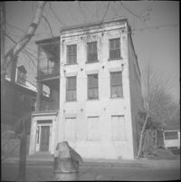
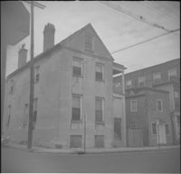
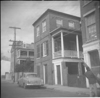
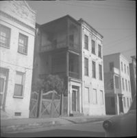
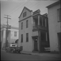
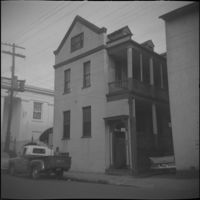
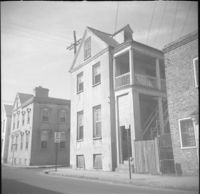
45 Wentworth Street, later demolished.
Date:
1960
Description:
45 Wentworth Street, later demolished.
Date:
1960
Description:
34-36 Wentworth Street (St. Peter's Roman Catholic Church and Rectory)
Date:
1960
Description:
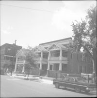
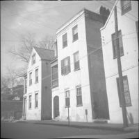
43 Society Street (Robert M. Venning House). 41 Society Street also in view at left.
Date:
1960
Description:
51 Society Street. Partial view of 49 Society Street at left.
Date:
1960
Description:
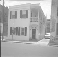
57 Anson Street (Ann Hunt's House).
Date:
1960
Description:
57 Anson Street (Ann Hunt's House).
Date:
1960
Description:
54 Anson Street.
Date:
1960
Description:
28 Wentworth Street, located at the northeast corner of Wentworth Street and Anson Street. Also features 26 Wentworth Street (right edge) and 53 Anson Street (William Thompson Tenement) (at left). Note, the Wentworth Street elevation of 53 Anson Street is 30 Anson Street.
Date:
1960
Description:
Right to left: 38 Society Street and 40 Society Street (Juliana Dupre House). Partial view of 42 Society Street at left edge.
Date:
1960
Description:
Left to right: 42 Society Street (Juliana Dupre House), 40 Society Street (Juliana Dupre House), and partial view of 38 Society Street.
Date:
1960
Description:
42 Society Street (Juliana Dupre House). Partial view of 40 Society Street at right.
Date:
1960
Description:
55 Hasell Street (left) and partial view of 57 Hasell Street.