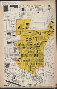
1. Ansonborough Historic District As Established in the Charleston City Ordinance of 1966 Description: A map of the Ansonborough Historic District. The boundaries of the 1966 Charleston City Ordinance are indicated in yellow.
2. Ansonborough map Description: Map of Ansonborough showing Meeting Street, King Street, Hasell Street, Maiden Street, Old Church Street, Bay Street, and others. A small piece of paper taped to the back reads: "Kindness of: Mr. Gedney M. Howe."