Search
« Previous |
1,121 - 1,140 of 1,158
|
Next »
Search Results
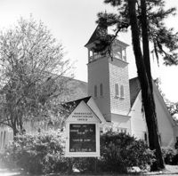
Date:
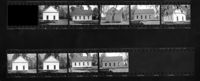
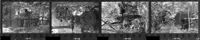
1973-03-15
Description:
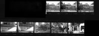
Appleby Methodist Church, Wire Road - intersection of County Roads 19 & 71. Contact Sheet 13 - Multiple Views. Reevesville, S.C.;10" x 4" B/W photo. Box 20, Folder: Miscellaneous Photos: Scanned Contact Sheets. One copy.
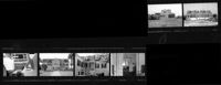
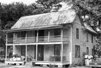
Date:
1973-04-10
Description:
Old Carroll House (Carroll Place), Junction of Quaker and Wire Roads. Contact Sheet 12 - Multiple Views. St. George, S.C.;10" x 5" B/W photo. Box 20, Folder: Miscellaneous Photos: Scanned Contact Sheets. One copy.
Date:
1973-03-15
Description:
Old Carroll House (Carroll Place), Junction of Quaker and Wire Roads. Contact Sheet 13 - Multiple Views. St. George, S.C.;10" x 4" B/W photo. Box 20, Folder: Miscellaneous Photos: Scanned Contact Sheets. One copy.
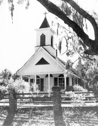
Date:
1970-09-19
Description:
Trinity Episcopal Church. View of Front elevation. Edisto Island, S.C.;10" x 8" B/W photo. Box 11, Folder 2-3-14. One copy.
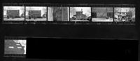
Date:
1970
Description:
Middleburg Plantation, Middleburg Lane. Contact Sheet 14 - Multiple Views of Unidentified Building and Steam Engine Ruins. Huger, S.C.;10" x 6" B/W photo. Box 20, Folder: Miscellaneous Photos: Scanned Contact Sheets. One copy.
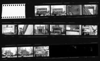
Date:
1971-11-19
Description:
Ralph Ingle House (Simonds House), 1009 Middle Street. Contact Sheet 15 - Multiple views of exterior and interior. Sullivans Island, S.C.;10" x 3.5" B/W photo. Box 20, Folder: Miscellaneous Photos: Scanned Contact Sheets. One copy.
Description:
Middleburg Plantation - Stable. View of Front elevation. Huger, S.C.;10" x 7" B/W photo. Box 4, Folder 1-12-4. One copy.
Date:
1973-02-25
Description:
Unitarian Church, 6 Archdale Street. Contact Sheet - Multiple Views. Charleston, S.C.;10" x 4" B/W photo. Box 7, Folder 2-1-41. One copy.
Date:
1973-05-26
Description:
Unitarian Church, 6 Archdale Street. Contact Sheet 16 - Multiple Views of Gage Hall, Gates, and Graveyard. Charleston, S.C.;10" x 3.5" B/W photo. Box 20, Folder: Miscellaneous Photos: Scanned Contact Sheets. One copy.
Date:
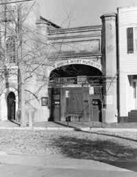
1973-03-16
Description:
Old Slave Mart, 6 Chalmers Street. View of South (Front) elevation. Charleston, S.C.;10" x 8" B/W photo. Box 7, Folder 2-1-44. One copy.
Date:
1970
Description:
Pompion Hill Chapel, Pompion Hill Lane. Contact Sheet 14 - Detail Views of building. Huger, S.C.;9" x 1.5" B/W photo. Box 20, Folder: Miscellaneous Photos: Scanned Contact Sheets. One copy.
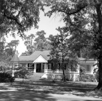
Description:
White Gables House, 603 Richardson Avenue. View of Front. Summerville Historic District. Summerville, S.C.;8" x 8" B/W photo. Box 17, Folder 3-1-1. One Copy.
Description:
Summerville Presbyterian Church, South Laurel Street. View of Front. Summerville Historic District. Summerville, S.C.;8" x 8" B/W photo. Box 17, Folder 3-1-1. One Copy.
Description:
Lanneau House, 404 Central Avenue. View of Front. Summerville Historic District. Summerville, S.C.;8" x 8" B/W photo. Box 17, Folder 3-1-1. One Copy.
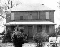
Date:
1970
Description:
Unidentified House. Unidentified Location, South Carolina.;6.5" x 10" B/W photo. Box 20, Folder: Miscellaneous Photos: Unidentified Images. Three copies.
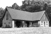
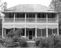
Date:
1970
Description:
Old Carroll House (Carroll Place), Junction of Quaker and Wire Roads. View of North (Front) elevation. St. George, S.C.;8" x 10" B/W photo. Box 20, Folder: Miscellaneous Photos: Unidentified Images. One copy.
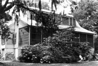
Date:
1970
Description:
Unidentified House. Unidentified Location, South Carolina.;6.5" x 10" B/W photo. Box 20, Folder: Miscellaneous Photos: Unidentified Images. Two copies.
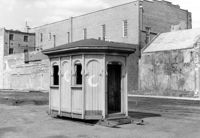
Date:
1972-02-09
Description:
Unidentified Structure. Unidentified Location, South Carolina. Photo labeled, "Gazebo. Belk's Parking Lot".;6.5" x 10" B/W photo. Box 20, Folder: Miscellaneous Photos: Unidentified Images. Three copies.
Date:
1970
Description:
Robert Marion, Sr. House. View of Front elevation. Pinville Historic District. St. Stephen, S.C.;8" x 10" B/W photo. Box 3, Folder 1-9-1 (I). One copy.
Date:
1970
Description:
Unidentified View. Unidentified Location, South Carolina.;10" x 8" B/W photo. Box 20, Folder: Miscellaneous Photos: Unidentified Images. One copy.