House on site affected by the widening of State Road 13 (Remount Road). 1548 Remount Road. Surveyor notations on back of photo: "Dkt.: 10.562. Property owner: Harry R. Parkinson, et al. Tract: 61. Date: Jul. 19, 1967." [See collection description for explanation of surveyor notations.]
House on site affected by the widening of State Road 13 (Remount Road). 1552 Remount Road. Surveyor notations on back of photo: "Dkt.: 10.562. Property owner: Robert W. Kimbel. Tract: 60. Date: Jul. 19, 1967." [See collection description for explanation of surveyor notations.]
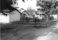
Houses on site affected by the widening of State Road 13 (Remount Road). Surveyor notations on back of photo: "Dkt.: 10.562. Property owner: James R. Robinson, Estate. Tract: 41. Date: Jul. 19, 1967." [See collection description for explanation of surveyor notations.]
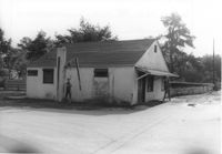
House on site affected by the widening of State Road 13 (Remount Road). Surveyor notations on back of photo: "Dkt.: 10.562. Property owner: Olivia Fleisher Estate. Tract: 38. Date: Jul. 19, 1967." [See collection description for explanation of surveyor notations.]
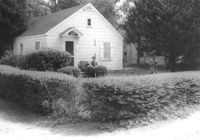
House on site affected by the widening of State Road 13 (Remount Road). Surveyor notations on back of photo: "Dkt.: 10.562. Property owner: Mrs. J.L. McFadyen. Tract: 69. Date: Jul. 19, 1967." [See collection description for explanation of surveyor notations.]
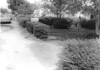
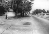
Site affected by the widening of State Road 13 (Remount Road). Surveyor notations on back of photo: "Dkt.: 10.562. Property owner: Barbara Pringle. Tract: 43. Date: Jul. 19, 1967." [See collection description for explanation of surveyor notations.]
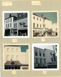
Four photographs of buildings on the east side of King Street (both color and B&W): Top left (316-320): 316 King Street (316-Rosalie Meyers) and 320 King Street (Evelyn Rubin); Top right (304-308): 304 King Street (Leroy's Jewelry Co.), 306 King Street (China Hall) and 308 King Street (Croghan's Jewel Box/The New Shoe Factory) (color photograph); Bottom left: 306 King Street (China Hall) (color photograph); Bottom right (294-296): 294 King Street (Haverty's) and 296 King Street (Levy's) (B&W photograph).
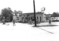
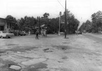
Crown gas station, on site affected by the widening of State Road 13 (Remount Road). Johnny's in back. Possibly the corner of North Rhett Avenue and Remount Road. Surveyor notations on back of photo: "Dkt.: 10.562. Property owner: Corco Realty Co. (Crown). Tract: 142. Date: Jul. 19, 1967." [See collection description for explanation of surveyor notations.]
Crown gas station, on site affected by the widening of State Road 13 (Remount Road). Possibly the corner of North Rhett Avenue and Remount Road. Surveyor notations on back of photo: "Dkt.: 10.562. Property owner: Corco Realty Co. (Crown). Tract: 142. Date: Jul. 19, 1967." [See collection description for explanation of surveyor notations.]
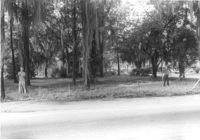
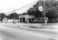
Esso gas station, on site affected by the widening of State Road 13 (Remount Road). Louie's Speed shop in background. Surveyor notations on back of photo: "Dkt.: 10.562. Property owner: Harry R. Williams. Tract: 113. Date: Jul. 19, 1967." [See collection description for explanation of surveyor notations.]