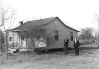
House on site affected by the widening of Route 171 (Folly Road). Surveyor notations on back of photo: "Dkt.: 10.494. Property owner: Sophie Sabel, Est. Tract: 97. Station: 371+20 Lt. Date: Mar. 21, 1962. To be cut off at R/W by SCHD [SC Highway Dept.?]. [See collection description for explanation of surveyor notations.]
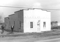
Building, on site affected by the widening of Route 171 (Folly Road). Dave Richardson and Son General Contractor. Front facade has stepped parapet. Surveyor notations on back of photo: "Dkt.: 10.494. Property owner: Dave Richardson, et al. Tract: 93. Station: 314+40 Lt. Date: Mar. 21, 1962. To be cut off at R/W by SCHD [SC Highway Department?]. [See collection description for explanation of surveyor notations.]
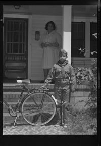
Black and white negative of a cub scout and his bicycle with a woman (perhaps a Mrs. Washington?) on the porch of an unidentified house, 1962; 9 x 6.5 cm.
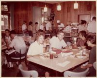
Photograph of students inside Craig Cafeteria, 33 St. Philip St. Built in stages in 1962, 1970 and 1978, the Craig Cafeteria and Residence Hall originally included a student union and represented the College's first step in its expansion from the original main campus.