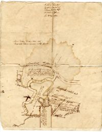
A hand-drawn map of land along the Waccamaw River and Wando Passo Thoroughfare in Georgetown, South Carolina, marking the owners of the surrounding land tracts The map also explains the sale of Sandy Island between the Pee Dee and Waccamaw Rivers from Thomas Waities to William Alston, Jr
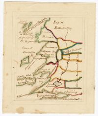
A hand-drawn map of land along the Pee Dee River which records the original land grants from 1711 The land of Thomas Diston and Lady Elizabeth Drake is marked, as well as swamp land and Tapsaw Plantation