Search
Search Results
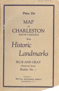
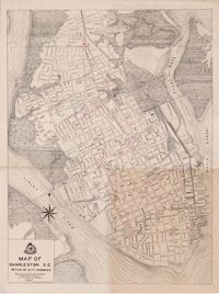
Date:
1926
Description:
Map of the Charleston peninsula featuring points of interest. Cover title: Map of Charleston, South Carolina with historic landmarks. Blue and gray historical series, booklet no. 1. Published by Wil-Tuc Advertising Agency. Map measures 21” x 6.25” folded to create 13 pages measuring 6.25” x 3.5.
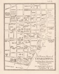
Description:
Map entitled "The Historic Heart of Charleston ... Compliments of the Old Slave Mart Museum," with advertisements on back of "The Historic Heart of Charleston."
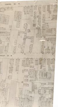
Description:
Map (not color-coded) of area between Coming Street and St. Philip Street near Morris Brown A.M.E. Church.
Description:
Map (not color-coded) of area where Bogard Street meets St. Philip Street, bounded by King Street.
Description:
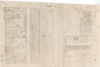
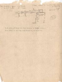
Map (not color-coded) of area on Mary Street at Southern Railroad Freight Depot.
Description:
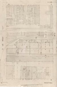
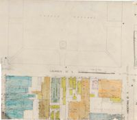
Map (not color-coded) of area bounded by King Street, Ann Street, Meeting Street, and John Street
Description:
Map (not color-coded) of area around Woolfe Street at the Southern Ice Co.
Description:
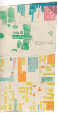
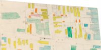
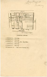
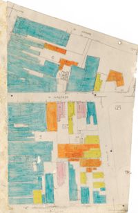
Color-coded map of area where Liberty Street meets St. Philip Street.
Description:
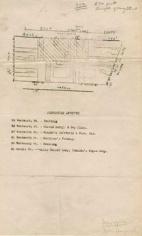
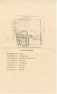
Map of area bounded by Beaufain, St. Philip, Wentworth, and King Street.
Description:
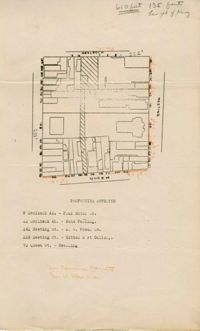
Map of area bounded by Wentworth, King, Liberty, and St. Philip Street.
Description:
Description of the layout and format of the map of Charleston for the Charleston Metropolitan Area Exhibit at the Gibbes Art Gallery rotunda.
Date:
1945
Description:
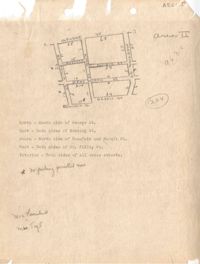
Map of Area 1 bounded by George Street, St. Philip Street, Vanderhorst Street, Hutson Street, and Meeting Street assigned to Mrs. T W. Thornhill.
Date:
1945
Description:
Map of Area 3 bounded by Beaufain Street, Hasell Street, Meeting Street, Broad Street, Legare Street, and Archdale Street assigned to Ferdinanda Waring.
Date:
1945
Description:
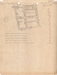
Map of Area 2 bounded by George Street, Meeting Street, Philip Street, Beaufain Street, and Hasell Street assigned to Mrs. Thornhill and Mrs. Taft.
Description:
Map of area bounded by Archdale, Market, King and Beaufain Streets.
Description:
Map (not color-coded) of area around Reid Street and Meeting Street
Description:
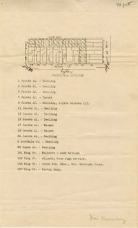
Map of area bounded by Jacob's Alley, Queen, King, and Archdale Street.
Description:
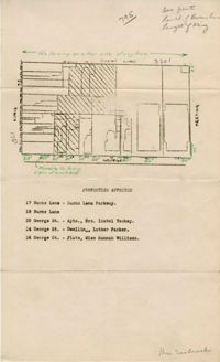
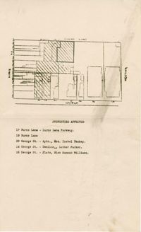
Map of area bounded by Burns Lane, Meeting, Calhoun, and King Street.
Description:
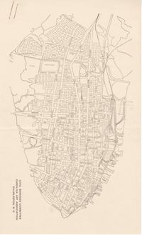
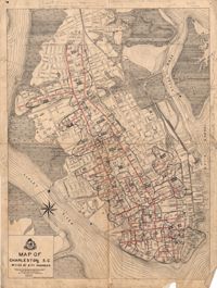
Map of peninsula.
Description:
Map of peninsula.
Date:
1945
Description:
Map of Area 4 bounded by Broad Street, East Bay Street, and Tradd Street assigned to Mr. Martin Powers and Maier Triest.
Description:
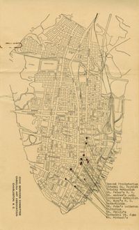
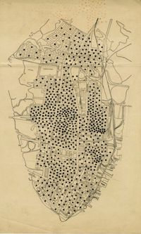
Map of the Charleston peninsula showing churches in congested areas.
Description:
Map of area bounded by Wentworth, Meeting, and Hasell Street.
Description:
Map of area bounded by Horlbeck Alley, Meeting, and Queen Street.
Description:
Map of peninsula.
Description:
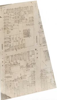
Map (not color-coded) of area between Radcliffe Street and Warren Street at St. Patrick's Catholic School.
Description:
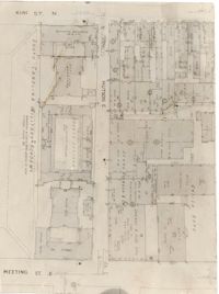
Map (not color-coded) of area between King Street and Meeting Street at Hutson Street (SC Military Academy).
Description:
Map of peninsula.
Description:
Color-coded map of area between Meeting Street and King Street, bisected by Horlbeck Alley..
Description:
Color-coded map of area around St. Philip Street at Calhoun Street near the Charleston Orphan House.
Description:
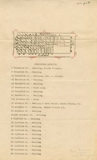
Color-coded map of Archdale Street where Clifford Street, Beresford, and Princess intersect.
Description:
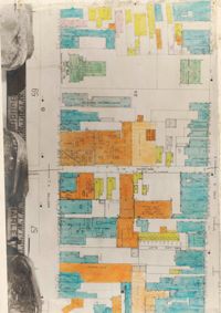
Color-coded map of area bounded by Wentworth Street, Meeting Street, Market Street, and King Street.
Description:
Color-coded map of area around St. Philip Street near the Charleston Orphan House.
Description:
Map of area bounded by George, King, Calhoun, and St. Philip Street.
Description:
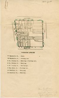
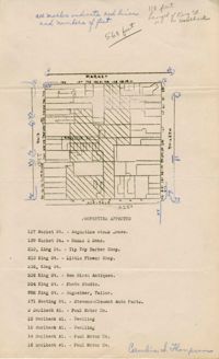
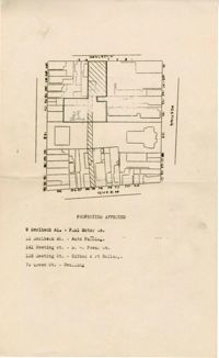
Map of area bounded by Wentworth, King, Beaufain, and St. Philip Street.
Description:
Map of area bounded by Burns Lane, George, Meeting, and King Street.
Description:
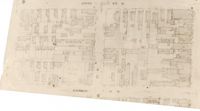
Map of area bounded by Society, Meeting, Wentworth, and King Street.
Description:
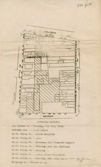
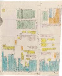
Color-coded map of area between George Street and Burns Lane, where they meet King Street.
Description:
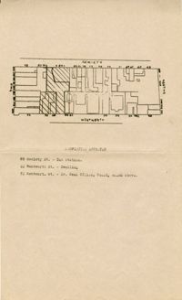
Color-coded map of area between Society Street and Wentworth Street at Meeting Street..
Description:
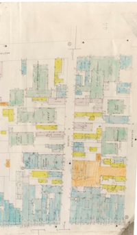
Map of area bounded by George Street, King Street, Burns Lane, and Meeting Street.
Description:
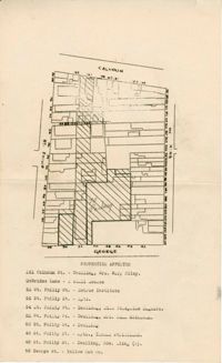
Map of area bounded by Calhoun Street, King Street, George Street, and St. Philip Street.
Description:
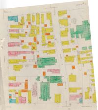
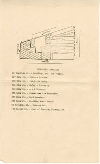
Color-coded map of area around Vanderhorst Street, near a police station and St. Paul's Episcopal Church.
Description:
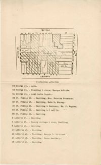
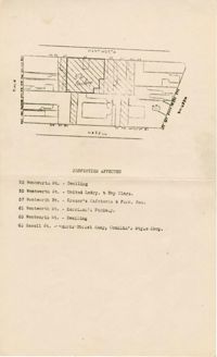
Color-coded map of area bounded by Wentworth Street, Coming Street, George Street, and Glebe Street.
Description:
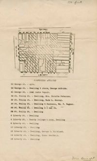
Map of area bounded by Liberty, King, George, and St. Philip Street.
Description:
Map of area bounded by Hasell, Meeting, King and Market Street.
Description:
Map of area bounded by Horlbeck Alley, King, Market, and Meeting Street.
Date:
1945
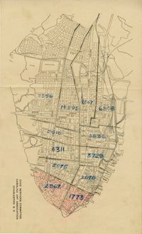
Description:
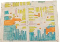
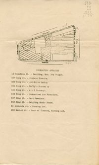
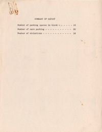
Map of the Charleston peninsula with one area marked to indicate number of parking spaces.
Description:
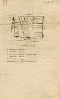
Map of area bounded by Wentworth Street, St. Philip Street, Liberty Street, and King Street.
Description:
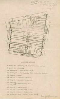
Map of area bounded by George Street, King Street, Liberty Street, and St. Philip Street.
Description:
Map of area bounded by Horlbeck Street, Meeting Street, and Queen Street.
Description:
Map of area bounded by Society, Meeting, George, and King Street.
Description:
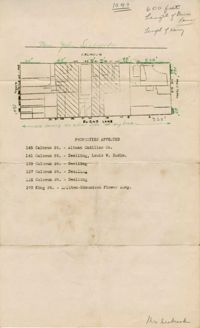
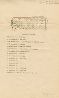
Map of area bounded by Market, King, Princess, and Archdale Street.
Description:
Map of area bounded by Jacob's Alley, Archdale, Clifford, and King Street.
Description:
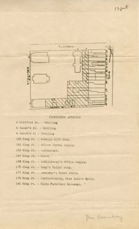
Map of area bounded by Clifford, King, Beresford, and Archdale Street.
Description:
Map of area bounded by Princess, King, Beresford, and Archdale Street.
Description:
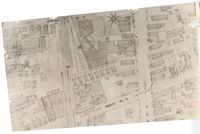
Map of the Charleston peninsula.
Date:
1942
Description:
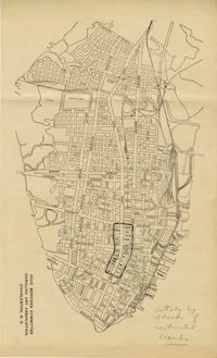
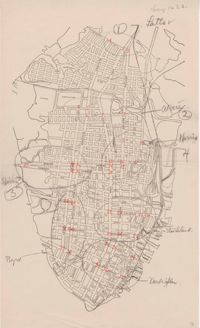
Map of the Charleston peninsula showing the traffic count locations for the Metropolitan Council Traffic Survey.
Date:
1942
Description:
Map of the Charleston peninsula showing the traffic count locations for the Metropolitan Council Traffic Survey.
Date:
1944
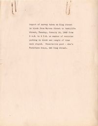
Date:
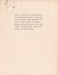
1945-01-16
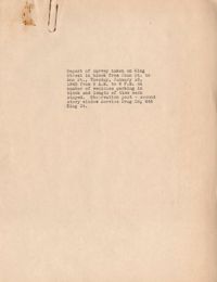
Date:
1945-01-16
Date:
1945-01-16
Description:
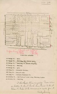
Map of area bounded by Wentworth Street, St. Philip Street, Beaufain Street, and King Street.
Description:
Map (not color-coded) of area where St. Philip Street meets Morris Street.
Description:
Map (not color-coded) of area between Cannon Street ad Spring Street
Description:
Map of area bounded by Society Street, Meeting Street, Wentworth Street, and King Street.
Description:
Map of area bounded by Wentworth Street, Meeting Street, Hasell Street, and King Street.
Description:
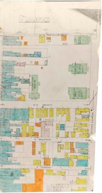
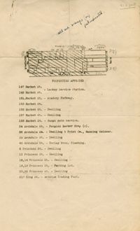
Map of area bounded by Archdale Street, Beaufain Street, King Street, and Market Street.
Description:
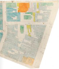
Map of area bounded by Market Street, Meeting Street, Horlbeck Street, and King Street.
Description:
Map of area bounded by Market Street, King Street, Princess Street, and Archdale Street.
Description:
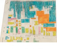
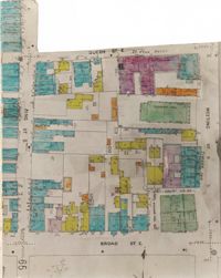
Color-coded map of area bounded by Meeting Street, Broad Street, Queen Street, and King Street.
Description:
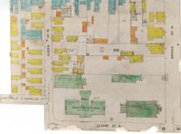
Color-coded map of area bounded by Broad Street, Legare Street, and Queen Street.
Description:
Color-coded map of area near where Market Street and Beaufain Street meet..
Description:
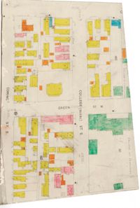
Color-coded map of area where College Street and Green Street intersect.
Description:
Color-coded map of Calhoun Street where Meeting Street intersects.
Date:
1942
Description:
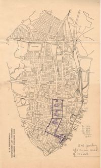
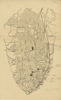
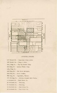
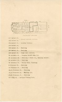
Map of Charleston peninsula with parking questionnaire areas indicated. (See Parking Survey Area Descriptions.)