Search
« Previous |
1 - 100 of 228
|
Next »
Search Results
Date:
1960
Description:
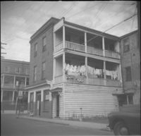
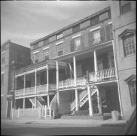
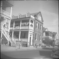
Looking east on Wentworth Street from 26 Wentworth Street (Gardner Kitchen House). Features (left to right): 26 Wentworth Street, 22-24 Wentworth Street (Francis Q. McHugh Tenements), 18-20 Wentworth Street, and 14 Wentworth Street.
Date:
1960
Description:
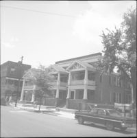
Left to right: 32 Society Street (Gabriel B. Browne House and 30 Society Street.
Date:
1960
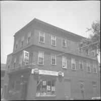
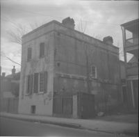
Description:
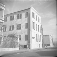
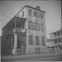
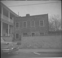
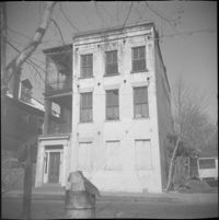
309 East Bay Street (Watson's Grocery), located at the southwest corner of East Bay and Laurens Street, before demolition. (The house at 116 Anson Street was moved to this site with the current address 39 Laurens Street.)
Date:
1960
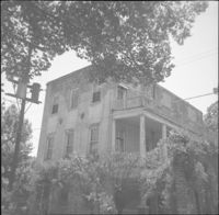
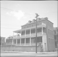
Description:
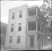
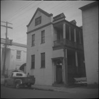
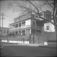
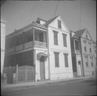
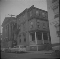
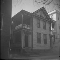
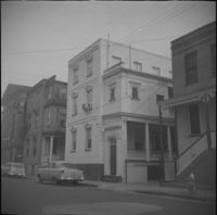
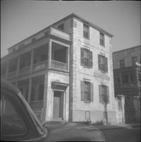
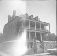
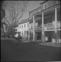
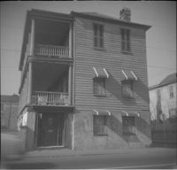
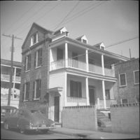
The house originally located at 116 Anson Street being moved to its new location at 39 Laurens Street.
Date:
1960
Description:
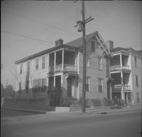
Left to right: 32 Wentworth Street and 30 Wentworth Street (William Thompson Houses).
Date:
1960
Description:
26 Wentworth Street, flanked by 28 Wentworth Street (left edge) and 22-24 Wentworth Street (right edge).
Date:
1960
Description:
39 Society Street. Partial view of 35 Society Street at left.
Date:
1960
Description:
41 Society Street. 39 Society Street also in view at left.
Date:
1960
Description:
34 Society Street. (30 Society Street also in view at right.)
Date:
1960
Description:
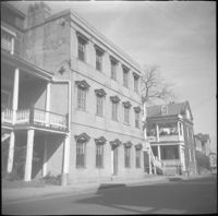
Anson Street elevation of 29 Wentworth Street.
Date:
1960
Description:
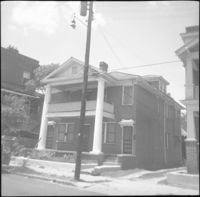
36 Society Street (Henry Street House).
Date:
1960
Description:
63-65 Society Street (St. Paul’s Catholic Church [German Church], later American Legion Palmetto Post 112). 61 Society Street also in view (at left).
Date:
1960
Description:
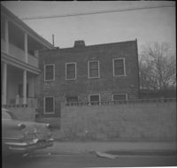
The original house at 82 Anson Street, later demolished to clear the lot for the relocation of the house at 86 Anson Street (Mary Smith House).
Date:
1960
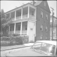
Description:
57 Society Street (William McElheran House), flanked by 55 Society Street (High School of Charleston) (left) and partial view of 59 Society Street (right).
Date:
1960
Description:
74 Anson Street before its demolition. (The house originally at 15 Wall Street was moved to the site in 1966.)
Date:
1960
Description:
76 Anson Street before its demolition, located at the southeast corner of Anson and Laurens Streets.
Date:
1960
Description:
75 Anson Street (Joseph Legare House) before the removal of the third story ca. 1969.
Date:
1960
Description:
Original house with the address 73 Anson Street, demolished in 1963.
Date:
1960
Description:
79 Anson Street (Daniel Legare House).
Date:
1960
Description:
79 Anson Street (Daniel Legare House).
Date:
1960
Description:
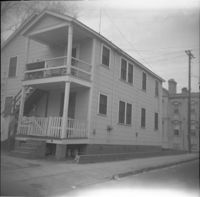
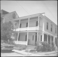
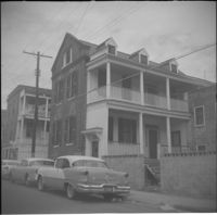
61 Laurens Street, which had originally located at 114 Anson Street.
Date:
1960
Description:
63-65 Society Street (St. Paul’s Catholic Church [German Church], later American Legion Palmetto Post 112).
Date:
1960
Description:
Looking east on George Street to where it ended at Anson Street before the continuation of George Street occurred. Left to right: What was 86 Anson Street, later relocated to 82 Anson Street, and the original house at 82 Anson Street, later demolished for the relocation of 86 Anson Street.
Date:
1960
Description:
59 Society Street, flanked to its left by 55 Society Street (High School of Charleston) and 57 Society Street (William McElheran House), and to its right by 61 Society Street.
Date:
1960
Description:
61 Society Street. Partial view of 59 Society Street at left.
Date:
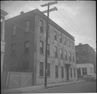
1960
Description:
58 Society Street (John Charles Burckmeyer House).
Date:
1960
Description:
62 Society Street (Hieronymus-Tiedeman House).
Date:
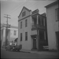
1960
Description:
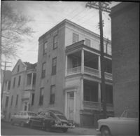
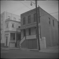
43 Laurens Street.
Date:
1960
Description:
62 Hasell Street.
Date:
1960
Description:
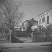
Original 11 George Street, since demolished and currently the site of a parking lot.
Date:
1960
Description:
36-40 Anson Street, later demolished. 34 Anson Street at far right.
Date:
1960
Description:
5 Maiden Lane, located at the southwest corner of Maiden Lane and Hasell Street.
Date:
1960
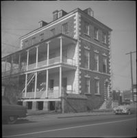
Description:
329 East Bay Street (Gadsden-Morris House).
Date:
1960
Description:
57 Laurens Street (Augustus Taft House).
Date:
1960
Description:
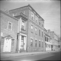
4 George Street (James W. Brown House).
Date:
1960
Description:
6 George Street.
Date:
1960
Description:
35 Hasell Street (John McNellage House).
Date:
1960
Description:
33 Hasell Street (John Hamilton House).
Date:
1960
Description:
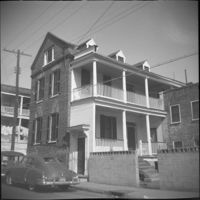
71 Anson Street (Thomas Doughty House).
Date:
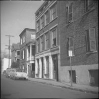
1960
Description:
Likely the 320 block of East Bay Street, east side of street, houses since demolished.
Date:
1960
Description:
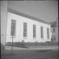
48 Hasell Street (St. Johannes Lutheran Church), located at the northwest corner of Hasell Street and Anson Street.
Date:
1960
Description:
Possibly an outbuilding to 325 East Bay Street, since demolished.
Date:
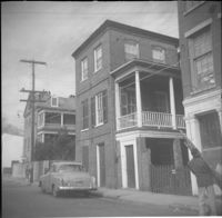
1960
Description:
311 East Bay Street (Stephen Shrewsbury House), located at the corner of East Bay Street and Laurens Street.
Date:
1960
Description:
317 East Bay Street (Benjamin Dupre House) and 319 East Bay Street.
Date:
1960
Description:
Right to left: 48-50 Anson Street and 52 Anson Street (Thomas Wallace and Martin Dowd Tenements).
Date:
1960
Description:
Rear of 53 Anson Street (William Thompson Tenement).
Date:
1960
Description:
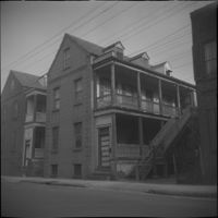
18-20 Wentworth Street (Lopez-Moise Tenements).
Date:
1960
Description:
317 East Bay Street (Benjamin Dupre House).
Date:
1960
Description:
53 Anson Street (William Thompson Tenement).
Date:
1960
Description:
57 Anson Street (Ann Hunt's House).
Date:
1960
Description:
313 East Bay Street.
Date:
1960
Description:
319 East Bay Street.
Date:
1960
Description:
315 East Bay Street.
Date:
1960
Description:
14-16 Wentworth Street, later demolished. Also features partial view of 18 Wentworth Street (left) and 10 Wentworth Street (right).
Date:
1960
Description:
10 Wentworth Street (Charles W. Seignious House), with partial view of 12 Wentworth Street (left edge) and 8 Wentworth Street and 6 Wentworth Street (far right).
Date:
1960
Description:
23 Wentworth Street (James J. Jeffords House), flanked by 21 Wentworth Street (left) and partial view of 25 Wentworth Street.
Date:
1960
Description:
1 Wall Street, located at the northwest corner of Wall Street and Laurens Street.
Date:
1960
Description:
7-11 Wentworth Street (Edward Winslow Tenements).
Date:
1960
Description:
56 Anson Street.
Date:
1960
Description:
56 Anson Street.
Date:
1960
Description:
56 Anson Street.
Date:
1960
Description:
54 Anson Street.
Date:
1960
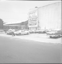
Description:
Northeast corner of Hasell Street and Meeting Street. Parking lot and building with billboards advertising "Hartnett for House" and Paul Motor Co.
Date:
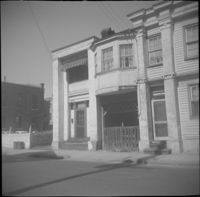
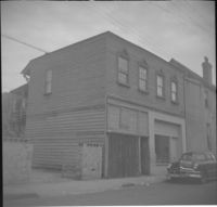
1960
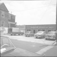
Description:
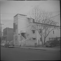
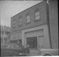
Charleston Automotive Services (63 Hasell Street), now a parking lot.
Date:
1960
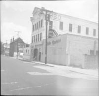
Description:
65-67 Hasell Street (USO Building).
Date:
1960
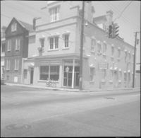
Description:
28 Hasell Street (Charleston Blueprint and Supply Co.), located at the northwest corner of Hasell Street and East Bay Street.
Date:
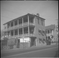
1960
Description:
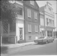
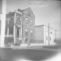
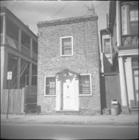
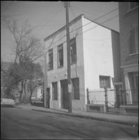
5 George Street (Robert Roulain House), now known as 9 George Street.
Date:
1960
Description:
66 Society Street (Hieronymous-Roper House).
Date:
1960
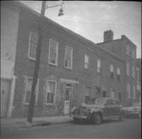
Description:
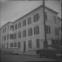
56 Laurens Street.
Date:
1960
Description:
58 Laurens Street.
Date:
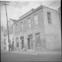
1960
Description:
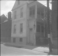
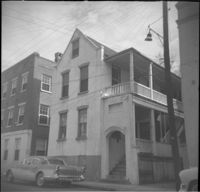
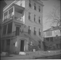
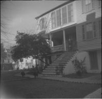
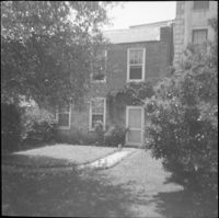
7 George Street (Mary Scott House), now known as 11 George Street.
Date:
1960
Description:
66 Hasell Street (Lazarus-Gadsden Building). Partial view of 64 Hasell Street at right.
Date:
1960
Description:
Left to right: 30 Hasell Street, 28 Hasell Street .
Date:
1960
Description:
29 Hasell Street.
Date:
1960
Description:
28 Wentworth Street, located at the northeast corner of Wentworth Street and Anson Street. Also features 26 Wentworth Street (right edge) and 53 Anson Street (William Thompson Tenement) (at left). Note, the Wentworth Street elevation of 53 Anson Street is 30 Anson Street.
Date:
1960
Description:
78 Anson Street (Royal Food Market), corner store located at the northeast corner of Anson and Laurens Streets, before its demolition.
Date:
1960
Description:
Right to left: 38 Society Street and 40 Society Street (Juliana Dupre House). Partial view of 42 Society Street at left edge.
Date:
1960
Description:
Left to right: 42 Society Street (Juliana Dupre House), 40 Society Street (Juliana Dupre House), and partial view of 38 Society Street.
Date:
1960
Description:
42 Society Street (Juliana Dupre House). Partial view of 40 Society Street at right.
Date:
1960
Description:
55 Hasell Street (left) and partial view of 57 Hasell Street.
Date:
1960
Description:
54 Hasell Street (Col. William Rhett House).
Date:
1960
Description:
57 Hasell Street.
Date:
1960
Description:
58 Hasell Street.
Date:
1960
Description:
53 Hasell Street.
Date:
1960
Description:
Right to left: 64 Anson Street (later demolished), 66 Anson Street (Chazal House), and 72 Anson Street (Kohne-Leslie House).
Date:
1960
Description:
Right to left: 64 Anson Street (later demolished) and 66 Anson Street (Chazal House).
Date:
1960
Description:
Left to right: 46 Wentworth Street and 44 Wentworth Street. Partial view of the Central Fire Station parking lot also in view at left.
Date:
1960
Description:
60 Anson Street (Robert M. Venning House), located at the southeast corner of Anson and Society Streets.
Date:
1960
Description:
58 Anson Street (Robert M. Venning House).
Date:
1960
Description:
58 Anson Street (Robert M. Venning House).
Date:
1960
Description:
57 Anson Street (Ann Hunt's House).
Date:
1960
Description:
57 Anson Street (Ann Hunt's House).
Date:
1960
Description:
54 Anson Street.
Date:
1960
Description:
32 Anson Street, which had been located at the northeast corner of Anson and Hasell Streets, later demolished. 45 Hasell Street at right.
Date:
1960
Description:
45 Wentworth Street, later demolished.
Date:
1960
Description:
45 Wentworth Street, later demolished.
Date:
1960
Description:
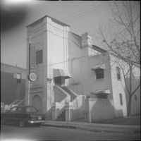
34-36 Wentworth Street (St. Peter's Roman Catholic Church and Rectory)
Date:
1960
Description:
43 Society Street (Robert M. Venning House). 41 Society Street also in view at left.
Date:
1960
Description:
51 Society Street. Partial view of 49 Society Street at left.
Date:
1960
Description:
46 Society Street (Jonah M. Venning House).
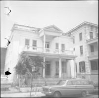
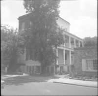
![116 Anson Street [now at 39 Laurens Street]](https://iiif.library.cofc.edu/iiif/2/48432/full/200,/0/default.jpg)

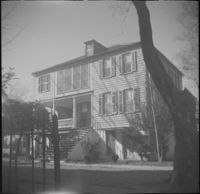
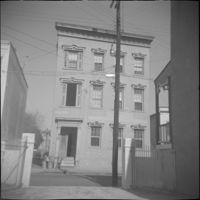

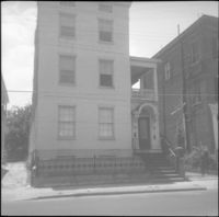
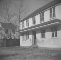
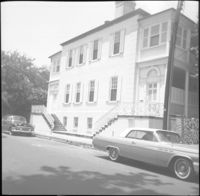
![5 George Street [9 George Street]](https://iiif.library.cofc.edu/iiif/2/36331/full/200,/0/default.jpg)
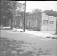
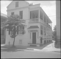
![7 George Street [11 George Street]](https://iiif.library.cofc.edu/iiif/2/36332/full/200,/0/default.jpg)