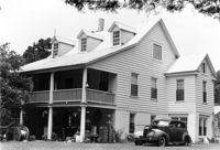
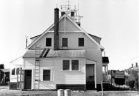
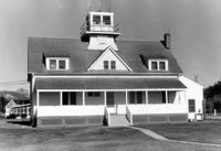
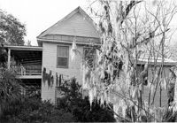
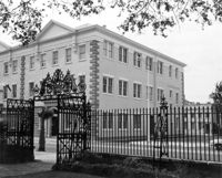
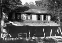
U.S. Coast Guard Historical District, I'on Avenue. Administration Building - View of SW (Side and Rear) elevation. Sullivans Island, S.C.;6.5" x 10" (and 3.5" x 5") B/W photo. Box 16, Folder 2-13-1. Two copies.
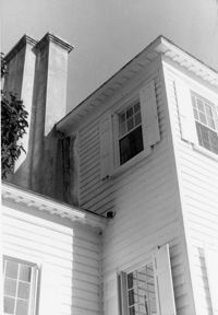
U.S. Coast Guard Historical District, I'on Avenue. Administration Building - View of East (Side) elevation. Sullivans Island, S.C.;6.5" x 10" (and 3.5" x 5") B/W photo. Box 16, Folder 2-13-1. Two copies.
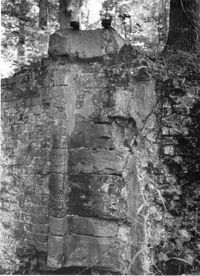
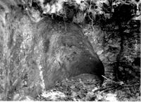
White Oak Lock. Lock #2 - Detail View of floodgate pintel. Tailrace Canal, Old Santee Canal Park. Berkeley, SC.;9.5" x 6.5" B/W photo. Box 3, Folder 1-9-2. One copy.
White Oak Lock. Lock #2 - View of water sluice. Tailrace Canal, Old Santee Canal Park. Berkeley, SC.;6.5" x 9.5" B/W photo. Box 3, Folder 1-9-2. One copy.
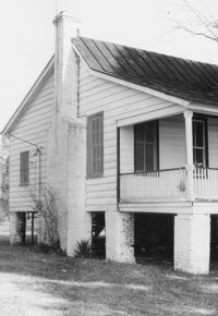
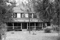
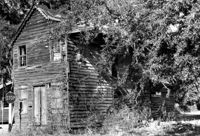
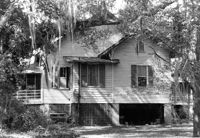
Isaac Porcher House - Slave Quarters. View of NW (Front and Side) elevation. Pinopolis Historic District North. Pinopolis, S.C.;6.5" x 9.5" B/W photo. Box 4, Folder 1-10-1 (III). Two copies.
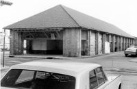
City Market - Market Hall and Third Section of Sheds. View of SW (Front and Side) elevation. Charleston, S.C.;6.5" x 10" B/W photo. Box 6, Folder 2-1-14. One copy.
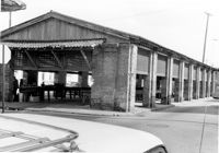
City Market - Market Hall and Second Section of Sheds. View of SW (Front and Side) elevation. Charleston, S.C.;6.5" x 10" B/W photo. Box 6, Folder 2-1-14. One copy.
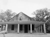
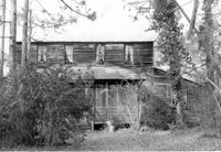
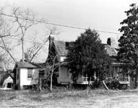
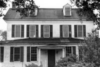
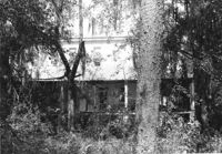
Unidentified - House. Pivotal to Historic District. View of Side and Front elevation. Labeled as, "Heirs of J.S. Sanders". Cainhoy, S.C.;8" x 10" B/W photo. Box 4, Folder 1-12-3. One copy.
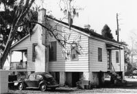
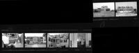
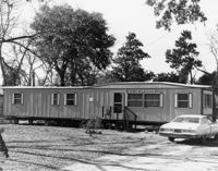
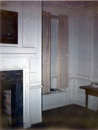
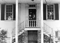
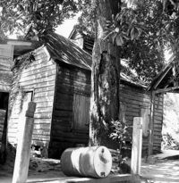
Ralph Ingle House (Simonds House), 1009 Middle Street. Contact Sheet 15 - Multiple views of exterior and interior. Sullivans Island, S.C.;10" x 3.5" B/W photo. Box 20, Folder: Miscellaneous Photos: Scanned Contact Sheets. One copy.
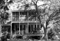
Rockville Historic District - Cornelia J. Whaley House, Grace Chapel Road. View of SW (Front and Side) elevation. Wadmalaw Island, S.C.;6.5" x 10" B/W photo. Box 17, Folder 2-14-19. Two copies.
Rockville Historic District - Old Episcopal Rectory, Maybank Highway. View of South (Front) elevation. Wadmalaw Island, S.C.;6.5" x 10" (and 8" x 10") B/W photo. Box 17, Folder 2-14-13. Two copies.
Mount Pleasant Presbyterian Church (Trinity Methodist Church, Hibben Methodist Church, Mount Pleasant Seventh Day Adventist Church), corner of Hibben and Bennet Streets. View of North (Side) elevation. Mount Pleasant, S.C.;10" x 6.5" B/W photo. Box 13, Folder 2-8-1. One copy.
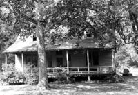
Unidentified - House. Contributing to Historic District. View of Front elevation. Labeled as, "Owned by Rachel M. Humphrey". Cainhoy, S.C.;8" x 10" B/W photo. Box 4, Folder 1-12-3. One copy.
U.S. Coast Guard Historical District, I'on Avenue. Administration Building - View of South (Rear) elevation. Sullivans Island, S.C.;6.5" x 10" (and 3.5" x 5") B/W photo. Box 16, Folder 2-13-1. Two copies.
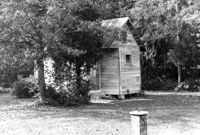
U.S. Coast Guard Historical District, I'on Avenue. Garage - View of East (Front) elevation. Sullivans Island, S.C.;6.5" x 10" (and 3.5" x 5") B/W photo. Box 16, Folder 2-13-1. Two copies.
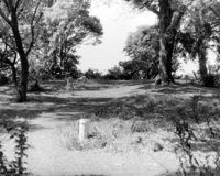
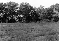
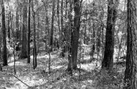
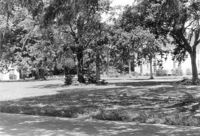
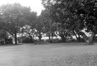
Stono River Rebellion Site (Cato's Rebellion Site), North Side of U.S. Highway 17, west of the Wallace River. View looking NW. Hollywood, S.C.;6.5" x 10" B/W photo. Box 16, Folder 2-11-16. One copy.
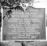
Johns Island Presbyterian Church, 2550 Bohicket Road. Church - Detail View of door and lamppost, Front elevation. Johns Island, S.C.;8" x 10" B/W photo. Box 12, Folder 2-5-4. One copy.
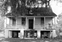
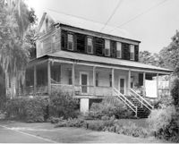
Rockville Historic District - Hagood House (Micah Jenkins House), Grace Chapel Road. View of South (Front) elevation. Wadmalaw Island, S.C.;6.5" x 10" B/W photo. Box 17, Folder 2-14-16. One copy.
Rockville Historic District - Hagood House (Micah Jenkins House), Grace Chapel Road. View of South (Front) elevation. Wadmalaw Island, S.C.;8" x 10" B/W photo. Box 17, Folder 2-14-16. One copy.
Rockville Historic District - Old Episcopal Rectory, Maybank Highway. View of SE (Side and Front) elevation. Wadmalaw Island, S.C.;6.5" x 10" B/W photo. Box 17, Folder 2-14-13. One copy.
Rockville Historic District - Mary A. Whaley House, Maybank Highway. View of West (Side) elevation. Wadmalaw Island, S.C.;6.5" x 10" B/W photo. Box 17, Folder 2-14-12. One copy.
Rockville Historic District - Perry House, Maybank Highway. View of South (Front) elevation. Wadmalaw Island, S.C.;6.5" x 10" B/W photo. Box 17, Folder 2-14-14. One copy.
Rockville Historic District - W.E. Jenkins House (James LaRoche House). View of South (Front) elevation. Wadmalaw Island, S.C.;6.5" x 10" B/W photo. Box 17, Folder 2-14-15. One copy.
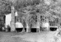
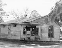
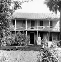
Village Store and Blacksmith Shop, ca. 1873. View of NW (Front and Side) elevation. Cainhoy, S.C.;6.5" x 9.5" B/W photo. Box 4, Folder 1-12-3. One copy.
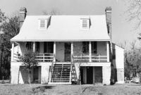
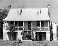
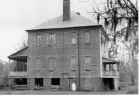
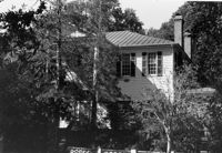
John Henry Porcher House (Percival Porcher House?). View of North (Front) elevation. Pinopolis, S.C.;6.5" x 9.5" B/W photo. Box 4, Folder 1-10-1 (III). Two copies.
John Henry Porcher House (Percival Porcher House?). View of West (Side) elevation. Pinopolis, S.C.;6.5" x 9.5" B/W photo. Box 4, Folder 1-10-1 (III). Two copies.
How Tavern. View of NE (Front and Side) elevation. Cainhoy (Huger vicinity, Lewisville, Louisville), S.C.;8" x 10" B/W photo. Box 4, Folder 1-12-3. One copy.
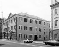
Charleston County Courthouse, 77 Meeting Street. View of NE (Side and Front) elevation. Charleston, S.C.;8" x 10" B/W photo. Box 5, Folder 2-1-8. One copy.
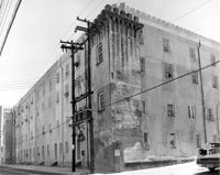
Old Citadel (South Carolina State Arsenal, Embassy Suites Hotel), 337 Meeting Street. View of NW (Side and Rear) elevation. Charleston, S.C.;8" x 10" B/W photo. Box 5, Folder 2-1-5. One copy.
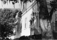
Lowndes Grove Plantation, 260 St. Margaret Street. Main House - View of SW (Side and Rear) elevation. Charleston, S.C.;6.5" x 10" B/W photo. Box 8, Folder 2-1-148. One copy.
Old Citadel (South Carolina State Arsenal, Embassy Suites Hotel), 337 Meeting Street. View of Interior Courtyard. Charleston, S.C.;8" x 10" B/W photo. Box 5, Folder 2-1-5. One copy.
Lowndes Grove Plantation, 260 St. Margaret Street. Main House - View of North (Front) elevation. Charleston, S.C.;6.5" x 10" B/W photo. Box 8, Folder 2-1-148. One copy.
Charleston County Courthouse, 77 Meeting Street. View from Washington Square Park - NE (Front and Side) elevation. Charleston, S.C.;8" x 10" B/W photo. Box 5, Folder 2-1-8. One copy.
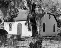
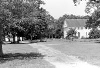
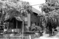
Johns Island Presbyterian Church, 2550 Bohicket Road. Church and Educational Building - View of Front and Side elevation (from street). Johns Island, S.C.;6.5" x 10" B/W photo. Box 12, Folder 2-5-4. One copy.
Johns Island Presbyterian Church, 2550 Bohicket Road. Church and Educational Building - View of Front and Side elevation (from street). Johns Island, S.C.;6.5" x 10" B/W photo. Box 12, Folder 2-5-4. One copy.
Lowndes Grove Plantation, 260 St. Margaret Street. View of Entry Gate and Ashley River, SW elevation. Charleston, S.C.;6.5" x 10" B/W photo. Box 8, Folder 2-1-148. One copy.
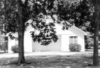
Johns Island Presbyterian Church, 2550 Bohicket Road. Education Building - Front elevation. Johns Island, S.C.;6.5" x 10" B/W photo. Box 12, Folder 2-5-4. One copy.
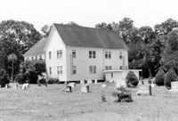
Johns Island Presbyterian Church, 2550 Bohicket Road. Cemetery and Church - Rear and Side elevation. Johns Island, S.C.;6.5" x 10" B/W photo. Box 12, Folder 2-5-4. One copy.
Johns Island Presbyterian Church, 2550 Bohicket Road. Education Building and Church - South elevation. Johns Island, S.C.;6.5" x 10" B/W photo. Box 12, Folder 2-5-4. One copy.
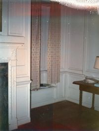
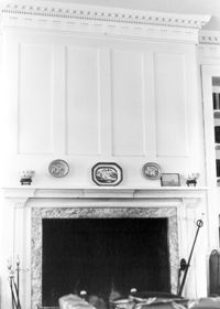
Seaside Plantation (Locksley Hall), off of Cypress Bottom Road. Interior View - Parlor, Detail of Fireplace. Edisto Island, S.C.;10" x 8" B/W photo. Box 11, Folder 2-3-12. One copy.
Seaside Plantation (Locksley Hall), off of Cypress Bottom Road. Interior View - Parlor, Detail of Mantle. Edisto Island, S.C.;8" x 10" B/W photo. Box 11, Folder 2-3-12. One copy.
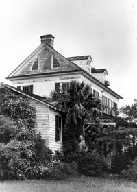
Seaside Plantation (Locksley Hall), off of Cypress Bottom Road. View of SW (Front and Side) elevation. Edisto Island, S.C.;10" x 8" B/W photo. Box 11, Folder 2-3-12. One copy.
Seaside Plantation (Locksley Hall), off of Cypress Bottom Road. View of SE (Front and Side) elevation. Edisto Island, S.C.;8" x 10" B/W photo. Box 11, Folder 2-3-12. One copy.
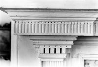
Seaside Plantation (Locksley Hall), off of Cypress Bottom Road. Detail View of South (Front) elevation. Edisto Island, S.C.;8" x 10" B/W photo. Box 11, Folder 2-3-12. One copy.
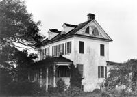
Seaside Plantation (Locksley Hall), off of Cypress Bottom Road. View of North (Rear) elevation. Edisto Island, S.C.;8" x 10" B/W photo. Box 11, Folder 2-3-12. One copy.
Seaside Plantation (Locksley Hall), off of Cypress Bottom Road. View of East (Side) elevation. Edisto Island, S.C.;8" x 10" B/W photo. Box 11, Folder 2-3-12. One copy.
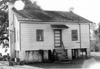
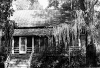
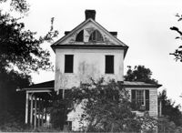
Fishburne House, ca. 1911 - Pivotal to Historic District. View of Front elevation. Pinopolis, S.C.;5" x 7" B/W photo. Box 3, Folder 1-10-1 (II). One copy.
St. Andrews Episcopal Church (Mount Pleasant), 440 Whilden Street. View of SE (Front and Side) elevation. Mount Pleasant, S.C.;6.5" x 10" B/W photo. Box 13, Folder 2-8-18. One copy.
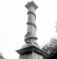
Magnolia Cemetery, Huguenin Avenue and Algonquin Road. Monument of Colonel William Washington. Detail View of column. South elevation. Charleston, S.C.;8" x 8" B/W photo. Box 5, Folder 2-1-3. Three copies.
Village Store and Blacksmith Shop, ca. 1873. View of SW (Rear and Side) elevation. Cainhoy, S.C.;6.5" x 9.5" B/W photo. Box 4, Folder 1-12-3. One copy.
Village Store and Blacksmith Shop, ca. 1873. View of SW (Side and Rear) elevation. Cainhoy, S.C.;6.5" x 9.5" B/W photo. Box 4, Folder 1-12-3. One copy.