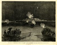
Caption: 'Departure of the Great Southern Expedition from Beaufort, North Carolina.--sketched by an amateur.--[see page 119.]' [full date February 21, 1863.]
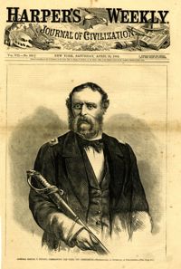
Caption: 'Admiral Samuel F. DuPont, Commanding the fleet off Charleston--photographed by Gutekurst, of Philadelphia.--see page 270.' [Full date April 25, 1863]
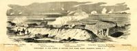
Caption: 'Bombardment of Fort Sumter, as sketched from Morris Island, Charleston Harbor, S.C.' Identified in image: Mortar Battery, Fort Johnson; James Island; City; Castle Pinckney; Fort Sumter; Mount Pleasant; Floating Battery; Mortar Battery; Fort Moultrie; Enfilading Battery; Iron Battery; Sand-bag cover for reserve; Traverse behind Trapier Battery and Magazine covered with sand bags.
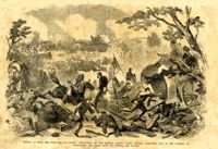
Caption: 'Battle of Bull Run, July 21st, 1861--Grand "Skedaddle" of the Federal troops under General McDowell, and of the citizens of Washington who came down to witness the battle.'
Caption: 'The Old Flag again on Sumter--raised (on a temporary staff formed of an oar and boathook) by Captain H.M. Bragg, of General Gillmore's staff, February 18th, 1865.'
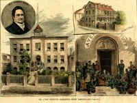
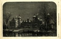
[Color image.] Caption: 'The Avery Institute, Charleston, South Carolina.--[see page 867.]' Also identified in image: Rev. Charles Avery and Teachers' Home.
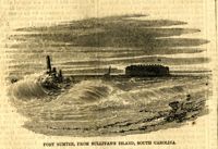
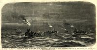
Caption: 'The night guard of boats on Charleston Bar during the first of the bombardment of Fort Sumpter (sic), to prevent reinforcements being sent to Major Anderson, April 12th, 1861.--from a sketch by our artist on Morris Island.'
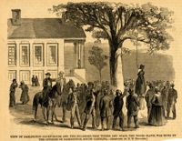
Caption: 'View of Darlington Court-House and the Sycamore-Tree where Amy Spain, the Negro slave, was hung by the citizens of Darlington, South Carolina.--[Sketched by N.N. Edwards.]' [full date September 30, 1865.]
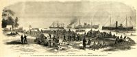
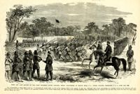
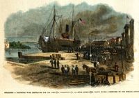
Caption: 'The advance upon Charleston--pioneer movement--landing of the 100th N.Y. Vols. upon Cole's Island, March 28.--from a sketch by our Special Artist.--see page 6.' Also identified with labels: Camp of 100th N.Y. Vols., Pawnee, Com. McDonough, Expounder and Belvidere. [full date April 25, 1863.]
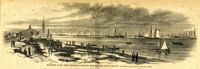
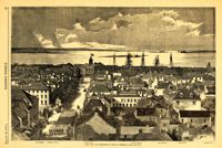
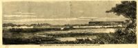
Caption: 'The city of Charleston, South Carolina.--[see page 62.]' Also identified in image: Broad Street, "Mercury" office, Custom-house, Castle Pinckney, Fort Moultrie, Fort Sumter and Morris Island. [full date January 26, 1861.]
Caption: 'The Siege of Charleston--attack on Battery Gregg, September 5, 1863.--from a sketch by Mr. Theodore R. Davis. [See page 629.]' [full date October 3, 1863.]
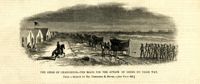
Caption: 'The Siege of Charleston--the boats for the attack of Gregg on their way. From a sketch by Mr. Theodore R. Davis.--[see page 629.]' [full date October 3, 1863.]
Caption: 'First and last review of the First Regiment, South Carolina Negro Volunteers, on Hilton Head, S.C., under Colonel Fessenden, U.S.A., June 25th, 1862.'
Caption: 'Siege of Charleston--the magazine of Fort Moultrie exploded by a shell from the grounded monitor Weehawken, Sept. 8.--from a sketch by our own Special Artist, W.T. Crane.' [full date October 3, 1863.]
[Color image.] Caption: 'Unloading a transport with ambulances for the Army, at Wilmington, N.C.--View looking up Water Street.--sketched by our Special Artist.' [full date April 15, 1865.]
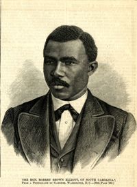
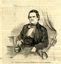
Caption: 'The Hon. Robert Brown Elliott, of South Carolina. From a photograph by Gardner, Washington, D.C.--see page 150.' [full date February 14,1874.]
Letter from Abraham Lott to Nathanael Greene regarding his poor health, family, and the current state of military affairs, including the enemy retreat from Charlestown, where their current strong holds are, and movements of companies of men.
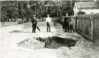
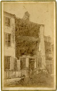
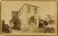
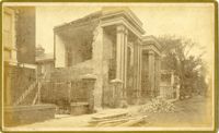
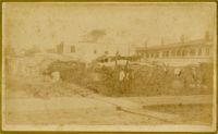
Caption: 'Cook's Earthquake Views of Charleston and Vicinity. Taken after the 31st of August, 1886. No.70, E.B. Hume, Legare Street.' Charleston city directory for 1886 shows Errington B. Hume at 17 Legare Street.
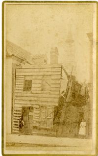
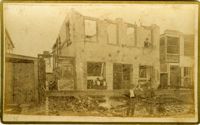
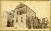
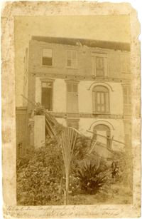
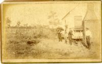
Written on reverse: 'House in which young Mr. Robson was killed. Two young ladies were buried in the ruins were rescued. Coming near Cannon.' Possibly from Cook's Earthquake Views, No.132, residence of J.N. Robson, from west. Written on front, at bottom: 'Charleston Earthquake view. Residence of Mr. J.N. Robson, whose eldest son was killed.' Charleston city directory for 1886 shows James N. Robson at 200 Coming Street.
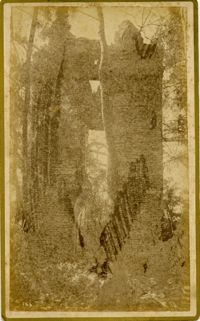
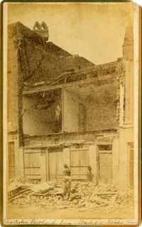
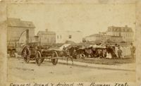
Caption: 'Cook's Earthquake Views of Charleston and Vicinity. Taken after the 31st of August, 1886. No.149, Robb's Lot.' Handwritten on reverse: ' Robb's Lot E. side [of] King bet[ween] Market & Horlbeck.'