"Copy of a plat of a tract now belonging to Richard Goughlr." The tract contains 500 acres and states that it was granted to Isaac Lewis on March 21, 1715. Names associated with this plat are Isaac Lewis, John Broughton, John Glover, John Diamond, and Richard Goughlr [?]. Notable geographic locations include Goose Creek, St. James Parish and Black Jon Bay.
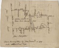
Plan of approximately 1500 acres on Black River near Georgetown part now belonging to Kinloch and Gadsden. Names associated with this plat are Gadsden, Kinloch, Alston, Thomas Gadsden, James Lloyd, and Morreau [?] Sarrazin.
Copy of a plat annexed to the original grant for 1153 acres of land to Thomas Farr lettered A-E. Names associated with this plat are Daniel Green, Thomas Farr, Elizabeth Gibbs, Christopher Wilkinson, Joseph Smith, Andrew Smith, Thomas Smith, George Haig, Joseph Farr, Humphrey Sommers, and Benjamin Stoney.
156 acres laid out to John Bayly and granted to the said John Bayly in 1698 in Colleton County. Names associated with this plat are George Mitchell, John Bayly, and John Andrews.
100 square plot sold by Beauford, Boggy Gully runs through the southwest corner of the property. Names associated with this plat are William Byrd Beauford and J.B. Johnson.
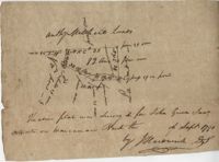
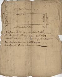
Plat of 230 acres on Johns Island. Little detail included on the plat, but there is an short explanation of the deed. Names associated with this plat are John Jones, Ebenezer Simmons, James Witter, Samuel Palmevine, John Palmavin, and Welkins. Notable geographic locations included in this plat are the Keiwaugh [Kiawah] River, Coll’s Creek, Savannah Tract, Johns Island, and Colleton County.
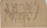
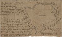
Plan of a parcel of land situated on Johns Island and containing 86 1/2 acres. Being part of a body of land belonging to Thomas Mathews. Bounded northwardly by a public road, eastwardly on James Legare's land, and southwardly on land belonging to Isaac Holmes and Thomas Legare. Intended to be conveyed to Isaac Holmes. Names associated with this plat are Thomas Mathews, Isaac Holmes, Thomas Legare, William Stanyarn, Matthews and James Legare.
Two plats of lands along the Savannah River belonging to Stobo and Bullock. Names associated with this plat are Archibald Stobo, James Stobo, James Bullock, W. Hugh Bryan, Clawton [?], Cranford, J. Southerland, and Patrick Mikas. Notable geographic locations include the Savannah River, St. Peter's Parish and Purrysburgh Township.
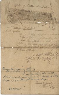
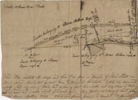
222 acres sold by Archibald Stanyarn to Andrew Down in 1772. Reverse side includes notes on various conveyances. Names associated with this plat are Archibald Stanyarn, Andrew Down, J. Williamson, Edmond Bellizer, Thomas Cliffon, Kewn [?], David Joomer [?] and Henry. Notable geographic locations include Colleton County and Stono River.
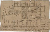
Copy of a plat part now belonging to Benjamin Perry and part to John Pringle on the west side of Ashley River. Names associated with this plat include John Pringle, Benjamin Perry, John Julius Pringle, Lambert Lance, Abraham Ladson, Sarah Rose, Nathaniel Bradwell, Ephraim Mitchell, Thomas Drayton, John Frazer, Frances Baker, Thomas Osborn, Isaac Landson, Isaac Perry, John Drayton, Glen Drayton, Francis Ladson and W. John Cattle. Notable geographic locations include the Ashley River, Charleston, Berkeley County, and Ashley River Road.