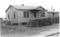
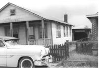
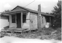
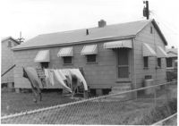
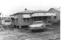
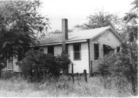
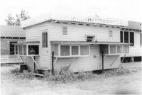
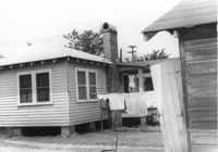
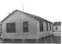
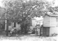
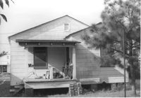
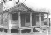
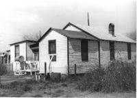
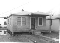
House (rear view), possibly multi-family dwelling, on site affected by the construction of Interstate 26 (I-26). Surveyor notations on back of photo: "Dkt.: 10.490. Property owner: F.F. Bellinger, et al. Tract: 49. Station: 5800+50 Rt. Line 'G'. Date: September 11, 1962. To be cut off at R/W by SCHD [SC Highway Department]." [See collection description for explanation of surveyor notations.]
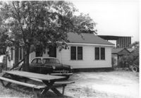
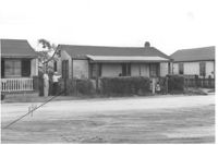
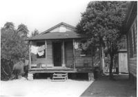
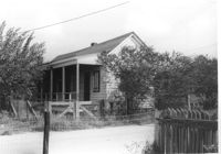
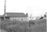
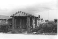
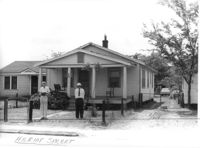
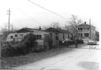
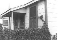
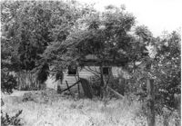
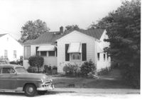
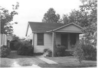
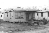
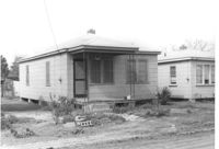
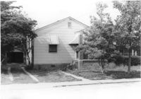
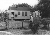
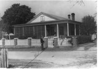
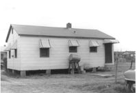
House on site affected by the construction of Interstate 26 (I-26). Address: 2157 Heriot Street. Picnic table in foreground. Surveyor notations on back of photo: "Dkt.: 10.490. Property owner: Thos. W. Towns [Thomas W. Towns]. Tract: 147-C. Station: 230' Lt. Sta. 5880+40. Date: May 15, 1962. Proximity." [See collection description for explanation of surveyor notations.]
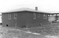
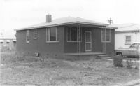
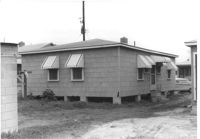
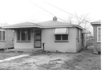
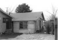
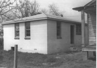
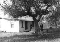
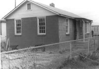
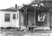
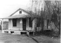
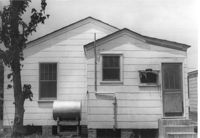
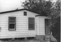
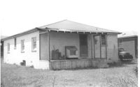
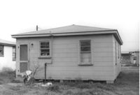
House (corner view, rear) on site affected by the construction of Interstate 26 (I-26). Surveyor notations on back of photo: "Dkt.: 10.490. Property owner: Gladys Owens. Tract: 110. Station: 5830+00 Rt. Date: March 22, 1962. In R/W - Bought." [See collection description for explanation of surveyor notations.]
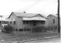
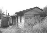
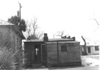
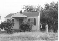
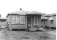
House on site affected by the construction of Interstate 26 (I-26). Surveyor notations on back of photo: "Dkt.: 10.490. Property owner: Harold I. Sherman, et al. Tract: 109-A. Station: 5828+70 Rt. Date: March 22, 1962. In R/W - Bought." [See collection description for explanation of surveyor notations.]
House on site affected by the construction of Interstate 26 (I-26). Surveyor notations on back of photo: "Dkt.: 10.490. Property owner: Christine Morris, et al. Tract: 109. Station: 5828+75 Rt. Date: March 22, 1962. In R/W - Bought." [See collection description for explanation of surveyor notations.]
House on site affected by the construction of Interstate 26 (I-26). Surveyor notations on back of photo: "Dkt.: 10.490. Property owner: Henry Ford, et al. Tract: 138-C. Station: 5858+40 Lt. Date: August 29, 1962. In R/W - Bought." [See collection description for explanation of surveyor notations.]
House on site affected by the construction of Interstate 26 (I-26). Surveyor notations on back of photo: "Dkt.: 10.490. Property owner: Louis Green. Tract: 138-B. Station: 5858+70 Lt. Date: August 29, 1962. In R/W - Bought." [See collection description for explanation of surveyor notations.]
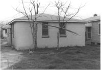
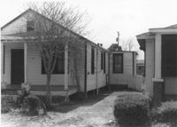
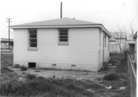
House on site affected by the construction of Interstate 26 (I-26). Surveyor notations on back of photo: "Dkt.: 10.490. Property owner: Gladys Owens. Tract: 110. Station: 5830+00 Rt. Date: March 22, 1962. In R/W - Bought." [See collection description for explanation of surveyor notations.]
House (rear view) and lot on site affected by the construction of Interstate 26 (I-26). [Address 2208 Delano.] Surveyor notations on back of photo: "Dkt.: 10.490. Property owner: O.D. Tanner. Tract: 77. Station: 5822+32 Rt. Line 'G'. Date: March 22, 1962. In R/W - Bought." [See collection description for explanation of surveyor notations.]
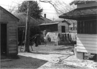
Structures and backyard behind house on site affected by the construction of Interstate 26 (I-26). [Address 2207 Delano.] Surveyor notations on back of photo: "Dkt.: 10.490. Property owner: Harry G. Cusack. Tract: 80. Station: 5824+15 Lt. Date: March 22, 1962. In R/W - Bought." [See collection description for explanation of surveyor notations.]
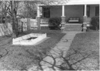
House and front yard on site affected by the construction of Interstate 26 (I-26). [Address 2208 Delano.] Surveyor notations on back of photo: "Dkt.: 10.490. Property owner: Geo. F. Garner [George F. Garner]. Tract: 78. Station: 5822+50 Lt. Date: March 22, 1962. In R/W - Bought." [See collection description for explanation of surveyor notations.]
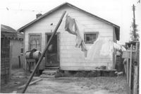
House (rear view) on site affected by the construction of Interstate 26 (I-26). Surveyor notations on back of photo: "Dkt.: 10.490. Property owner: George L. Haseldor. Tract: 55. Station: 5801+15 Lt. Line 'F'. Date: September 12, 1962. In R/W - Bought." [See collection description for explanation of surveyor notations.]
House on site affected by the construction of Interstate 26 (I-26). Surveyor notations on back of photo: "Dkt.: 10.490. Property owner: Barney Witherspoon, et al. Tract: 53. Station: 5800+40 on CL Line 'F'. Date: September 12, 1962. In R/W - Bought." [See collection description for explanation of surveyor notations.]
House on site affected by the construction of Interstate 26 (I-26). Surveyor notations on back of photo: "Dkt.: 10.490. Property owner: William Parineau, et al. Tract: 54. Station: 5800+80 Lt. Line 'F'. Date: September 12, 1962. In R/W - Bought." [See collection description for explanation of surveyor notations.]
House on site affected by the construction of Interstate 26 (I-26). Surveyor notations on back of photo: "Dkt.: 10.490. Property owner: George L. Haseldor. Tract: 55. Station: 5801+15 Lt. Line 'F'. Date: September 12, 1962. In R/W - Bought." [See collection description for explanation of surveyor notations.]
House (corner view, rear) on site affected by the construction of Interstate 26 (I-26). Surveyor notations on back of photo: "Dkt.: 10.490. Property owner: Herbert Williams, et al. Tract: 108. Station: 5828+90 Rt. Date: March 22, 1962. In R/W - Bought." [See collection description for explanation of surveyor notations.]
House (rear view) on site affected by the construction of Interstate 26 (I-26). Surveyor notations on back of photo: "Dkt.: 10.490. Property owner: Daisey Bough, et al. Tract: 106. Station: 5828+90 Lt. Tract: 105. Station: 5828+90 Lt. Date: March 22, 1962. In R/W - Bought." [See collection description for explanation of surveyor notations.]
House (corner view, rear) on site affected by the construction of Interstate 26 (I-26). Surveyor notations on back of photo: "Dkt.: 10.490. Property owner: Christine Morris, et al. Tract: 109. Station: 5828+75 Rt. Date: March 22, 1962. In R/W - Bought." [See collection description for explanation of surveyor notations.]
House (side view) and lot, on site affected by the construction of Interstate 26 (I-26). Surveyor notations on back of photo: "Dkt.: 10.490. Property owner: Jacob Bennekin. Tract: 138-A. Station: 5858+90 Lt. Date: August 29, 1962. In R/W - Bought." [See collection description for explanation of surveyor notations.]
House on site affected by the construction of Interstate 26 (I-26). Surveyor notations on back of photo: "Dkt.: 10.490. Property owner: Daisey Bough, et al. Tract: 106. Station: 5828+90 Lt. Tract: 105. Station: 5828+90 Lt. Date: March 22, 1962. In R/W - Bought." [See collection description for explanation of surveyor notations.]
House (rear view) on site affected by the construction of Interstate 26 (I-26). Surveyor notations on back of photo: "Dkt.: 10.490. Property owner: Louis Green. Tract: 138-B. Station: 5858+70 Lt. Date: August 29, 1962. In R/W - Bought." [See collection description for explanation of surveyor notations.]
House on site affected by the construction of Interstate 26 (I-26). Surveyor notations on back of photo: "Dkt.: 10.490. Property owner: Herbert Williams, et al. Tract: 108. Station: 5828+90 Rt. Date: March 22, 1962. In R/W - Bought." [See collection description for explanation of surveyor notations.]
House on site affected by the construction of Interstate 26 (I-26). Surveyor notations on back of photo: "Dkt.: 10.490. Property owner: Jacob Bennekin. Tract: 138-A. Station: 5858+90 Lt. Date: August 29, 1962. In R/W - Bought." [See collection description for explanation of surveyor notations.]
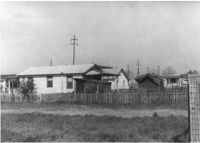
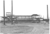
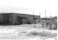
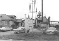
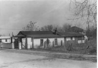
Virginia-Carolina Chemical Corp. structures on site affected by the construction of Interstate 26 (I-26). [VC Chemical Corp. was located on King Street Extn.] Surveyor notations on back of photo: "Dkt.: 10.490. Property owner: V.C. Chemical Co. Tract: 1. Station: 5800+00 Rt. Date: September 11, 1962. To be cut off at R/W." [See collection description for explanation of surveyor notations.]
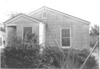
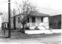
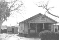
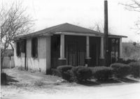
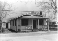
House on site affected by the construction of Interstate 26 (I-26). Building address number 2135. Surveyor notations on back of photo: "Dkt.: 10.490. Property owner: Sheppard Siders. Tract: 138-E. Station: 5858+00 Lt. Date: May 15, 1962. Owner to cut porch to clear R/W." [See collection description for explanation of surveyor notations.]
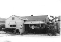
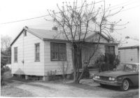
House at 2161 Heriot Street, on site affected by the construction of Interstate 26 (I-26). Address: 2159 Heriot Street. Surveyor notations on back of photo: "Dkt.: 10.490. Property owner: Henry Yaschik. Tract: 147-B. Station: 175' Lt. Sta. 5879+35. Date: May 15, 1962. Proximity." [See collection description for explanation of surveyor notations.]
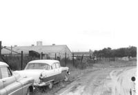
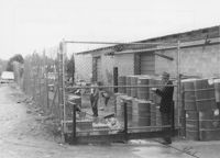
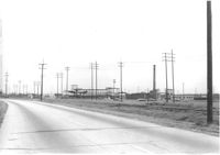
Dirt road and Charleston Oil Co. structures, on site affected by the construction of Interstate 26 (I-26). Surveyor notations on back of photo: "Dkt.: 10.490. Property owner: Charleston Oil Co. Tract: 140 and 140-A. Station: 5861+51 Rt. and Lt. (crosses CL). Date: August 29, 1962. In R/W - Bought." [See collection description for explanation of surveyor notations.]
House (rear view) on site affected by the construction of Interstate 26 (I-26). Surveyor notations on back of photo: "Dkt.: 10.490. Property owner: Henry Ford, et al. Tract: 138-C. Station: 5858+40 Lt. Date: August 29, 1962. In R/W - Bought." [See collection description for explanation of surveyor notations.]
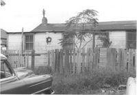
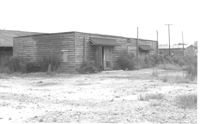
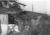
Structure on site affected by the construction of Interstate 26 (I-26). Surveyor notations on back of photo: "Dkt.: 10.490. Property owner: Ashley River Realty Co. Tract: 142. Station: 5876+60 Lt. Date: August 29, 1962. In R/W - Bought." [See collection description for explanation of surveyor notations.]
Structure on site affected by the construction of Interstate 26 (I-26). Surveyor notations on back of photo: "Dkt.: 10.490. Property owner: Ashley River Realty Co. Tract: 142. Station: 5876+60 Lt. Date: August 29, 1962. In R/W - Bought." [See collection description for explanation of surveyor notations.]
Renken Boat Co, on site affected by the widening of Route 171 (Folly Road). Surveyor notations on back of photo: "Dkt.: 10.494. Property owner: Renken Finance Co. Tract: 19. Station: 157+00 Lt. Date: Mar. 21, 1962. Proximity. [See collection description for explanation of surveyor notations.]
House (rear view) on site affected by the construction of Interstate 26 (I-26). [Building address number 2003(?).]Surveyor notations on back of photo: "Dkt.: 10.490. Property owner: L. Bradley. Tract: 39. Station: 5797+70 on CL Line 'G'. Date: September 11, 1962. In R/W - Bought." [See collection description for explanation of surveyor notations.]
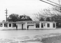
Furniture Repair Shop, on site affected by the widening of Route 171 (Folly Road). Surveyor notations on back of photo: "Dkt.: 10.494. Property owner: Isadora Bischoff. Tract: 32. Station: 162+00 Lt. Date: Mar. 21, 1962. Owner to cut off at R/W. [See collection description for explanation of surveyor notations.]
House on site affected by the construction of Interstate 26 (I-26). Building address number 2009(?). Surveyor notations on back of photo: "Dkt.: 10.490. Property owner: John Simmons, Est. Tract: 42. Station: 5798+60 on CL Line 'G'. Date: September 12, 1962. In R/W - Bought." [See collection description for explanation of surveyor notations.]
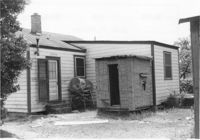
House and garage or shed on site affected by the construction of Interstate 26 (I-26). Surveyor notations on back of photo: "Dkt.: 10.490. Property owner: Loretta Gillard [Loretta Gaillard]. Tract: 56. 5800+00 Lt. Line 'G'. Date: September 12, 1962. In R/W - Bought." [See collection description for explanation of surveyor notations.]
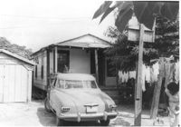
House (rear view) on site affected by the construction of Interstate 26 (I-26). Surveyor notations on back of photo: "Dkt.: 10.490. Property owner: Loretta Gillard [Loretta Gaillard]. Tract: 56. 5801+50 Lt. Line 'F'. Date: September 12, 1962. In R/W - Bought." [See collection description for explanation of surveyor notations.]
House (rear view) on site affected by the construction of Interstate 26 (I-26). Address: 2132 Montford Avenue. Surveyor notations on back of photo: "Dkt.: 10.490. Property owner: Wm. P. Mahon [William P. Mahon]. Tract: 172. Station: 5884+30 Rt. Date: May 15, 1962. In R/W - Bought." [See collection description for explanation of surveyor notations.]
House (rear view) on site affected by the construction of Interstate 26 (I-26). Address: 2136 Montford Avenue. Surveyor notations on back of photo: "Dkt.: 10.490. Property owner: Werner R. Mohrmann. Tract: 170. Station: 5884 ±20 Rt. Date: August 29, 1962. In R/W - Bought." [See collection description for explanation of surveyor notations.]
House, trailer, and street on site affected by the construction of Interstate 26 (I-26). Surveyor notations on back of photo: "Dkt.: 10.490. Property owner: Jacob Myers, et al. Tract: 86-A. Station: 5823+90 Rt. Date: March 22, 1962. Proximity to house. Owner to move trailer." [See collection description for explanation of surveyor notations.]
House (rear view) and backyard on site affected by the construction of Interstate 26 (I-26). Surveyor notations on back of photo: "Dkt.: 10.490. Property owner: Christer Bell King. Tract: 96-D. Station: 5826+95 Rt. Date: March 22, 1962. Proximity" [See collection description for explanation of surveyor notations.]
House on site affected by the construction of Interstate 26 (I-26). [Address 2213 Delano.] Surveyor notations on back of photo: "Dkt.: 10.490. Property owner: Cath. Mason Lewis. Tract: 83. Station: 5824+00 on CL. Date: March 22, 1962. In R/W - Bought." [See collection description for explanation of surveyor notations.]
House (corner view, rear) on site affected by the construction of Interstate 26 (I-26). Surveyor notations on back of photo: "Dkt.: 10.490. Property owner: Buddy Floyd, et al. Tract: 90. Station: 5825+10 Lt. Date: March 22, 1962. In R/W - Bought." [See collection description for explanation of surveyor notations.]
House on site affected by the construction of Interstate 26 (I-26). [Address 2213 Delano.] Surveyor notations on back of photo: "Dkt.: 10.490. Property owner: Cath. Mason Lewis. Tract: 83. Station: 5824+00 on CL. Date: March 22, 1962. In R/W - Bought." [See collection description for explanation of surveyor notations.]
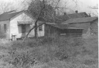
House (rear view) and shed on site affected by the construction of Interstate 26 (I-26). Surveyor notations on back of photo: "Dkt.: 10.490. Property owner: Minnie R. Sherman. Tract: 92. Station: 5827+10 Lt. Date: March 22, 1962. In R/W - Bought." [See collection description for explanation of surveyor notations.]
House (corner view, rear) on site affected by the construction of Interstate 26 (I-26). Surveyor notations on back of photo: "Dkt.: 10.490. Property owner: Harold I. Sherman. Tract: 101. Station: 5827+80 Lt. Date: March 22, 1962. In R/W - Bought." [See collection description for explanation of surveyor notations.]
House (rear view) on site affected by the construction of Interstate 26 (I-26). Surveyor notations on back of photo: "Dkt.: 10.490. Property owner: Geo. L. Robertson [George L. Robertson]. Tract: 87. Station: 5825+30 Rt. Date: May 15, 1962. In R/W - Bought." [See collection description for explanation of surveyor notations.]
House (corner view, rear) on site affected by the construction of Interstate 26 (I-26). Surveyor notations on back of photo: "Dkt.: 10.490. Property owner: Minnie R. Sherman. Tract:96. Station: 5826+50 Rt. Date: March 22, 1962. In R/W - Bought." [See collection description for explanation of surveyor notations.]
Outbuilding on site affected by the construction of Interstate 26 (I-26). Address: 2117 Weaver Avenue. See also I-26 Photos 1448-1449. Surveyor notations on back of photo: "Dkt.: 10.490. Property owner: Marion Butler, et al. Tract: 192. Station: 5888+80 Rt. Date: May 15, 1962. In R/W - Bought." [See collection description for explanation of surveyor notations.]
Bird house on site affected by the construction of Interstate 26 (I-26). Address: 2117 Weaver Avenue. See also I-26 Photos 1448-1449. Surveyor notations on back of photo: "Dkt.: 10.490. Property owner: Mrs. Lucretia Nowak. Tract: 191. Station: 5888+85 Lt. House, 5889+23 on CL Bird House. Date: May 15, 1962. In R/W - Bought." [See collection description for explanation of surveyor notations.]
Structure (possibly a bird coop) on site affected by the construction of Interstate 26 (I-26). Address: 1338 Rutledge Avenue. Surveyor notations on back of photo: "Dkt.: 10.490. Property owner: Louise S. Carter. Tract: 157. Station: 5880+90 Lt. Date: May 15, 1962. In R/W - Bought." [See collection description for explanation of surveyor notations.]
House (rear view) on site affected by the construction of Interstate 26 (I-26). Address: 2129 Weaver Avenue. Surveyor notations on back of photo: "Dkt.: 10.490. Property owner: Lewis W. Infinger, Est. Tract: 197. Sta.: 110' Rt. Sta. 5889+25. Date: May 15, 1962. In R/W - Bought." [See collection description for explanation of surveyor notations.]
House on site affected by the widening of Route 171 (Folly Road). Surveyor notations on back of photo: "Dkt.: 10.494. Property owner: Sophie Sabel, Est. Tract: 97. Station: 372+20 Lt. Date: Mar. 21, 1962. To be cut off at R/W by SCHD [SC Highway Dept.?]. [See collection description for explanation of surveyor notations.]
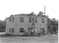
Building (rear view), perhaps once used commercially (market?), on site affected by the construction of Interstate 26 (I-26). Side facade has stepped parapet. [Building address number 2212(?).] Surveyor notations on back of photo: "Dkt.: 10.490. Property owner: F.F. Bellinger. Tract: 88. Station: 5825+40 Rt. Date: March 22, 1962. In R/W - Bought." [See collection description for explanation of surveyor notations.]
House (corner view, rear) on site affected by the construction of Interstate 26 (I-26). [Building address number 2220.] Surveyor notations on back of photo: "Dkt.: 10.490. Property owner: W.L. Gaillard, et al. Tract: 102. Station: 5827+85 Lt. Date: March 22, 1962. In R/W - Bought." [See collection description for explanation of surveyor notations.]
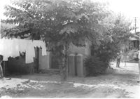
House and portion of lot, on site affected by the construction of Interstate 26 (I-26). View partially obscured by trees. Surveyor notations on back of photo: "Dkt.: 10.490. Property owner: Geo. L. Robertson [George L. Robertson]. Tract: 87. Station: 5824+80 Rt. Date: May 15, 1962. In R/W - Bought." [See collection description for explanation of surveyor notations.]
House (rear view) on site affected by the construction of Interstate 26 (I-26). [Building address number 2224.] Surveyor notations on back of photo: "Dkt.: 10.490. Property owner: Mary Jane Graham. Tract: 103-A. Station: 5827+90 Lt. Date: March 22, 1962. Owner to clear R/W." [See collection description for explanation of surveyor notations.]
House on site affected by the construction of Interstate 26 (I-26). Address: 2125 Weaver Avenue. Surveyor notations on back of photo: "Dkt.: 10.490. Property owner: Rob't O. Davey [Robert O. Davey]. Tract: 195. Station: 80' Rt. Sta. 5887+90. Date: May 15, 1962. In R/W - Bought." [See collection description for explanation of surveyor notations.]
House (corner view, rear) on site affected by the construction of Interstate 26 (I-26). Address: 1342 Rutledge Avenue. Surveyor notations on back of photo: "Dkt.: 10.490. Property owner: Louise S. Carter. Tract: 155. Station: 5880+40 Rt. Date: May 15, 1962. In R/W - Bought." [See collection description for explanation of surveyor notations.]
House on site affected by the construction of Interstate 26 (I-26). Address: 2129 Weaver Avenue. Surveyor notations on back of photo: "Dkt.: 10.490. Property owner: Lewis W. Infinger, Est. Tract: 197. Sta.: 110' Rt. Sta. 5889+25. Date: May 15, 1962. In R/W - Bought." [See collection description for explanation of surveyor notations.]
House (rear view) on site affected by the construction of Interstate 26 (I-26). Address: 2121 Weaver Avenue. Surveyor notations on back of photo: "Dkt.: 10.490. Property owner: Peter Putz. Tract: 193. Station: 5888+30 Rt. Date: May 15, 1962. In R/W - Bought." [See collection description for explanation of surveyor notations.]
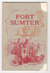
A pamphlet about Fort Sumter published by the National Parks Service as part of the "Historical Handbook Series." The pamphlet includes a brief history of Fort Sumter, including its construction, the initial bombardment which started the Civil War, it's role throughout the Civil War, and the purpose it served after the Civil War. It also includes a guide and map of the national monument as it existed in 1962.
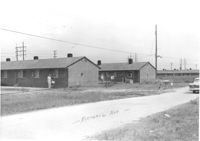
Daniel Jenkins Homes, federal multi-family housing, on Richland Avenue (119 Richland Avenue and 120 Richland Avenue), on site affected by the construction of Interstate 26 (I-26). Surveyor notations on back of photo: "Dkt.: 10.490. Property owner: Ashley Development Co. Tract: 1-A. Station: 5783+10 to 5784+00 Lt. Date: September 11, 1962. To be cut off at R/W by owner." [See collection description for explanation of surveyor notations.]
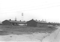
Daniel Jenkins Homes, federal multi-family housing, on Richland Avenue (111 Richland Avenue and 112 Richland Avenue), on site affected by the construction of Interstate 26 (I-26). Surveyor notations on back of photo: "Dkt.: 10.490. Property owner: Ashley Development Co. Tract: 1-A. Station: 5788+35 to 5789+25 Rt. and Lt. Date: September 11, 1962. In R/W - Bought." [See collection description for explanation of surveyor notations.]
House on site affected by the construction of Interstate 26 (I-26). Address: 2123 Weaver Avenue. Surveyor notations on back of photo: "Dkt.: 10.490. Property owner: Henry Yaschik. Tract: 194. Station: 5888+10 Rt. Date: May 15, 1962. In R/W - Bought." [See collection description for explanation of surveyor notations.]
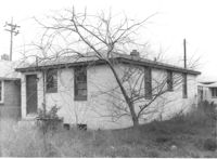
House on site affected by the construction of Interstate 26 (I-26). Surveyor notations on back of photo: "Dkt.: 10.490. Property owner: Theodore Nelson, et al. Tract: 111 and 112. Station: 5830+00 Rt. Date: August 29, 1962. In R/W - Bought." [See collection description for explanation of surveyor notations.]
House on site affected by the construction of Interstate 26 (I-26). Surveyor notations on back of photo: "Dkt.: 10.490. Property owner: W.L. Gaillard, et al. Tract: 100. Station: 5827+80 on CL. Date: March 22, 1962. In R/W - Bought." [See collection description for explanation of surveyor notations.]
House on site affected by the construction of Interstate 26 (I-26). Surveyor notations on back of photo: "Dkt.: 10.490. Property owner: W.L. Gaillard, et al. Tract: 98. Station: 5827+75 Rt. Date: March 22, 1962. In R/W - Bought." [See collection description for explanation of surveyor notations.]
House on site affected by the construction of Interstate 26 (I-26). Surveyor notations on back of photo: "Dkt.: 10.490. Property owner: W.L. Gaillard, et al. Tract: 99. Station: 5827+75 Rt. Date: March 22, 1962. In R/W - Bought." [See collection description for explanation of surveyor notations.]
House on site affected by the construction of Interstate 26 (I-26). Surveyor notations on back of photo: "Dkt.: 10.490. Property owner: Harold I. Sherman. Tract: 101. Station: 5827+80 Lt. Date: March 22, 1962. In R/W - Bought." [See collection description for explanation of surveyor notations.]
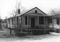
House on site affected by the construction of Interstate 26 (I-26). Building address number 2202. Surveyor notations on back of photo: "Dkt.: 10.490. Property owner: Julius A. Cercoply. Tract: 17. Station: 5818+20 Lt. Date: March 22, 1962. In R/W - Bought." [See collection description for explanation of surveyor notations.]
House (rear view) on site affected by the construction of Interstate 26 (I-26). Surveyor notations on back of photo: "Dkt.: 10.490. Property owner: Robert M. Huckabee. Tract: 14. Station: 5818+00 (Lt. Line "G"). Date: March 22, 1962. In R/W - Bought." [See collection description for explanation of surveyor notations.]
House on site affected by the construction of Interstate 26 (I-26). Surveyor notations on back of photo: "Dkt.: 10.490. Property owner: Robert M. Huckabee. Tract: 14. Station: 5818+00 (Lt. Line "G"). Date: March 22, 1962. In R/W - Bought." [See collection description for explanation of surveyor notations.]
Road (presumably King Street Extn.) to Virginia-Carolina Chemical Corp. with its buildings in background, on site affected by the construction of Interstate 26 (I-26). Surveyor notations on back of photo: "Dkt.: 10.490. Property owner: V.C. Chemical Co. Tract: 1. Station: Panoramic view from North (see plans). Date: September 11, 1962. (For information.)" [See collection description for explanation of surveyor notations.]
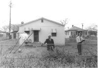
House (rear view) and yard with children "hanging out," on site affected by the construction of Interstate 26 (I-26). Address: 2124 Weaver Avenue. Surveyor notations on back of photo: "Dkt.: 10.490. Property owner: Harry L. Rumph, Jr. Tract: 188. Station: 5887+20 on CL. Date: May 15, 1962. In R/W - Bought." [See collection description for explanation of surveyor notations.]
House on site affected by the construction of Interstate 26 (I-26). Address: 2122 Weaver Avenue. View of house partially obscured by trees. Surveyor notations on back of photo: "Dkt.: 10.490. Property owner: Ola C. Verdier [Olar C. Verdier?]. Tract: 189. Station: 35' Lt. Sta. 5887+45. Date: May 15, 1962. In R/W - Bought." [See collection description for explanation of surveyor notations.]
House and driveway on site affected by the construction of Interstate 26 (I-26). Address: 2131 Courtland Avenue. Surveyor notations on back of photo: "Dkt.: 10.490. Property owner: John H. Cass, et al. Tract: 164. Station: 40' Lt. Sta. 5883+40. Date: May 15, 1962. In R/W - Bought." [See collection description for explanation of surveyor notations.]
House (rear view) on site affected by the construction of Interstate 26 (I-26). Address: 2137 Courtland Avenue. Surveyor notations on back of photo: "Dkt.: 10.490. Property owner: Baynard C. Lynes. Tract: 167. Station: 50' Rt. Sta. 5883+10. Date: May 15, 1962. In R/W - Bought." [See collection description for explanation of surveyor notations.]
House (rear view) on site affected by the construction of Interstate 26 (I-26). Address: 2132 Weaver Avenue. Surveyor notations on back of photo: "Dkt.: 10.490. Property owner: Alvin C. Jervey. Tract: 184. Station: 120' Rt. Sta. 5886+50. Date: May 15, 1962. Proximity." [See collection description for explanation of surveyor notations.]
House (rear view) on site affected by the construction of Interstate 26 (I-26). Address: 2131 Courtland Avenue. Surveyor notations on back of photo: "Dkt.: 10.490. Property owner: John H. Cass, et al. Tract: 164. Station: 5883+40. Date: May 15, 1961. In R/W - Bought." [See collection description for explanation of surveyor notations.]
House (rear view) on site affected by the construction of Interstate 26 (I-26). Address: 2133 Courtland Avenue. Surveyor notations on back of photo: "Dkt.: 10.490. Property owner: J.H. Black, et al. Tract: 165. Station: 5883±10 Lt. Date: August 29, 1962. In R/W - Bought." [See collection description for explanation of surveyor notations.]
House on site affected by the construction of Interstate 26 (I-26). Address: 2129 Courtland Avenue. Surveyor notations on back of photo: "Dkt.: 10.490. Property owner: The Beach Co. Tract: 163. Station: 5883±50 Lt. Date: August 29, 1962. In R/W - Bought." [See collection description for explanation of surveyor notations.]
Two-story dwelling (rear view) on site affected by the construction of Interstate 26 (I-26). Address: 1317 King Street. Presumably part of the Rose Garden Tourist Court; see I-26 Photo 1467. Surveyor notations on back of photo: "Dkt.: 10.490. Property owner: The Long Corporation. Tract: 200. Station: 7+10 Lt. (Mt. Pleasant Street). Date: September 11, 1962. To be cut off at R/W by SCHD [SC Highway Department]." [See collection description for explanation of surveyor notations.]
J&K Minute Market [893 Folly Road] and Sinclair gas station, on site affected by the widening of Route 171 (Folly Road). Surveyor notations on back of photo: "Dkt.: 10.494. Property owner: Otis R. Burbage. Tract: 40. Station: 176+40 Rt. Date: Mar. 21, 1962. Proximity. [See collection description for explanation of surveyor notations.]
House on site affected by the construction of Interstate 26 (I-26). Address: 2135 Montford Avenue. Surveyor notations on back of photo: "Dkt.: 10.490. Property owner: Paul E. West. Tract: 182. Station: 60'Rt. Sta. 5885+50. Date: May 15, 1962. In R/W - Bought. Storage house to be retained by owner." [See collection description for explanation of surveyor notations.]
Shed on site affected by the construction of Interstate 26 (I-26). Address: 2128 Montford Avenue. Surveyor notations on back of photo: "Dkt.: 10.490. Property owner: Chas. W. Jenkins, Jr. [Charles W. Jenkins, Jr.]. Tract: 174. Station: 50' Lt. Sta. 5884+00. Date: May 15, 1962. In R/W - Bought." [See collection description for explanation of surveyor notations.]
Koppers Company buildings and structures on site affected by the construction of Interstate 26 (I-26). Signage for Koppers Wood Preserving Division, Charleston Plant in foreground. Surveyor notations on back of photo: "Dkt.: 10.490. Property owner: Koppers Co. Tract: 137. Station: 5847+00 Rt. Date: August 29, 1962. In R/W - Bought." [See collection description for explanation of surveyor notations.]
House and shed at end of driveway, on site affected by the construction of Interstate 26 (I-26). Building address number 2215(?). Surveyor notations on back of photo: "Dkt.: 10.490. Property owner: Minnie R. Sherman. Tract: 94 & 95. Station: 5826+60 Rt. Date: March 22, 1962. In R/W - Bought." [See collection description for explanation of surveyor notations.]
House (rear view) on site affected by the construction of Interstate 26 (I-26). [Building address number 2215(?).] Surveyor notations on back of photo: "Dkt.: 10.490. Property owner: Minnie R. Sherman. Tract:95. Station: 5826+60 Rt. Date: March 22, 1962. In R/W - Bought." [See collection description for explanation of surveyor notations.]
House on site affected by the construction of Interstate 26 (I-26). Building address number 2215. [2215 Delano.] Surveyor notations on back of photo: "Dkt.: 10.490. Property owner: Cath. Mason Lewis. Tract: 84. Station: 5824+00 Rt. Date: March 22, 1962. In R/W - Bought." [See collection description for explanation of surveyor notations.]
House (rear view) on site affected by the construction of Interstate 26 (I-26). [Address 2213 Delano.] Surveyor notations on back of photo: "Dkt.: 10.490. Property owner: Cath. Mason Lewis. Tract: 83. Station: 5824+00 on CL. Date: March 22, 1962. In R/W - Bought." [See collection description for explanation of surveyor notations.]
House on site affected by the construction of Interstate 26 (I-26). Building address number ____ [____ Delano]. Surveyor notations on back of photo: "Dkt.: 10.490. Property owner: Ruth Mattox. Tract: 79. Station: 5823+00 Lt. Date: March 22, 1962. In R/W - Bought." [See collection description for explanation of surveyor notations.]
House on site affected by the construction of Interstate 26 (I-26). Building address number 220_. Surveyor notations on back of photo: "Dkt.: 10.490. Property owner: Harold I. Sherman, et al. Tract: 107. Station: 5828+90 on CL. Date: March 22, 1962. In R/W - Bought." [See collection description for explanation of surveyor notations.]
House (corner view, rear) on site affected by the construction of Interstate 26 (I-26). Surveyor notations on back of photo: "Dkt.: 10.490. Property owner: Theodore Nelson, et al. Tract: 111 and 112. Station: 5830+00 Rt. Date: August 29, 1962. In R/W - Bought." [See collection description for explanation of surveyor notations.]
House on site affected by the construction of Interstate 26 (I-26). Building address number 2221. Surveyor notations on back of photo: "Dkt.: 10.490. Property owner: Harold I. Sherman. Tract: 105. Station: 5829+00 Lt. Date: March 22, 1962. In R/W - Bought." [See collection description for explanation of surveyor notations.]
House (rear view) on site affected by the construction of Interstate 26 (I-26). Surveyor notations on back of photo: "Dkt.: 10.490. Property owner: Freddie Alston, et al. Tract: 97. Station: 5827+75 Rt. Date: March 22, 1962. In R/W - Bought." [See collection description for explanation of surveyor notations.]
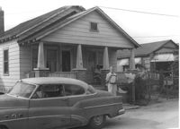
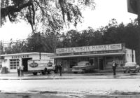
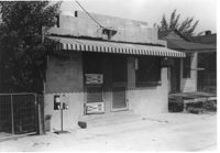
Building on site affected by the construction of Interstate 26 (I-26). Appears to previously have been a market; signage for Tru Ade (Drink) in window; gumball machines in front on sidewalk. Front facade has stepped parapet. Surveyor notations on back of photo: "Dkt.: 10.490. Property owner: Loretta Gillard [Loretta Gaillard]. Tract: 56. 5801+55 Lt. Line 'F'. Date: September 12, 1962. In R/W - Bought." [See collection description for explanation of surveyor notations.]
House (rear view) on site affected by the construction of Interstate 26 (I-26). Surveyor notations on back of photo: "Dkt.: 10.490. Property owner: W.L. Gaillard, et al. Tract: 100. Station: 5827+80 on CL. Date: March 22, 1962. In R/W - Bought." [See collection description for explanation of surveyor notations.]
House on site affected by the construction of Interstate 26 (I-26). Surveyor notations on back of photo: "Dkt.: 10.490. Property owner: Geo. L. Robertson [George L. Robertson]. Tract: 87. Station: 5825+30 Rt. Date: March 22, 1962. In R/W - Bought." [See collection description for explanation of surveyor notations.]
House on site affected by the construction of Interstate 26 (I-26). Surveyor notations on back of photo: "Dkt.: 10.490. Property owner: Jacob Myers, et al. Tract: 86-A. Station: 5823+90 Rt. Date: March 22, 1962. Proximity to house." [See collection description for explanation of surveyor notations.]