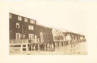
Photograph of the United Fruit Company dock after the September 29, 1938, tornadoes. (Based on Sanborn Maps, the dock was located at the foot of Laurens Street, Southern Railway Pier 2.)
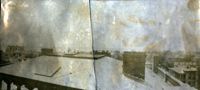
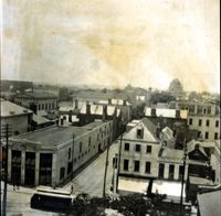
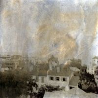
View of Charleston from rooftop of Calhoun Mansion, facing southwest. Buildings in image include Josiah Smith House and Stevens-Lathers House. Page 3, Photo 1 of collection. 6.25" x 2.75" B/W photograph, two images spliced together.
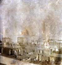
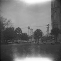
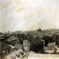
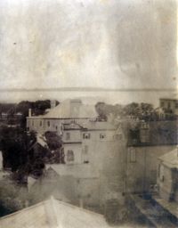
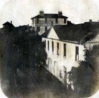
View of Charleston from rooftop of the Calhoun Mansion, facing southeast. Includes backs of buildings along Church Street, South Battery, and East Battery. Page 1, Photo 3 of collection. 3.25" x 3.5" B/W photograph.
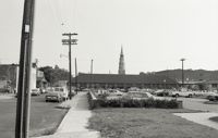
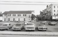
Black-and-white photograph of a parking lot on Wentworth Street near King Street [60 Wentworth / 260 King Street]; northeast corner of the Kerrison's building at upper right.
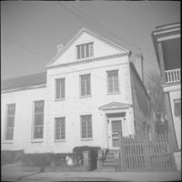
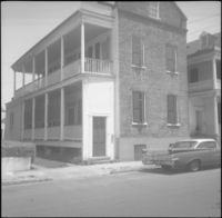
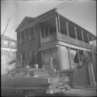
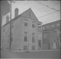
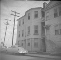
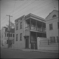
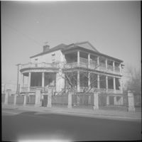
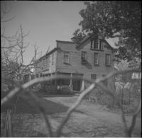
Right to left: 84 Anson Street before demolition and 86 Anson Street (Mary Smith House) before its relocation to its current address (82 Anson Street).
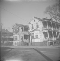
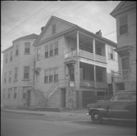
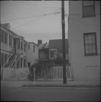
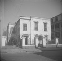
Left to right: 23 Society Street and 25 Society Street, later demolished. The houses were at the southwest corner of Society Street and East Bay Street.
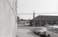
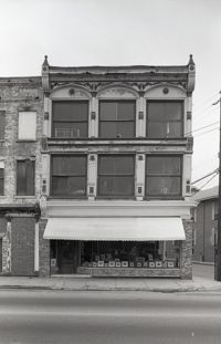
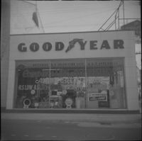
256 Meeting Street (William Gayer Carriage Factory) as a Goodyear Tire service center, before rehabilitation with a reconstructed façade. Located at the southeast corner of Meeting Street and Wentworth Street.
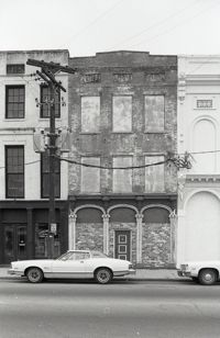
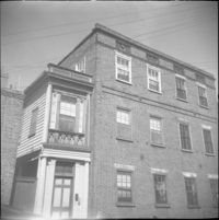
Wentworth Street façade of 256 Meeting Street (William Gayer Carriage Factory) when it was a Goodyear Tire service center. Located at the southeast corner of Meeting Street and Wentworth Street.
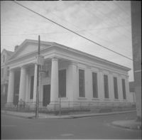
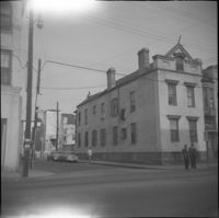
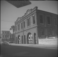
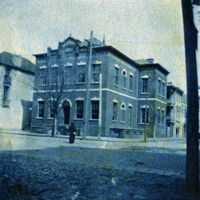
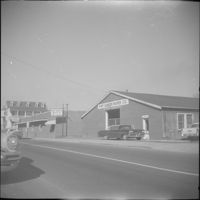
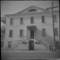
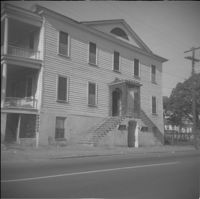
Wentworth Street elevation of the Central Fire Station (260-264 Meeting Street), located at the northeast corner of Meeting Street and Wentworth Street.
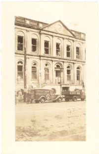
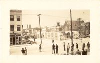
Photograph of City Hall after the tornadoes of September 29, 1938, showing the damage done to the building. Two trucks, including an Automatic Grocery truck, are parked in front of building. Onlookers are on the sidewalk in front of building; men stand at doorways and windows.
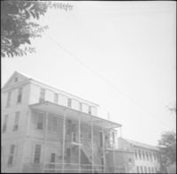
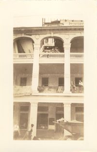
Photograph of the Timrod Hotel [ca. 101 Meeting Street], after the tornadoes of September 29, 1938, showing the damage done to the building. East elevation. Men are sitting on the second story piazza ledge. Men stand on the sidewalk by a truck that is carrying debris. [Note: The hotel was later demolished in the 1960s.]
Looking northwest on Market Street from the U.S. Custom House on East Bay Street, after the tornadoes of September 29, 1938, showing damaged and ruined Market Sheds. Also shows the damaged buildings on North Market Street. Onlookers and cars are in the street. Partial view of ca. 225 East Bay Street (now gone) is on the left.
View of rooftops of Hasell Street area between Maiden Lane and Anson Street. Buildings in image include Trinity Methodist Episcopal Church and the U.S. Customs House. Page 31, Photo 1 of collection. 3.5" x 3.5" B/W photograph.
View of Charleston from rooftop at northeast corner of Wentworth and Meeting Streets, facing west, with streetcar passing. Buildings in view include Kahal Kadosh Beth Elohim Synagogue and Hirsch Israel Building. Page 22, Photo 1 of collection. 3.5" x 3.5" B/W photograph.
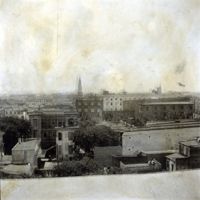
View of Charleston from rooftop in vicinity of northeast corner of Wentworth and Meeting Streets, facing south. Buildings in image include 64 Hasell, 66 Hasell, the Charleston Hotel, and St. Philip's Church steeple. Page 4, Photo 1 of collection. 3.5" x 3.5" B/W photograph.View of Charleston from rooftop in vicinity of northeast corner of Wentworth and Meeting Streets, facing south. Buildings in image include 64 Hasell, 66 Hasell, the Charleston Hotel, and St. Philip's Church steeple. Page 4, Photo 1 of collection. 3.5" x 3.5" B/W photograph.
This one-page typed document provides stipulations for properties under the Historic Charleston Foundation's Protective Covenants agreement, prior to 1977 and after 1965.
This two-page, handwritten document lists several properties in the Ansonborough neighborhood. The document title indicates that the properties listed were under use restrictions.
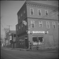
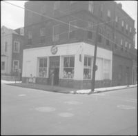
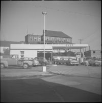
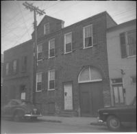
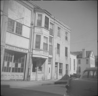
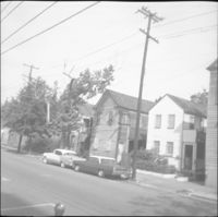
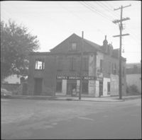
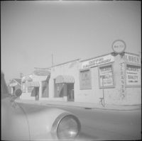
Businesses located at the northeast corner of East Bay Street and Vernon Street: Milbren's Laundry and Dry Cleaning (334 East Bay Street) and Fort Sumter Paper Co. (336 East Bay Street), since demolished.
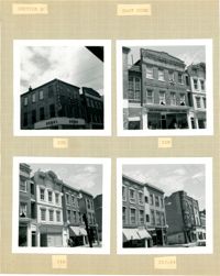
Four B&W photographs of buildings on the east side of King Street: Top left: 220 King Street (Dumas); Top right: 218 King Street (Sharnoff's Uniform Shop); Bottom left (212-218): 212 King Street, 214 King Street (Fabric Center), 216 King Street, and edge of 218 King Street; Bottom right (208-214): 208 King Street (Gatlin Opticians), 212 King Street (La Scaltro Antiques), and 214 King Street (Fabric Center).
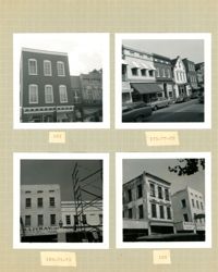
Four B&W photographs of buildings on the west side of King Street: Top left (181-183): 181 King Street (Jack Patla Antiques) and 183 King Street (The Art Shop); Top right (175-179): 175 King Street, 177 King Street, and 179 King Street (Fralix & Sons); Bottom left (169-173): 169 King Street (R.M. McGillivray's) and 171-173 King Street; Bottom right (165-169); 165 King Street and 169 King Street (R.M. McGillivray's).

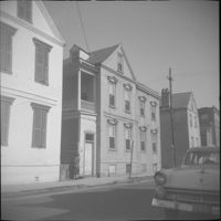


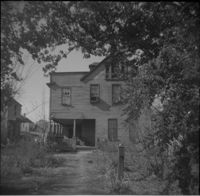

![116 Anson Street [now at 39 Laurens Street]](https://iiif.library.cofc.edu/iiif/2/48431/full/200,/0/default.jpg)