Search
« Previous |
41 - 60 of 1,613
|
Next »
Search Results
Date:
1977-1983
Description:
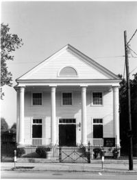
222 Calhoun Street, Old Bethel Methodist Church, ca. 1797. View of South (Front) elevation. 4" x 5" B/W photo.
Date:
1977-1983
Description:
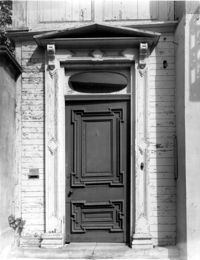
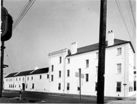
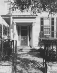
60 - 64 Broad Street, The Confederate Home, ca. 1800. Detail View of portico entry, South (Front) elevation. 4" x 5" B/W photo.
Date:
1977-1983
Description:
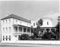
110 Broad Street, William Harvey House, ca. 1728. Main House - View of East (Side) elevation. 4" x 5" B/W photo.
Date:
1977-1983
Description:
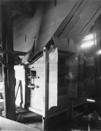
Georgetown County, Mansfield Plantation, ca. 1780. Rice Threshing Mill - Interior View. Threshers, SE elevation. 4" x 5" B/W photo.
Date:
1977-1983
Description:
456 King Street, William Aiken House, ca. 1811. Whole Property - View of SW (Front and Side) elevation. 4" x 5" B/W photo.
Date:
1977-1983
Description:
456 King Street, William Aiken House, ca. 1811. Whole Property - View of North (Side) elevation. 4" x 5" B/W photo.
Date:
1977-1983
Description:
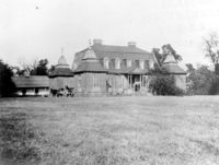
Berkley County, Mulberry Plantation, ca. 1714. Copy of undated historic photo. View of SW (Front and Side) elevation. 4" x 5" B/W photo.
Date:
1977-1983
Description:
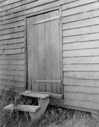
Georgetown County, Mansfield Plantation, ca. 1780. Rice Threshing Mill - Detail View of entrance. 4" x 5" B/W photo.
Date:
1977-1983
Description:
Georgetown County, Wicklow Hall Plantation, ca. 1825. Main House - View of South (Rear) elevation. 4" x 5" B/W photo.
Date:
1977-1983
Description:
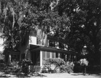
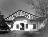
92 Church Street, Alexander Christie House, ca. 1908. View of NW (Front and Side) elevation. Shows extent of dependencies. 4" x 5" B/W photo.
Date:
1977-1983
Description:
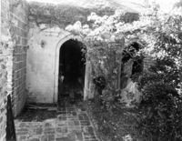
178 Ashley Avenue, Wickliffe House (John Hume Lucas House). Detail View of entry, West (Front) elevation. 4" x 5" B/W photo.
Date:
1977-1983
Description:
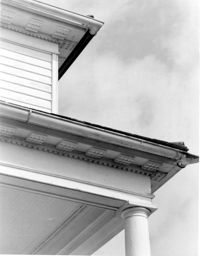
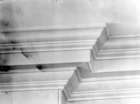
Charleston County (2695 Laurel Hill Road), Prospect Hill Plantation, ca. 1861. Detail View of portico and cornice elements. 4" x 5" B/W photo.
Date:
1977-1983
Description:
6 Glebe Street, St. Philip's Parsonage House (Bishop Robert Smith House), ca. 1770. Interior View. 1st and 2nd Floor - Hall, Detail of cornice. 4" x 5" B/W photo.
Date:
1977-1983
Description:
552 East Bay Street, Seaboard Airline RR Freight Station, date unknown. View of South (Front) elevation. 4" x 5" B/W photo.
Date:
1977-1983
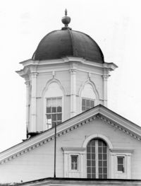
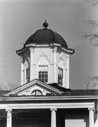
Description:
635 East Bay Street, Faber-Ward House, ca. 1832. Main House - Detail View of cupola and pediment, North (Side) elevation 4" x 5" B/W photo.
Date:
1977-1983
Description:
635 East Bay Street, Faber-Ward House, ca. 1832. Main House - Detail View of cupola and pediment, West (Rear) elevation 4" x 5" B/W photo.
Date:
1977-1983
Description:
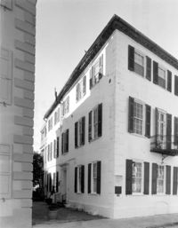
71 Church Street, Col. Robert Brewton House, ca.1732. View of SE (Front and Side) elevation. 4" x 5" B/W photo.
Date:
1977-1983
Description:
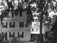
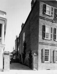
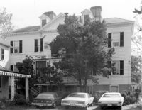
60 Montague Street, Gaillard-Bennett House, ca. 1800. Main House, View of North (Rear) elevation. 4" x 5" B/W photo.
Date:
1977-1983
Description:
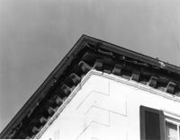
71 Church Street, Col. Robert Brewton House, ca.1732. Detail View of brick cornice. 4" x 5" B/W photo.
Date:
1977-1983
Description:
69 Church Street, Capers-Motte House, ca. 1745. View of Stable, East (Front) elevation. 4" x 5" B/W photo.