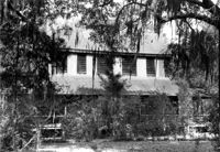
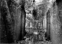
St. James Church, Goose Creek; Vestry Lane (off of Snake River Road, S.C. State Road 208). View of Front and Side elevation. Goose Creek, SC.;6.5" x 9.5" B/W photo. Box 2, Folder 1-5-1. One copy.
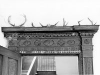
Church of the Redeemer (Pineville Chapel), Matilda Circle. Detail View of Window Sash and Shutter Dog - SE (Front) elevation. Pineville Historic District. Pineville, SC.;6.5" x 9.5" B/W photo. Box 3, Folder 1-9-1 (I). One copy.
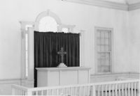
Church of the Redeemer (Pineville Chapel), Matilda Circle. Interior View - Detail of Chancel. SSE (Front and Side) elevation. Pineville Historic District. Pineville, SC.;6.5" x 9.5" B/W photo. Box 3, Folder 1-9-1 (I). One copy.
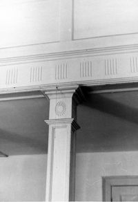
Church of the Redeemer (Pineville Chapel), Matilda Circle. Interior View - Detail of Column and Molding on Balcony. West (Rear) elevation. Pineville Historic District. Pineville, SC.;9.5" x 6.5" B/W photo. Box 3, Folder 1-9-1 (I). One copy.
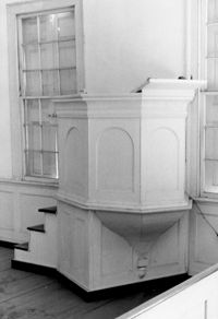
Church of the Redeemer (Pineville Chapel), Matilda Circle. Interior View - Detail of Pulpit. SSE (Front and Side) elevation. Pineville Historic District. Pineville, SC.;9.5" x 6.5" B/W photo. Box 3, Folder 1-9-1 (I). One copy.
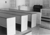
Church of the Redeemer (Pineville Chapel), Matilda Circle. Interior View - Detail of Pews. NNE (Side and Rear) elevation. Pineville Historic District. Pineville, SC.;6.5" x 9.5" B/W photo. Box 3, Folder 1-9-1 (I). One copy.
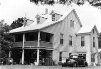
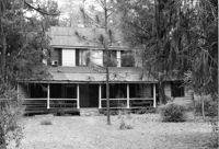
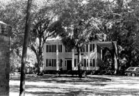
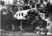
Dr. Morton Waring House, ca. 1834 - Pivotal to Historic District. View of East (Front) elevation. Pinopolis Historic District South. Pinopolis, S.C.;5" x 7" B/W photo. Box 3, Folder 1-10-1 (II). One copy.
Charles Macbeth House, ca. 1883 - Pivotal to Historic District. View of Side and Front elevations. Pinopolis Historic District North. Pinopolis, S.C.;5" x 7" B/W photo. Box 3, Folder 1-10-1 (II). One copy.
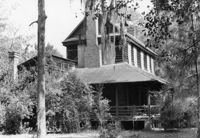
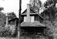
William Cain House Lodge, ca. 1834 - Pivotal to Historic District. View of Side elevation. Pinopolis Historic District North. Pinopolis, S.C.;5" x 7" B/W photo. Box 3, Folder 1-10-1 (II). One copy.
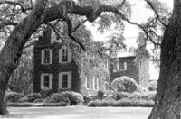
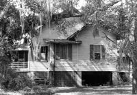
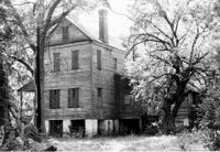
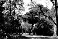
Mary Lesesne House (B.C. Cox House), ca. 1790. View of SE (Side and Rear) elevation. Cainhoy, S.C.;6.5" x 9.5" B/W photo. Box 4, Folder 1-12-3. One copy.
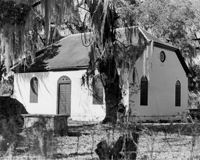
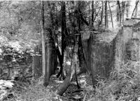
White Church (St. Thomas Church, The Brick Church), Off of Cainhoy Road. Vestry - View of Side elevation. Cainhoy, S.C.;8" x 10" B/W photo. Box 4, Folder 1-12-2. One copy.
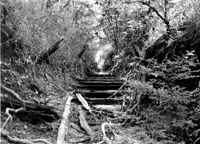
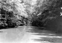
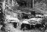
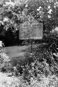
White Oak Lock. View down canal from White Oak lock showing cypress planking to retain water. Tailrace Canal, Old Santee Canal Park. Berkeley, SC.;6.5" x 9.5" B/W photo. Box 3, Folder 1-9-2. One copy.
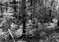
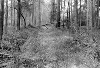
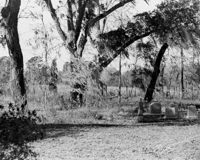
White Oak Lock. Santee Canal Section - General View; Trees in foreground are on Tow path. Tailrace Canal, Old Santee Canal Park. Berkeley, SC.;6.5" x 9.5" B/W photo. Box 3, Folder 1-9-2. One copy.
Mary Lesesne House (B.C. Cox House), ca. 1790. View of NW (Front and Side) elevation. Cainhoy, S.C.;6.5" x 9.5" B/W photo. Box 4, Folder 1-12-3. One copy.
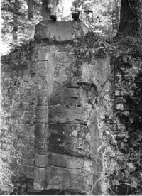
White Oak Lock. Lock #2 - Detail View of floodgate pintel. Tailrace Canal, Old Santee Canal Park. Berkeley, SC.;9.5" x 6.5" B/W photo. Box 3, Folder 1-9-2. One copy.
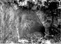
White Oak Lock. Lock #2 - View of water sluice. Tailrace Canal, Old Santee Canal Park. Berkeley, SC.;6.5" x 9.5" B/W photo. Box 3, Folder 1-9-2. One copy.
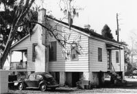
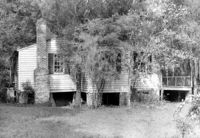
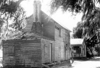
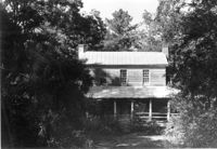
Isaac Porcher House - Slave Quarters. View of NW (Front and Side) elevation. Pinopolis Historic District North. Pinopolis, S.C.;6.5" x 9.5" B/W photo. Box 4, Folder 1-10-1 (III). Two copies.
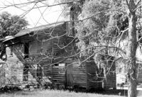
Unidentified - House. Pivotal to Historic District. View of Side and Front elevation. Labeled as, "Heirs of J.S. Sanders". Cainhoy, S.C.;8" x 10" B/W photo. Box 4, Folder 1-12-3. One copy.
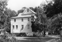
Unidentified - House. Contributing to Historic District. View of Front elevation. Labeled as, "Owned by Rachel M. Humphrey". Cainhoy, S.C.;8" x 10" B/W photo. Box 4, Folder 1-12-3. One copy.
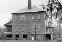
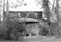
Village Store and Blacksmith Shop, ca. 1873. View of NW (Front and Side) elevation. Cainhoy, S.C.;6.5" x 9.5" B/W photo. Box 4, Folder 1-12-3. One copy.
John Henry Porcher House (Percival Porcher House?). View of North (Front) elevation. Pinopolis, S.C.;6.5" x 9.5" B/W photo. Box 4, Folder 1-10-1 (III). Two copies.
John Henry Porcher House (Percival Porcher House?). View of West (Side) elevation. Pinopolis, S.C.;6.5" x 9.5" B/W photo. Box 4, Folder 1-10-1 (III). Two copies.
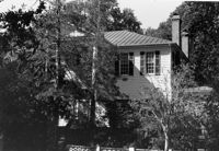
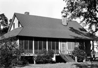
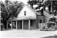
Fishburne House, ca. 1911 - Pivotal to Historic District. View of Front elevation. Pinopolis, S.C.;5" x 7" B/W photo. Box 3, Folder 1-10-1 (II). One copy.
Village Store and Blacksmith Shop, ca. 1873. View of SW (Rear and Side) elevation. Cainhoy, S.C.;6.5" x 9.5" B/W photo. Box 4, Folder 1-12-3. One copy.
Village Store and Blacksmith Shop, ca. 1873. View of SW (Side and Rear) elevation. Cainhoy, S.C.;6.5" x 9.5" B/W photo. Box 4, Folder 1-12-3. One copy.
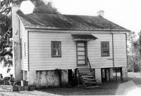
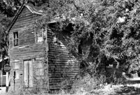
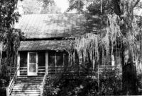
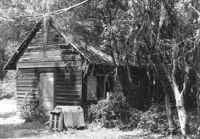
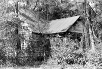
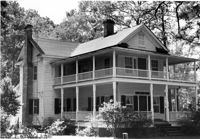
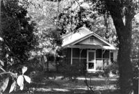
William Robertson House - Slave Cabin (Wampee Plantation Summer House). View of NW (Front and Side) elevation. Pinopolis, S.C.;6.5" x 9.5" B/W photo. Box 4, Folder 1-10-1 (III). Two copies.
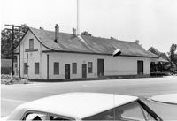
Moncks Corner Railroad Station. View of West (Front) elevation - taken from the SE. Moncks Corner, SC.;6.5" x 9.5" B/W photo. Box 2, Folder 1-8-15. Three copies.
William Cain House - Lodge. View of NW (Side and Front) elevation. Pinopolis Historic District North. Pinopolis, S.C.;6.5" x 9.5" B/W photo. Box 4, Folder 1-10-1 (III). Two copies.
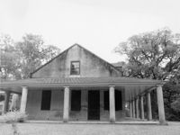
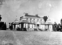
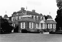
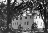
Stony Landing Plantation, East of U.S. Hwy. 52 and Riverwood Drive, along the Cooper River. View of Front elevation. Moncks Corner, SC.;6.5" x 9.5" B/W photo. Box 2, Folder 1-8-5. One copy.
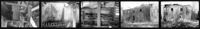
Comingtee Rice Barn (Mill), Located along the Western branch of the Cooper River. Contact Sheet 9 - Multiple Views. Berkeley County, S.C.;7.5" x 1" B/W photo. Box 20, Folder: Miscellaneous Photos: Scanned Contact Sheets. One copy.
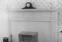
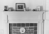
Old Rectory (Gourdin House). Interior View - Detail of Mantle on East Side. ENE elevation. Pineville Historic District. St. Stephen, SC.;6.5" x 9.5" B/W photo. Box 3, Folder 1-9-1 (I). One copy.
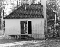
Lawson's Pond Plantation, Lawson Pond Lane. Interior View - Detail of door frame in East Front Room. West elevation. Cross, SC.;6.5" x 9.5" B/W photo. Box 2, Folder 1-4-3. One copy.
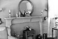
Library Society Building. Interior View - Detail of Mantel on East Side. WNW elevation. Pineville Historic District. St. Stephen, SC.;6.5" x 9.5" B/W photo. Box 3, Folder 1-9-1 (I). One copy.
Old Rectory (Gourdin House). Interior View - Detail of Newel Post. WSW elevation. Pineville Historic District. St. Stephen, SC.;6.5" x 9.5" B/W photo. Box 3, Folder 1-9-1 (I). One copy.
Martha M. Porcher House, ca. 1901 - Pivotal to Historic District. View of Side and Front elevations. Pinopolis Historic District South. Pinopolis, S.C.;5" x 7" B/W photo. Box 3, Folder 1-10-1 (II). One copy.
Louis H. Harvey House, ca. 1909 - Pivotal to Historic District. View of Front and Side elevations. Pinopolis Historic District South. Pinopolis, S.C.;5" x 7" B/W photo. Box 3, Folder 1-10-1 (II). One copy.
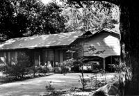
Unidentified House, ca. Early 20th century - Contributory to Historic District. Front and Side elevation. Pinopolis, S.C.;5" x 7" B/W photo. Box 3, Folder 1-10-1 (II). One copy.
W.K. Fishburne House, ca. 1911 - Pivotal to Historic District. View of Front and Side elevations. Pinopolis, S.C.;5" x 7" B/W photo. Box 3, Folder 1-10-1 (II). Three copies.
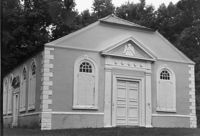
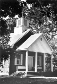
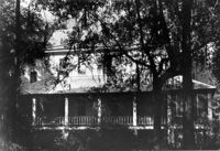
Trinity Episcopal Church, ca. 1844 - Contributory to Historic District. View of Front elevation. Pinopolis, S.C.;5" x 7" B/W photo. Box 3, Folder 1-10-1 (II). One copy.
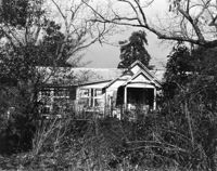
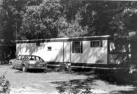
Unidentified House, ca. 1980 - Non-contributory to Historic District. Front and Side elevations. Pinopolis, S.C.;5" x 7" B/W photo. Box 3, Folder 1-10-1 (II). One copy.
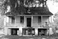
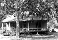
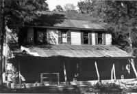
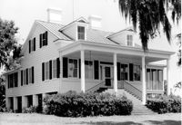
William Robertson House, ca. 1844 - Pivotal to Historic District. View of Front elevation. Pinopolis, S.C.;5" x 7" B/W photo. Box 3, Folder 1-10-1 (II). One copy.
Unidentified House, ca. 1920 - Contributory to Historic District. Front elevation. Pinopolis Historic District South. Pinopolis, S.C.;5" x 7" B/W photo. Box 3, Folder 1-10-1 (II). One copy.
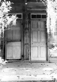
William Cain House - Main House. Detail View of Front Doors, North (Front) elevation. Pinopolis Historic District North. Pinopolis, S.C.;9.5" x 6.5" B/W photo. Box 4, Folder 1-10-1 (III). Two copies.
William Cain House - Main House. View of NE (Side and Front) elevation. Pinopolis Historic District North. Pinopolis, S.C.;6.5" x 9.5" B/W photo. Box 4, Folder 1-10-1 (III). Two copies.
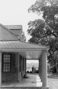
William Cain House - Main House. View of North (Front) elevation. Pinopolis Historic District North. Pinopolis, S.C.;6.5" x 9.5" B/W photo. Box 4, Folder 1-10-1 (III). Two copies.
William Cain House - Main House. View of East (Side) elevation. Pinopolis Historic District North. Pinopolis, S.C.;6.5" x 9.5" B/W photo. Box 4, Folder 1-10-1 (III). One copy.
Isaac Porcher House, ca. 1844 - Pivotal to Historic District. View of North (Front) elevation. Pinopolis Historic District North. Pinopolis, S.C.;5" x 7" B/W photo. Box 3, Folder 1-10-1 (II). One copy.
Charles Stevens House, ca. 1854 - Pivotal to Historic District. View of Front and Side elevations. Pinopolis, S.C.;5" x 7" B/W photo. Box 3, Folder 1-10-1 (II). One copy.
W.J. Dennis House, ca. 1889 - Pivotal to Historic District. View of Side and Front elevations. Pinopolis, S.C.;5" x 7" B/W photo. Box 3, Folder 1-10-1 (II). One copy.
Henry L. Stevens House, ca. 1854 - Pivotal to Historic District. View of Front elevation. Pinopolis, S.C.;5" x 7" B/W photo. Box 3, Folder 1-10-1 (II). One copy.
Unidentified House, ca. 1970 - Non-contributory to Historic District. Front elevation. Pinopolis, S.C.;5" x 7" B/W photo. Box 3, Folder 1-10-1 (II). One copy.
White Oak Lock. Lock #2 - Interior View of gate position. Tailrace Canal, Old Santee Canal Park. Berkeley, SC.;6.5" x 9.5" B/W photo. Box 3, Folder 1-9-2. One copy.
White Oak Lock. Lock #2 - View of flood gate pintel. Tailrace Canal, Old Santee Canal Park. Berkeley, SC.;6.5" x 9.5" B/W photo. Box 3, Folder 1-9-2. One copy.