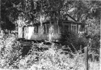
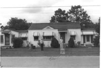
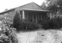
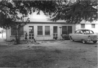
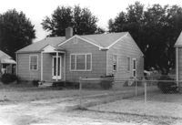
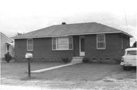
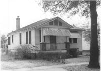
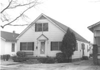
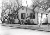
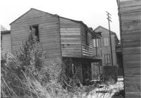
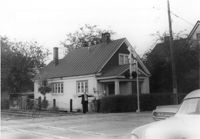
House on site affected by the construction of Interstate 26 (I-26). Surveyor notations on back of photo: "Dkt.: 10.471. Property owner: Mamie W. Brown. Tract: 91. Station: 5376+15 Rt. Date: Aug. 23, 1960. In R/W - Bought." [See collection description for explanation of surveyor notations.]
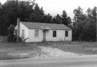
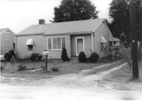
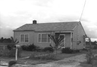
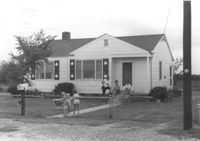
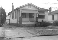
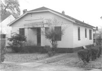
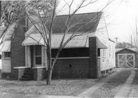
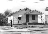
House on site affected by the construction of Interstate 26 (I-26). Sign posted in ground: Worms for sale. Surveyor notations on back of photo: "Dkt.: 10.471. Property owner: F.R. Shutt, et al. Tract: 92. Station: 5376+10 Rt. Date: Aug. 23, 1960. In R/W - Bought." [See collection description for explanation of surveyor notations.]
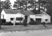
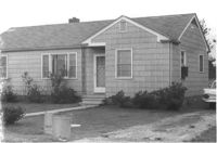
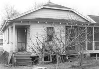
House on site affected by the construction of Interstate 26 (I-26). Surveyor notations on back of photo: "Dkt.: 10.471. Property owner: L.R. Watkins. Tract: 95. Station: 5378+90 Lt. Date: Aug. 23, 1960. In R/W - Bought." [See collection description for explanation of surveyor notations.]
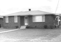
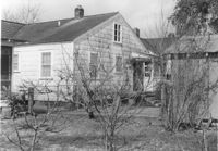
House on site affected by the construction of Interstate 26 (I-26). Surveyor notations on back of photo: "Dkt.: 10.471. Property owner: Isabella W. Meany. Tract: 98. Station: 5378+80 Rt. Date: Aug. 23, 1960. In R/W - Bought." [See collection description for explanation of surveyor notations.]
House on site affected by the construction of Interstate 26 (I-26). Surveyor notations on back of photo: "Dkt.: 10.471. Property owner: Eliz H. Riddle. Tract: 99. Station: 5378+20 Rt. Date: Aug. 23, 1960. In R/W - Bought." [See collection description for explanation of surveyor notations.]
House on site affected by the construction of Interstate 26 (I-26). Surveyor notations on back of photo: "Dkt.: 10.471. Property owner: C.D. Jones. Tract: 101. Station: 5377± Rt. Date: Aug. 23, 1960. Proximity." [See collection description for explanation of surveyor notations.]
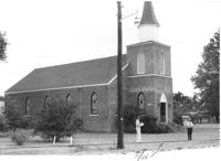
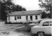
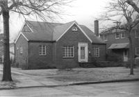
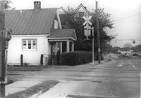
Mid Park Methodist Church, on site affected by the construction of Interstate 26 (I-26). Surveyor notations on back of photo: "Dkt.: 10.471. Property owner: Mid Park Meth. Church. Tract: 102. Station: 5376+50 Rt. Date: Aug. 23, 1960. Proximity." [See collection description for explanation of surveyor notations.]
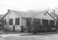
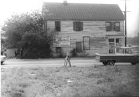
House, and Fuller's Grocery, on site affected by the construction of Interstate 26 (I-26). Surveyor notations on back of photo: "Dkt.: 10.471. Property owner: H.L. Fuller. Tract: 103. Station: 28+00 Lt. (Midland Park Road). Date: Aug. 23, 1960. Proximity." [See collection description for explanation of surveyor notations.]
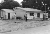
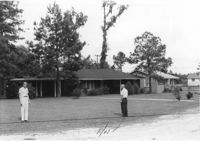
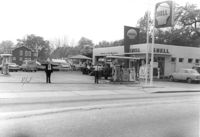
Gulf gas station, on site affected by the widening of State Road 13 (Remount Road). Surveyor notations on back of photo: "Dkt.: 10.562. Property owner: E.R. Gassman. Tract: 1. Date: Jul. 12, 1967." [See collection description for explanation of surveyor notations.]
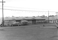
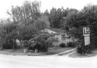
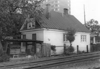
Renken Boat Co, on site affected by the widening of Route 171 (Folly Road). Surveyor notations on back of photo: "Dkt.: 10.494. Property owner: Renken Finance Co. Tract: 19. Station: 157+00 Lt. Date: Mar. 21, 1962. Proximity. [See collection description for explanation of surveyor notations.]
Houses (review view) on site affected by the construction of the Crosstown. Address: 80 Cooper Street. Surveyor notations on back of photo: "Dkt.: 10.518. Property owner: Helen Phillips Brown. Tract: 9. Station: 38+95 Rt. N.B. lane Route 17. Date: Mar. 6, 1963. In R/W - Bought. [See collection description for explanation of surveyor notations.]
House on site affected by the construction of Interstate 26 (I-26). Surveyor notations on back of photo: "Dkt.: 10.471. Property owner: Noble M. Drennen. Tract: 104. Station: 5379+30 Lt. Date: Aug. 23, 1960. Proximity." [See collection description for explanation of surveyor notations.]
House on site affected by the construction of Interstate 26 (I-26). Building address number 22 (painted on mailbox). Surveyor notations on back of photo: "Dkt.: 10.471. Property owner: Eleanor L. O'Brien. Tract: 105. Station: 5379+50 Lt. Date: Aug. 23, 1960. Proximity." [See collection description for explanation of surveyor notations.]
House on site affected by the construction of Interstate 26 (I-26). Surveyor notations on back of photo: "Dkt.: 10.471. Property owner: Donald C. Drennen. Tract: 106. Station: 5380+00 Lt. Date: Aug. 23, 1960. Proximity." [See collection description for explanation of surveyor notations.]
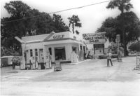
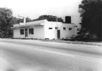
Gulf gas station on site affected by the construction of Interstate 26 (I-26). Surveyor notations on back of photo: "Dkt.: 10.471. Property owner: W.W. Holcombe. Tract: 109. Station: 5380+00 Lt. Date: Aug. 23, 1960. Proximity." [See collection description for explanation of surveyor notations.]
House on site affected by the construction of Interstate 26 (I-26). Surveyor notations on back of photo: "Dkt.: 10.471. Property owner: Annie C. Craven. Tract: 116. Station: 5396+10 Rt. Date: Aug. 23, 1960. In R/W - Bought." [See collection description for explanation of surveyor notations.]
House on site affected by the construction of Interstate 26 (I-26). Surveyor notations on back of photo: "Dkt.: 10.471. Property owner: Annie C. Craven. Tract: 116. Station: 5396+10 Rt. Date: Aug. 23, 1960. In R/W - Bought." [See collection description for explanation of surveyor notations.]
House on site affected by the construction of Interstate 26 (I-26). Surveyor notations on back of photo: "Dkt.: 10.471. Property owner: M.A. Carson. Tract: 119. Station: 18+50 Rt. (Eagle Dr.) Date: Aug. 23, 1960. Proximity." [See collection description for explanation of surveyor notations.]
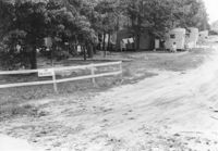
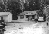
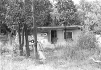
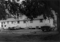
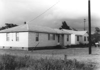
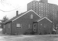
Mobile homes and lot, on site affected by the construction of Interstate 26 (I-26). Surveyor notations on back of photo: "Dkt.: 10.471. Property owner: Mary R. Walker. Tract: 131. Station: 5475+00 Lt. Date: Aug. 23, 1960. Proximity." [See collection description for explanation of surveyor notations.]
House on site affected by the construction of Interstate 26 (I-26). Surveyor notations on back of photo: "Dkt.: 10.471. Property owner: Pauline P. Badger. Tract: 132. Station: 5476+00 Lt. Date: Aug. 23, 1960. In R/W - Bought." [See collection description for explanation of surveyor notations.]
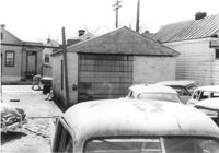
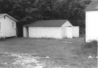
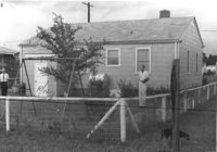
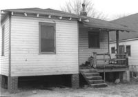
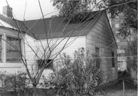
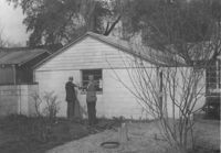
Outbuildings behind house on site affected by the construction of Interstate 26 (I-26). Surveyor notations on back of photo: "Dkt.: 10.471. Property owner: Pauline P. Badger. Tract: 132. Station: 5476+00 Lt. Date: Aug. 23, 1960. In R/W - Bought." [See collection description for explanation of surveyor notations.]
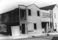
Building, on site affected by the construction of the Crosstown. Address: 80 Cooper Street. Front facade has stepped parapet. Surveyor notations on back of photo: "Dkt.: 10.518. Property owner: Helen Phillips Brown. Tract: 9. Station: 38+95 Rt. N.B. lane Route 17. Date: Mar. 6, 1963. In R/W - Bought. [See collection description for explanation of surveyor notations.]
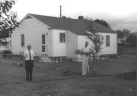
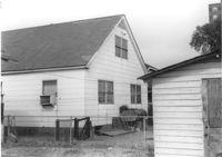
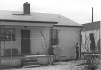
Outbuilding (small house) behind house on site affected by the construction of Interstate 26 (I-26). Surveyor notations on back of photo: "Dkt.: 10.471. Property owner: Pauline P. Badger. Tract: 132. Station: 5476+50 Lt. Date: Aug. 23, 1960. In R/W - Bought." [See collection description for explanation of surveyor notations.]
House on site affected by the construction of Interstate 26 (I-26). Surveyor notations on back of photo: "Dkt.: 10.471. Property owner: W.A. Buero. Tract: 133. Station: 5476+80 Lt. Date: Aug. 23, 1960. In R/W - Bought." [See collection description for explanation of surveyor notations.]
House on site affected by the construction of Interstate 26 (I-26). Surveyor notations on back of photo: "Dkt.: 10.471. Property owner: Sivley J. McKay. Tract: 134. Station: 5477+10 Lt. Date: Aug. 23, 1960. In R/W - Bought." [See collection description for explanation of surveyor notations.]
House on site affected by the construction of Interstate 26 (I-26). Sign for Owen's Dry Cleaners at left of photograph. Surveyor notations on back of photo: "Dkt.: 10.471. Property owner: Harry M. Charpia, Jr. Tract: 135. Station: 5377+50 Lt. Date: Aug. 23, 1960. In R/W - Bought." [See collection description for explanation of surveyor notations.]
House on site affected by the construction of Interstate 26 (I-26). Surveyor notations on back of photo: "Dkt.: 10.471. Property owner: Harry M. Charpia, Jr. Tract: 135. Station: 5377+50 Lt. Date: Aug. 23, 1960. In R/W - Bought." [See collection description for explanation of surveyor notations.]
Owen's Dry Cleaners, on site affected by the construction of Interstate 26 (I-26). Building address number 2160. Surveyor notations on back of photo: "Dkt.: 10.471. Property owner: Willa W.S. Owens. Tract: 136. Station: 5477+80 Lt. Date: Aug. 23, 1960. In R/W - Bought." [See collection description for explanation of surveyor notations.]
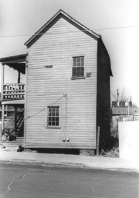
Small dilapidated building on site affected by the construction of Interstate 26 (I-26). Behind building in previous photograph (I-26 Photo 115). Surveyor notations on back of photo: "Dkt.: 10.471. Property owner: Willa W.S. Owens. Tract: 136. Station: 5477+80 Lt. Date: Aug. 23, 1960. In R/W - Bought." [See collection description for explanation of surveyor notations.]
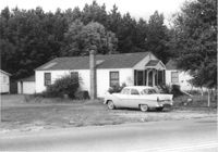
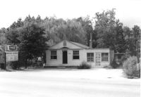
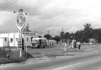
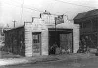
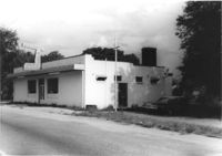
Sinclair gasoline station on site affected by the construction of Interstate 26 (I-26). Surveyor notations on back of photo: "Dkt.: 10.471. Property owner: Sinclair Refining Co. Tract: 138. Station: 1+50 Rt. (Remount Road). Date: Aug. 23, 1960. Proximity." [See collection description for explanation of surveyor notations.]
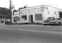
White Oak Acres, Inc. (butcher shop) on site affected by the construction of Interstate 26 (I-26). Neighboring Texaco gas station in background. Surveyor notations on back of photo: "Dkt.: 10.471. Property owner: R.H. Bowers. Tract: 139. Station: 1+30 Lt. (Remount Road). Date: Aug. 23, 1960. Proximity." [See collection description for explanation of surveyor notations.]
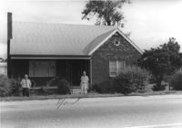
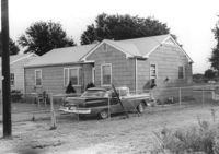
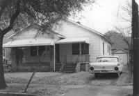
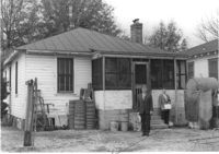
House on site affected by the construction of Interstate 26 (I-26). Surveyor notations on back of photo: "Dkt.: 10.471. Property owner: Mildred G. Bowers. Tract: 141. Station: 3+00 Lt. (Remount Road). Date: Aug. 23, 1960. Proximity." [See collection description for explanation of surveyor notations.]
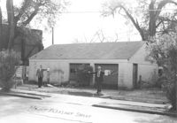
Building -- Simmons Garage -- on site affected by the construction of the Crosstown. Address: 76 Cooper Street or 78 Cooper Street. Front facade has stepped parapet. Surveyor notations on back of photo: "Dkt.: 10.518. Property owner: Helen Phillips Brown. Tract: 10. Station: 39+30 Rt. North Bound Survey of Route 17. Date: Mar. 6, 1963. In R/W - Bought. [See collection description for explanation of surveyor notations.]
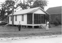
House on site affected by the construction of Interstate 26 (I-26). Surveyor notations on back of photo: "Dkt.: 10.471. Property owner: Palmetto Flower Corp. Tract: 143. Station: 5479+35 Lt. Date: Aug. 23, 1960. Building No. 1. In R/W - Bought." [See collection description for explanation of surveyor notations.]
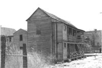
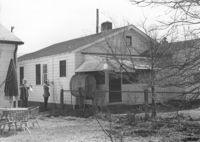
Dwelling on site affected by the construction of Interstate 26 (I-26). Appears to be a triplex or apartment house. Surveyor notations on back of photo: "Dkt.: 10.471. Property owner: Palmetto Flower Corp. Tract: 143. Station: 5480+00 Lt. Date: Aug. 23, 1960. Building No. 2. In R/W - Bought." [See collection description for explanation of surveyor notations.]
Dwelling on site affected by the construction of Interstate 26 (I-26). Surveyor notations on back of photo: "Dkt.: 10.471. Property owner: Palmetto Flower Corp. Tract: 143. Station: 5480+20 Lt. Date: Aug. 23, 1960. Building No. 3. In R/W - Bought." [See collection description for explanation of surveyor notations.]
Dwelling on site affected by the construction of Interstate 26 (I-26). Appears to be a duplex. Surveyor notations on back of photo: "Dkt.: 10.471. Property owner: Palmetto Flower Corp. Tract: 143. Station: 5480+30 Lt. Date: Aug. 23, 1960. Building No. 4. In R/W - Bought." [See collection description for explanation of surveyor notations.]
Dwelling on site affected by the construction of Interstate 26 (I-26). Appears to be apartments. Surveyor notations on back of photo: "Dkt.: 10.471. Property owner: Palmetto Flower Corp. Tract: 143. Station: 5480+20 Lt. Date: Aug. 23, 1960. Building No. 5. In R/W - Bought." [See collection description for explanation of surveyor notations.]
Dwelling on site affected by the construction of Interstate 26 (I-26). Appears to be a duplex. Surveyor notations on back of photo: "Dkt.: 10.471. Property owner: Palmetto Flower Corp. Tract: 143. Station: 5479+50 Lt. Date: Aug. 23, 1960. Building No. 6. In R/W - Bought." [See collection description for explanation of surveyor notations.]
Dwelling on site affected by the construction of Interstate 26 (I-26). Building address number Apt. 10. Surveyor notations on back of photo: "Dkt.: 10.471. Property owner: Palmetto Flower Corp. Tract: 143. Station: 5479+50 Lt. Date: Aug. 23, 1960. Building No. 7. In R/W - Bought." [See collection description for explanation of surveyor notations.]
Dwellings on site affected by the construction of Interstate 26 (I-26). See previous seven photographs. Lane's Dry Cleaners and Laundry at left of photo. Surveyor notations on back of photo: "Dkt.: 10.471. Property owner: Palmetto Flower Corp. Tract: 143. Station: 5480+00 Lt. Date: Aug. 23, 1960. Panoramic view. In R/W - Bought." [See collection description for explanation of surveyor notations.]
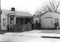
Portaro's Pizza Spaghetti Restaurant on site affected by the construction of Interstate 26 (I-26). Surveyor notations on back of photo: "Dkt.: 10.471. Property owner: Marko Moskas, et al. Tract: 144. Station: 5478+15 Lt. Date: Aug. 23, 1960. In R/W - Bought." [See collection description for explanation of surveyor notations.]
Portaro's Pizza Spaghetti Restaurant on site affected by the construction of Interstate 26 (I-26). Surveyor notations on back of photo: "Dkt.: 10.471. Property owner: Marko Moskas, et al. Tract: 144. Station: 5478+15 Lt. Date: Aug. 23, 1960. In R/W - Bought." [See collection description for explanation of surveyor notations.]
Rear view of building -- Simmons Garage -- on site affected by the construction of the Crosstown. Address: 76 Cooper Street or 78 Cooper Street. Surveyor notations on back of photo: "Dkt.: 10.518. Property owner: Helen Phillips Brown. Tract: 10. Station: 39+30 Rt. North Bound Route 17 Lane. Date: Mar. 6, 1963. In R/W - Bought. [See collection description for explanation of surveyor notations.]
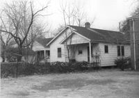
House on site affected by the construction of Interstate 26 (I-26). Surveyor notations on back of photo: "Dkt.: 10.471. Property owner: T.M. Evans. Tract: 145. Station: 5481+10 Lt. Date: Aug. 23, 1960. In R/W - Bought." [See collection description for explanation of surveyor notations.]
House on site affected by the construction of Interstate 26 (I-26). Surveyor notations on back of photo: "Dkt.: 10.471. Property owner: W.R. Wren. Tract: 148. Station: 5482+00 Lt. Date: Aug. 23, 1960. In R/W - Bought." [See collection description for explanation of surveyor notations.]
House on site affected by the construction of Interstate 26 (I-26). Surveyor notations on back of photo: "Dkt.: 10.471. Property owner: L. Pellatiro. Tract: 149. Station: 5282+60 Lt. Date: Aug. 23, 1960. In R/W - Bought." [See collection description for explanation of surveyor notations.]
House on site affected by the construction of Interstate 26 (I-26). Building address number 13. Surveyor notations on back of photo: "Dkt.: 10.471. Property owner: N.B. Charles. Tract: 150. Station: 5483+20 Lt. Date: Aug. 23, 1960. In R/W - Bought." [See collection description for explanation of surveyor notations.]
House on site affected by the construction of Interstate 26 (I-26). Surveyor notations on back of photo: "Dkt.: 10.471. Property owner: Laura M. McGorty. Tract: 151. Station: 5483+80 Lt. Date: Aug. 23, 1960. In R/W - Bought." [See collection description for explanation of surveyor notations.]
House on site affected by the construction of Interstate 26 (I-26). Surveyor notations on back of photo: "Dkt.: 10.471. Property owner: T.M. Evans. Tract: 152. Station: 5484+40 Lt. Date: Aug. 23, 1960. In R/W - Bought." [See collection description for explanation of surveyor notations.]
House on site affected by the construction of Interstate 26 (I-26). Surveyor notations on back of photo: "Dkt.: 10.471. Property owner: T.M. Evans. Tract: 153. Station: 5485+00 Lt. Date: Aug. 23, 1960. In R/W - Bought." [See collection description for explanation of surveyor notations.]
House on site affected by the construction of Interstate 26 (I-26). Surveyor notations on back of photo: "Dkt.: 10.471. Property owner: Andrew J. Hovanec. Tract: 154. Station: 5485+50 Lt. Date: Aug. 23, 1960. Proximity." [See collection description for explanation of surveyor notations.]
House (rear view) on site affected by the construction of Interstate 26 (I-26). Surveyor notations on back of photo: "Dkt.: 10.471. Property owner: Andrew J. Hovanec. Tract: 154. Station: 5485+50 Lt. Date: Aug. 23, 1960. Proximity." [See collection description for explanation of surveyor notations.]
House (rear view) on site affected by the construction of Interstate 26 (I-26). Surveyor notations on back of photo: "Dkt.: 10.471. Property owner: Jacquelyne E. Kaylor. Tract: 156. Station: 5486+75 Lt. Date: Aug. 23, 1960. Proximity." [See collection description for explanation of surveyor notations.]
House (review view) on site affected by the construction of the Crosstown. Address: 76 Cooper Street. Surveyor notations on back of photo: "Dkt.: 10.518. Property owner: Lewis Rosen. Tract: 11. Station: 5965+10 CL Line 3, S.B. lane Route 17. Date: Mar. 6, 1963. In R/W - Bought. [See collection description for explanation of surveyor notations.]
House on site affected by the construction of Interstate 26 (I-26). Surveyor notations on back of photo: "Dkt.: 10.471. Property owner: Jacquelyne E. Kaylor. Tract: 156. Station: 5486+75 Lt. Date: Aug. 23, 1960. Proximity." [See collection description for explanation of surveyor notations.]
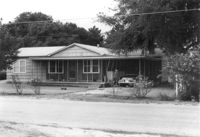
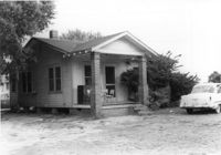
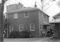
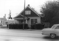
House on site affected by the construction of Interstate 26 (I-26). Address: 40 Enston Avenue [40 North Enston Avenue]. Surveyor notations on back of photo: "Dkt.: 10.503. Property owner: George Stamos, et al. Tract: 2. Station: 5891+35 Rt. Date: Feb. 19, 1963. In R/W - Bought." [See collection description for explanation of surveyor notations.]
House (rear view) on site affected by the construction of Interstate 26 (I-26). Address: 40 Enston Avenue [40 North Enston Avenue[. Surveyor notations on back of photo: "Dkt.: 10.503. Property owner: George Stamos, et al. Tract: 2. Station: 5891+35 Rt. Date: Feb. 19, 1963. In R/W - Bought." [See collection description for explanation of surveyor notations.]
Dwelling (rear view) on site affected by the construction of Interstate 26 (I-26). Address: 39-43 Mount Pleasant Street. Surveyor notations on back of photo: "Dkt.: 10.503. Property owner: Joyce L. Darby, et al. Tract: 3. Station: 5891+00 Rt. Date: Feb. 19, 1963. Portion in R/W to be removed." [See collection description for explanation of surveyor notations.]
Dwelling on site affected by the construction of Interstate 26 (I-26). Address: 39-43 Mount Pleasant Street. Appears to be a duplex. Surveyor notations on back of photo: "Dkt.: 10.503. Property owner: Joyce L. Darby, et al. Tract: 3. Station: 5891+00 Rt. Date: Feb. 19, 1963. Portion in R/W to be removed." [See collection description for explanation of surveyor notations.]
Dwelling (rear view) on site affected by the construction of Interstate 26 (I-26). Address: 39-43 Mount Pleasant Street. Surveyor notations on back of photo: "Dkt.: 10.503. Property owner: Mary Ellen Long Way. Tract: 4. Station: 5891+80 Lt. Date: Feb. 19, 1963. In R/W - Bought." [See collection description for explanation of surveyor notations.]
Dwelling on site affected by the construction of Interstate 26 (I-26). Address: 39-43 Mount Pleasant Street. Appears to be a duplex. Surveyor notations on back of photo: "Dkt.: 10.503. Property owner: Mary Ellen Long Way. Tract: 4. Station: 5891+80 Lt. Date: Feb. 19, 1963. In R/W - Bought." [See collection description for explanation of surveyor notations.]
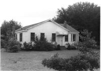
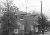
House on site affected by the construction of Interstate 26 (I-26). Address: 169 Laurel Avenue. Surveyor notations on back of photo: "Dkt.: 10.503. Property owner: Ernestine L. Captain. Tract: 5. Station: 5892+10 Rt. Date: Feb. 19, 1963. In R/W - Bought." [See collection description for explanation of surveyor notations.]
House (corner view, rear) on site affected by the construction of Interstate 26 (I-26).Address: 169 Laurel Avenue. Joseph Floyd Manor (Mount Pleasant Street and King Street) in background. Surveyor notations on back of photo: "Dkt.: 10.503. Property owner: Ernestine L. Captain. Tract: 5. Station: 5892+10 Rt. Date: Feb. 19, 1963. In R/W - Bought." [See collection description for explanation of surveyor notations.]
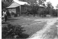
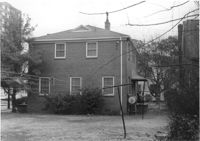
Backyard area and neighboring houses on site affected by the construction of Interstate 26 (I-26). Address: Laurel Avenue (?). Surveyor notations on back of photo: "Dkt.: 10.503. Property owner: Francis D. Guzzell. Tract: 7. Station: 5894+55 Rt. Date: Feb. 19, 1963. Proximity." [See collection description for explanation of surveyor notations.]
House on site affected by the construction of the Crosstown. Address: 76 Cooper Street. Surveyor notations on back of photo: "Dkt.: 10.518. Property owner: Lewis Rosen. Tract: 11. Station: 5965+10 CL Line 3, S.B. lane Route 17. Date: Mar. 6, 1963. In R/W - Bought. [See collection description for explanation of surveyor notations.]
House (rear view) on site affected by the construction of Interstate 26 (I-26). Waverly Novels, Tales of a Grandfather; being stories taken from Scottish history, 2nd series in 2 volumes, vol. I. 160 Laurel Avenue. Surveyor notations on back of photo: "Dkt.: 10.503. Property owner: Joseph A. Pippin. Tract: 8. Station: 5894+40 Rt. Date: Feb. 19, 1963. In R/W - Bought." [See collection description for explanation of surveyor notations.]
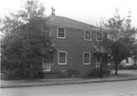
House on site affected by the construction of Interstate 26 (I-26). Address: 160 Laurel Avenue. Surveyor notations on back of photo: "Dkt.: 10.503. Property owner: Joseph A. Pippin. Tract: 8. Station: 5894+40 Rt. Date: Feb. 19, 1963. In R/W - Bought." [See collection description for explanation of surveyor notations.]
House on site affected by the construction of Interstate 26 (I-26). Address: 162 Laurel Avenue. Number 22 on porch column. Surveyor notations on back of photo: "Dkt.: 10.503. Property owner: David E. O'Brien. Tract: 9. Station: 5894+15 Rt. Date: Feb. 19, 1963. In R/W - Bought." [See collection description for explanation of surveyor notations.]
House (rear view) on site affected by the construction of Interstate 26 (I-26). Address: 162 Laurel Avenue. Surveyor notations on back of photo: "Dkt.: 10.503. Property owner: David E. O'Brien. Tract: 9. Station: 5894+15 Rt. Date: Feb. 19, 1963. In R/W - Bought." [See collection description for explanation of surveyor notations.]
House (rear view) on site affected by the construction of Interstate 26 (I-26). Address: 164 Laurel Avenue. Surveyor notations on back of photo: "Dkt.: 10.503. Property owner: J.W. Johnson, Jr. Tract: 10. Station: 5894+00 Rt. Date: Feb. 19, 1963. In R/W - Bought." [See collection description for explanation of surveyor notations.]
House on site affected by the construction of Interstate 26 (I-26). Address: 164 Laurel Avenue. Surveyor notations on back of photo: "Dkt.: 10.503. Property owner: J.W. Johnson, Jr. Tract: 10. Station: 5894+00 Rt. Date: Feb. 19, 1963. In R/W - Bought." [See collection description for explanation of surveyor notations.]
House on site affected by the construction of Interstate 26 (I-26). Address: 166-168 Laurel Avenue. Surveyor notations on back of photo: "Dkt.: 10.503. Property owner: J.W. Johnson, Jr. Tract: 10. Station: 5894+00 Rt. Date: Feb. 19, 1963. In R/W - Bought." [See collection description for explanation of surveyor notations.]
House (rear view) on site affected by the construction of Interstate 26 (I-26). Address: 166-168 Laurel Avenue. Surveyor notations on back of photo: "Dkt.: 10.503. Property owner: J.W. Johnson, Jr. Tract: 10. Station: 5894+00 Rt. Date: Feb. 19, 1963. In R/W - Bought." [See collection description for explanation of surveyor notations.]
House (rear view) on site affected by the construction of Interstate 26 (I-26). Address: 170 Laurel Avenue. Surveyor notations on back of photo: "Dkt.: 10.503. Property owner: Eula Mae Ryan. Tract: 12. Station: 5893+40 Lt. Date: Feb. 19, 1963. In R/W - Bought." [See collection description for explanation of surveyor notations.]
House on site affected by the construction of Interstate 26 (I-26). Address: 170 Laurel Avenue. Number 28 on porch column. Surveyor notations on back of photo: "Dkt.: 10.503. Property owner: Eula Mae Ryan. Tract: 12. Station: 5893+40 Lt. Date: Feb. 19, 1963. In R/W - Bought." [See collection description for explanation of surveyor notations.]
Houses on site affected by the construction of the Crosstown. Address: 74½ Cooper Street [74 Cooper Street]. Surveyor notations on back of photo: "Dkt.: 10.518. Property owner: Beatrice Hayward. Tract: 12. Station: 5965+30 Rt. Line 3, S.B. lane of Route 17. Date: Mar. 6, 1963. In R/W - Bought. [See collection description for explanation of surveyor notations.]
House on site affected by the construction of Interstate 26 (I-26).Address: 172 Laurel Avenue. Surveyor notations on back of photo: "Dkt.: 10.503. Property owner: Marguerite E. Jacques. Tract: 13. Station: 5893+20 Lt. Date: Feb. 19, 1963. In R/W - Bought." [See collection description for explanation of surveyor notations.]
House (rear view) on site affected by the construction of Interstate 26 (I-26). Address: 172 Laurel Avenue. Surveyor notations on back of photo: "Dkt.: 10.503. Property owner: Marguerite E. Jacques. Tract: 13. Station: 5893+20 Lt. Date: Feb. 19, 1963. In R/W - Bought." [See collection description for explanation of surveyor notations.]
House (side view) on site affected by the construction of Interstate 26 (I-26). Address: 29 Mount Pleasant Street. Joseph Floyd Manor (Mount Pleasant Street and King Street) faintly in background. On corner of on Mount Pleasant Street and King Street. Surveyor notations on back of photo: "Dkt.: 10.503. Property owner: Charles B. Cromer, et al. Tract: 14. Station: 5892+90 Lt. Date: Feb. 19, 1963. In R/W - Bought." [See collection description for explanation of surveyor notations.]
House on site affected by the construction of Interstate 26 (I-26). Address: 29 Mount Pleasant Street. Surveyor notations on back of photo: "Dkt.: 10.503. Property owner: Charles B. Cromer, et al. Tract: 14. Station: 5892+90 Lt. Date: Feb. 19, 1963. In R/W - Bought." [See collection description for explanation of surveyor notations.]
Garage building on site affected by the construction of Interstate 26 (I-26). Address: 29 Mount Pleasant Street. Surveyor notations on back of photo: "Dkt.: 10.503. Property owner: Charles B. Cromer, et al. Tract: 14. Station: 5893+35 Lt. Date: Feb. 19, 1963. Bought." [See collection description for explanation of surveyor notations.]
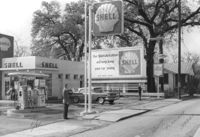
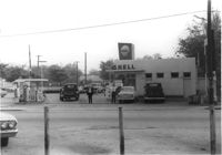
Shell gas station on site affected by the construction of Interstate 26 (I-26). Address: 1227 King Street. Surveyor notations on back of photo: "Dkt.: 10.503. Property owner: Shell Oil Co. Tract: 14-A. Station: 5893+80 Lt. Date: Feb. 19, 1963." [See collection description for explanation of surveyor notations.]
Shell gas station on site affected by the construction of Interstate 26 (I-26). Address: 1227 King Street. Surveyor notations on back of photo: "Dkt.: 10.503. Property owner: Shell Oil Co. Tract: 14-A. Station: 9+50 Rt. (Mt. Pleasant St.). Date: Apr. 20, 1965." [See collection description for explanation of surveyor notations.]
Shell gas station on site affected by the construction of Interstate 26 (I-26). Address: 1227 King Street. Surveyor notations on back of photo: "Dkt.: 10.503. Property owner: Shell Oil Co. Tract: 14-A. Station: 9+50 Rt. (Mt. Pleasant St.). Date: Apr. 20, 1965." [See collection description for explanation of surveyor notations.]
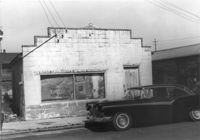
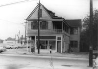
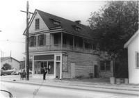
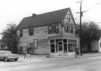
House on site affected by the construction of Interstate 26 (I-26). Address: 1226 King Street. View of street corner; corner of King Street and Mount Pleasant Street. First story is Sanex Cleaners. Surveyor notations on back of photo: "Dkt.: 10.503. Property owner: Mary E. Lea Ward. Tract: 14-B. Station: 11+50 Rt. (Mt. Pleasant St.). Date: Apr. 20, 1965. Partially in R/W." [See collection description for explanation of surveyor notations.]
House (corner view) on site affected by the construction of Interstate 26 (I-26). Address: 1226 King Street. View of street corner; corner of King Street and Mount Pleasant Street. First story is Sanex Cleaners. Sign for Coastal Carolina Fair posted on side of building. Surveyor notations on back of photo: "Dkt.: 10.503. Property owner: Mary E. Lea Ward. Tract: 14-B. Station: 11+50 Rt. (Mt. Pleasant St.). Date: Apr. 20, 1965." [See collection description for explanation of surveyor notations.]
Houses (rear view) on site affected by the construction of the Crosstown. Address: 74½ Cooper Street [74 Cooper Street]. Surveyor notations on back of photo: "Dkt.: 10.518. Property owner: Beatrice Hayward. Tract: 12. Station: 5965+30 Rt. Line 3, S.B. lane of Route 17. Date: Mar. 6, 1963. In R/W - Bought. [See collection description for explanation of surveyor notations.]
House (corner view) on site affected by the construction of Interstate 26 (I-26). Address: 1226 King Street. View of street corner; corner of King Street and Mount Pleasant Street. First story is Sanex Cleaners. Directional sign for St. John Hotel and sign for Coastal Carolina Fair posted on side of building. Surveyor notations on back of photo: "Dkt.: 10.503. Property owner: Mary E. Lea Ward. Tract: 14-B. Station: 11+50 Rt. (Mt. Pleasant St.). Date: Apr. 20, 1965." [See collection description for explanation of surveyor notations.]
House (side view) on site affected by the construction of Interstate 26 (I-26). Address: 1226 King Street. View of street corner; corner of King Street and Mount Pleasant Street. First story is Sanex Cleaners. Directional sign for St. John Hotel and sign for Coastal Carolina Fair posted on side of building. Surveyor notations on back of photo: "Dkt.: 10.503. Property owner: Mary E. Lea Ward. Tract: 14-B. Station: 11+50 Rt. (Mt. Pleasant St.). Date: Apr. 20, 1965." [See collection description for explanation of surveyor notations.]
House on site by the construction of Interstate 26 (I-26). Address; 35 Mount Pleasant Street. Number 7 on porch column. At corner of railroad tracks and Mount Pleasant Street. Surveyor notations on back of photo: "Dkt.: 10.503. Property owner: Henry Fritz. Tract: 14-C. Station: 12+10 Rt. (Mt. Pleasant St.). Date: Apr. 20, 1965." [See collection description for explanation of surveyor notations.]
House on site by the construction of Interstate 26 (I-26). Address: 35 Mount Pleasant Street. Corner view from railroad tracks at Mount Pleasant Street. Surveyor notations on back of photo: "Dkt.: 10.503. Property owner: Henry Fritz. Tract: 14-C. Station: 12+10 Rt. (Mt. Pleasant St.). Date: Apr. 20, 1965." [See collection description for explanation of surveyor notations.]
House on site by the construction of Interstate 26 (I-26). Address: 35 Mount Pleasant Street. Corner (rear) view from railroad tracks in foreground. Joseph Floyd Manor (Mount Pleasant Street and King Street) in background. Surveyor notations on back of photo: "Dkt.: 10.503. Property owner: Henry Fritz. Tract: 14-C. Station: 12+10 Rt. (Mt. Pleasant St.). Date: Apr. 20, 1965." [See collection description for explanation of surveyor notations.]
House (side view) on site by the construction of Interstate 26 (I-26). Address: 35 Mount Pleasant Street. View of house from railroad tracks at Mount Pleasant Street. View of street corner, looking down King Street. Surveyor notations on back of photo: "Dkt.: 10.503. Property owner: Henry Fritz. Tract: 14-C. Station: 12+10 Rt. (Mt. Pleasant St.). Date: Apr. 20, 1965." [See collection description for explanation of surveyor notations.]
House on site by the construction of Interstate 26 (I-26). Address: 1215 King Street. Surveyor notations on back of photo: "Dkt.: 10.503. Property owner: Mary M.J. Clifton. Tract: 15. Station: 5894+60 Lt. Date: Feb. 19, 1963. In R/W - Bought." [See collection description for explanation of surveyor notations.]
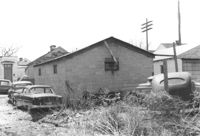
Garage on site by the construction of Interstate 26 (I-26). Address: 1215 King Street. Surveyor notations on back of photo: "Dkt.: 10.503. Property owner: Mary M.J. Clifton. Tract: 15. Station: 5894+05 Lt. Date: Feb. 19, 1963. In R/W - Bought." [See collection description for explanation of surveyor notations.]
House (rear view) on site by the construction of Interstate 26 (I-26). Address: 1215 King Street. Surveyor notations on back of photo: "Dkt.: 10.503. Property owner: Mary M.J. Clifton. Tract: 15. Station: 5894+60 Lt. Date: Feb. 19, 1963. In R/W - Bought." [See collection description for explanation of surveyor notations.]
House (rear view) on site by the construction of Interstate 26 (I-26). Address: 1213 King Street. Surveyor notations on back of photo: "Dkt.: 10.503. Property owner: Robert C. Benke, et al. Tract: 16. Station: 5894+90 Lt. Date: Feb. 19, 1963. In R/W - Bought." [See collection description for explanation of surveyor notations.]
Houses on site affected by the construction of the Crosstown. Address: 73 Cooper Street. Surveyor notations on back of photo: "Dkt.: 10.518. Property owner: Centeur Corp. Tract: 13. Station: 5963+90 Rt. Line 3 of the S.B. lane of Route 17. Date: Mar. 6, 1963. Proximity. [See collection description for explanation of surveyor notations.]
House on site by the construction of Interstate 26 (I-26). Address: 1213 King Street. Surveyor notations on back of photo: "Dkt.: 10.503. Property owner: Robert C. Benke, et al. Tract: 16. Station: 5894+90 Lt. Date: Feb. 19, 1963. In R/W - Bought." [See collection description for explanation of surveyor notations.]