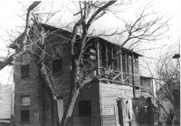
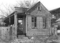
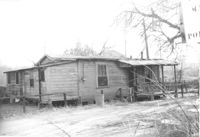
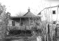
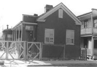
Dilapidated dwelling on site affected by the construction of Interstate 26 (I-26). Address: 22½ Poinsett Street. Surveyor notations on back of photo: "Dkt.: 10.503. Property owner: J.W. Blanchard, Est. Tract: 102. Station: 5921+80 Lt. Date: Feb. 20, 1963. In R/W - Bought." [See collection description for explanation of surveyor notations.]
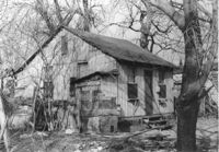
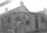
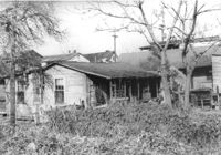
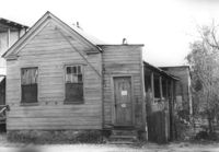
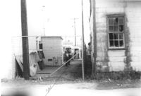
Dilapidated dwelling on site affected by the construction of Interstate 26 (I-26). Address: 22½ Poinsett Street (rear). Surveyor notations on back of photo: "Dkt.: 10.503. Property owner: J.W. Blanchard, Est. Tract: 102. Station: 5921+00 Lt. Date: Feb. 20, 1963. In R/W - Bought." [See collection description for explanation of surveyor notations.]
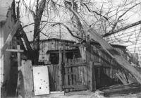
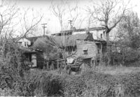
Dilapidated structure on site affected by the construction of Interstate 26 (I-26). Address: 22½ Poinsett Street (rear). Surveyor notations on back of photo: "Dkt.: 10.503. Property owner: J.W. Blanchard, Est. Tract: 102. Station: 5921+00 Lt. Date: Feb. 20, 1963. In R/W - Bought." [See collection description for explanation of surveyor notations.]
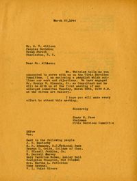
Letter from Homer M. Pace to A. W. Allison and others regarding membership in the Charleston Regional Planning Advisory Committee of the Carolina Art Association (Mar. 20, 1944). (See list of recipients at bottom of front page and continuation on back.)
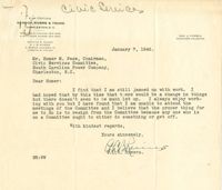
Letter from Homer M. Pace to F. C. Riddick regarding his ex-officio membership in the Civic Services Committee and a list of additional recipients of letter from Homer M. Pace regarding membership in the Civic Services Committee (Dec. 1, 1944).
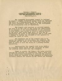
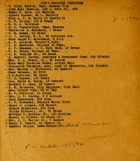
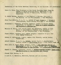
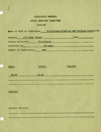
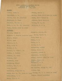
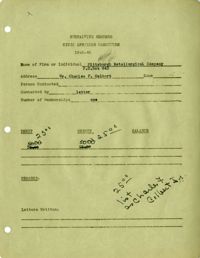
Purpose and Objects of the Community Development Council for the Metropolitan Area of Charleston, S.C. And the membership list for the Architectural Survey Committee. ("Committee appointed 1940" handwritten on document.)
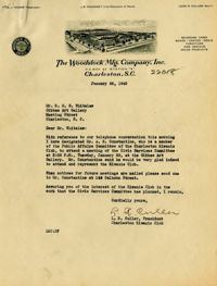
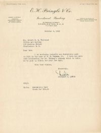
Letter from Robert N.S. Whitelaw to Julian Mitchell, Jr. regarding his (and Hasell E. Rivers's) appointment to the city planning and zoning commission to work with the CSC on the off-street parking project (Nov. 7, 1944).
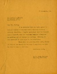
Letter from Homer M. Pace to Dr. Joseph I. Waring regarding membership in the Charleston Regional Planning Advisory Committee of the Carolina Art Association (Nov. 18, 1941).
Letter from Homer M. Pace to Frederick McDonald regarding membership in the Charleston Regional Planning Advisory Committee of the Carolina Art Association (Nov. 4, 1941).
Letter from Robert N.S. Whitelaw to James J. Altman regarding membership in the Charleston Regional Planning Advisory Committee of the Carolina Art Association (July 25, 1944).
Letter from William M. Means to Homer M. Pace regarding membership in the Charleston Regional Planning Advisory Committee of the Carolina Art Association (May 22, 1941).
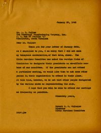
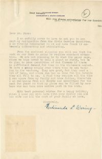
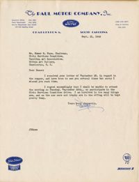
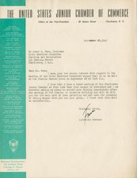
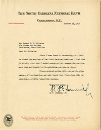
Letter from JDB [signature illegible] at Paul Motor Company to Homer M. Pace declining request to attend CSC meeting or participate with fundraising efforts (Sept. 21, 1945).
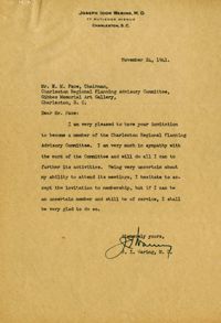
Letter from Dr. Joseph I. Waring to Homer M. Pace regarding membership in the Charleston Regional Planning Advisory Committee of the Carolina Art Association (Nov. 24, 1941).
Letter from Frederick H. McDonald to Homer M. Pace regarding membership in the Charleston Regional Planning Advisory Committee of the Carolina Art Association (Nov. 8, 1941).
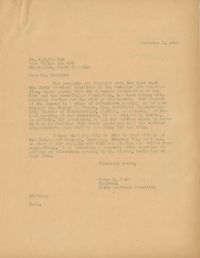
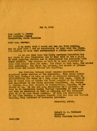
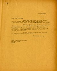
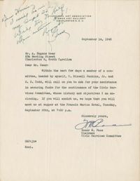
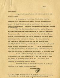
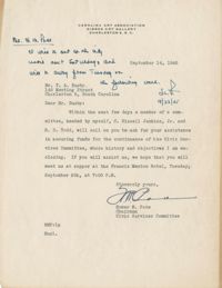
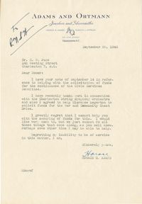
Letter from Homer M. Pace to A. Eugene Geer requesting his assistance securing of funds for the continuance of the Civic Services Committee (Sept. 14, 1945).
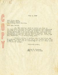
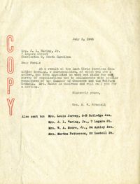
Letter from Marian T. Mitchell to Mrs. Harry Rubin regarding her chairmanship on the committee to work out plans for a survey of organizations (July 3, 1945).
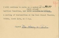
Postcard from Mrs. Harry M. Rubin to the Carolina Art Association indicating continued service on the Civic Services Committee, with an RSVP to upcoming meeting.
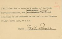
Postcard from G. C. Rogers to the Carolina Art Association indicating continued service on the Civic Services Committee, with an RSVP to upcoming meeting.
Postcard from G. C. Grice to the Carolina Art Association indicating continued service on the Civic Services Committee, with an RSVP to upcoming meeting.
Postcard from Mary Vardine McBee to the Carolina Art Association indicating continued service on the Civic Services Committee, with an RSVP to upcoming meeting.
Postcard from Creighton Frampton to the Carolina Art Association indicating continued service on the Civic Services Committee, with an RSVP to upcoming meeting.
Postcard from Frederick H. McDonald to the Carolina Art Association indicating continued service on the Civic Services Committee, with an RSVP to upcoming meeting.
Postcard from R. T. Rosemond to the Carolina Art Association indicating continued service on the Civic Services Committee, with an RSVP to upcoming meeting.
Postcard from William M. Means to the Carolina Art Association indicating continued service on the Civic Services Committee, with an RSVP to upcoming meeting.
Postcard from James J. Altman to the Carolina Art Association indicating continued service on the Civic Services Committee, with an RSVP to upcoming meeting.
Letter from Marian T. Mitchell to Mrs. Joseph I. Waring Jr. regarding her work on the committee to work out plans for a survey of organizations (includes list of other letter recipients) (July 3, 1945).
Letter from Homer M. Pace to Dr. Joseph I. Waring regarding membership in the Charleston Regional Planning Advisory Committee of the Carolina Art Association (Nov. 27, 1941).
Letter from Homer M. Pace to T. A. Busby requesting his assistance securing of funds for the continuance of the Civic Services Committee (Sept. 14, 1945).
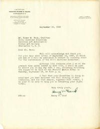
Letter from Henry T. Gaud to Homer M. Pace regarding his assistance securing of funds for the continuance of the Civic Services Committee (Sept. 19, 1945).
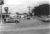
Shell gas station, on site affected by the widening of State Road 13 (Remount Road). Arrow Restaurant in background. Surveyor notations on back of photo: "Dkt.: 10.562. Property owner: Shell Oil Co., Inc. Tract: 2. Date: Jul. 12, 1967." [See collection description for explanation of surveyor notations.]
Letter from Homer M. Pace to William M. Means regarding membership in the Charleston Regional Planning Advisory Committee of the Carolina Art Association (May 19, 1941).
Postcard from E. Gaillard Dotterer to the Carolina Art Association indicating continued service on the Civic Services Committee, with an RSVP to upcoming meeting.
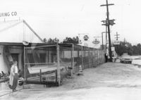
Renken Boat Co, on site affected by the widening of Route 171 (Folly Road). Surveyor notations on back of photo: "Dkt.: 10.494. Property owner: Renken Finance Co. Tract: 19. Station: 157+00 Lt. Date: Mar. 21, 1962. Proximity. [See collection description for explanation of surveyor notations.]
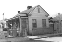
Freedman's cottage on site affected by the construction of the Crosstown. Address: 169 Nassau Street. Surveyor notations on back of photo: "Dkt.: 10.518. Property owner: R.F. Momier. Tract: 23. Station: 40+85 Rt. N.B. lane Route 17. Date: Mar. 6, 1963. In R/W - Bought. [See collection description for explanation of surveyor notations.]
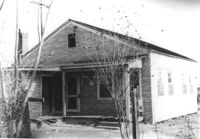
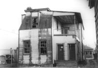
House in dilapidated condition (freedman's cottage) on site affected by the construction of Interstate 26 (I-26). Address: 22 Poinsett Street. Surveyor notations on back of photo: "Dkt.: 10.503. Property owner: Emma J. Marjen Hoff, Est. Tract: 103. Station: 5921+70 CL. Date: Feb. 20, 1963. In R/W - Bought." [See collection description for explanation of surveyor notations.]
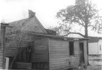
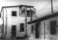
House in dilapidated condition (freedman's cottage) (rear view) on site affected by the construction of Interstate 26 (I-26). Address: 22 Poinsett Street. Surveyor notations on back of photo: "Dkt.: 10.503. Property owner: Emma J. Marjen Hoff, Est. Tract: 103. Station: 5921+70 CL. Date: Feb. 20, 1963. In R/W - Bought." [See collection description for explanation of surveyor notations.]
House in dilapidated condition (freedman's cottage) (rear view) on site affected by the construction of Interstate 26 (I-26). Address: 24 Poinsett Street. Surveyor notations on back of photo: "Dkt.: 10.503. Property owner: Frank Brown, Est. Tract: 104. Station: 5921+70 Rt. Date: Feb. 20, 1963. In R/W - Bought." [See collection description for explanation of surveyor notations.]
House in dilapidated condition (freedman's cottage) on site affected by the construction of Interstate 26 (I-26). Address: 24 Poinsett Street. Surveyor notations on back of photo: "Dkt.: 10.503. Property owner: Frank Brown, Est. Tract: 104. Station: 5921+70 Rt. Date: Feb. 20, 1963. In R/W - Bought." [See collection description for explanation of surveyor notations.]
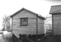
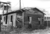
Dilapidated dwelling (corner view, rear) on site affected by the construction of Interstate 26 (I-26). Address; 19½ Poinsett Street. Surveyor notations on back of photo: "Dkt.: 10.503. Property owner: S.A.L.R.R. Tract: 105. Station: 5922+65 CL. Date: Feb. 20, 1963. In R/W - Bought." [See collection description for explanation of surveyor notations.]
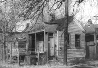
Dilapidated dwellings on site affected by the construction of Interstate 26 (I-26). Address: 19½ Poinsett Street. Surveyor notations on back of photo: "Dkt.: 10.503. Property owner: S.A.L.R.R. Tract: 105. Station: 5922+65 CL. Date: Feb. 20, 1963. In R/W - Bought." [See collection description for explanation of surveyor notations.]
Dilapidated dwellings on site affected by the construction of Interstate 26 (I-26). Address: 7 Poinsett Street. Surveyor notations on back of photo: "Dkt.: 10.503. Property owner: S.A.L.R.R. Tract: 105. Station: 5923+12 CL. Date: Feb. 20, 1963. In R/W - Bought." [See collection description for explanation of surveyor notations.]
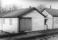
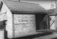
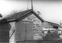
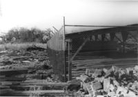
Shed (railroad building) on site affected by the construction of Interstate 26 (I-26). Address: 19½ Poinsett Street (rear). Surveyor notations on back of photo: "Dkt.: 10.503. Property owner: S.A.L.R.R. Tract: 105. Station: 5924+25 Rt. Date: Feb. 20, 1963." [See collection description for explanation of surveyor notations.]
Shed (railroad building) along railroad tracks, on site affected by the construction of Interstate 26 (I-26). Address: 19½ Poinsett Street (rear). Surveyor notations on back of photo: "Dkt.: 10.503. Property owner: S.A.L.R.R. Tract: 105. Station: 5924+35 Rt. & Lt. Date: Feb. 20, 1963." [See collection description for explanation of surveyor notations.]
Shed (railroad building) along railroad tracks, on site affected by the construction of Interstate 26 (I-26). Address: 19½ Poinsett Street (rear). Surveyor notations on back of photo: "Dkt.: 10.503. Property owner: S.A.L.R.R. Tract: 105. Station: 5924+40 Lt. Date: Feb. 20, 1963." [See collection description for explanation of surveyor notations.]
"Junk lot" behind houses on site affected by the construction of the Crosstown. Address: 171 Nassau Street. Surveyor notations on back of photo: "Dkt.: 10.518. Property owner: Samuel J. Lloyd. Tract: 24. Station: 40+70 CL N.B. lane Route 17. Date: Mar. 6, 1963. In R/W - Bought. [See collection description for explanation of surveyor notations.]
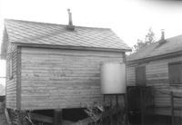
Rear view of shed (railroad building) on site affected by the construction of Interstate 26 (I-26). Address: 19½ Poinsett Street (rear). Surveyor notations on back of photo: "Dkt.: 10.503. Property owner: S.A.L.R.R. Tract: 105. Station: 5924+40 Lt. Date: Feb. 20, 1963." [See collection description for explanation of surveyor notations.]
Rear view of shed (railroad building) on site affected by the construction of Interstate 26 (I-26). Address: 19½ Poinsett Street (rear). Surveyor notations on back of photo: "Dkt.: 10.503. Property owner: S.A.L.R.R. Tract: 105. Station: 5924+40 Rt. & Lt. Date: Feb. 20, 1963." [See collection description for explanation of surveyor notations.]
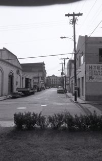
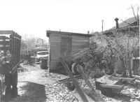
Shed (railroad building) along railroad tracks, on site affected by the construction of Interstate 26 (I-26). Address: 19½ Poinsett Street (rear). Trolley barn on 665 Meeting Street, and buses, in background. Surveyor notations on back of photo: "Dkt.: 10.503. Property owner: S.A.L.R.R. Tract: 105. Station: 5924+40 Rt. & Lt. Date: Feb. 20, 1963." [See collection description for explanation of surveyor notations.]
House (corner view, rear) on site affected by the construction of Interstate 26 (I-26). Unnumbered house, on unnamed road, behind 35 Poinsett Street. Trolley barn on 665 Meeting Street, and buses, in background. Surveyor notations on back of photo: "Dkt.: 10.503. Property owner: Manuel F. Fernandez. Tract: 106. Station: 5923+80 Lt. Date: Feb. 20, 1963. In R/W - Bought." [See collection description for explanation of surveyor notations.]
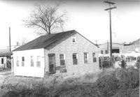
House on site affected by the construction of Interstate 26 (I-26). Unnumbered house, on unnamed road, behind 35 Poinsett Street. Surveyor notations on back of photo: "Dkt.: 10.503. Property owner: Manuel F. Fernandez. Tract: 106. Station: 5923+80 Lt. Date: Feb. 20, 1963. In R/W - Bought." [See collection description for explanation of surveyor notations.]
Dilapidated structure on site affected by the construction of Interstate 26 (I-26). Address: 35½ Poinsett Street. Bus in background. Surveyor notations on back of photo: "Dkt.: 10.503. Property owner: Manuel F. Fernandez. Tract: 106. Station: 5923+10 Lt. Date: Feb. 20, 1963. In R/W - Bought." [See collection description for explanation of surveyor notations.]
House in dilapidated condition (freedman's cottage) (rear view) on site affected by the construction of Interstate 26 (I-26). Address: 7 Poinsett Street. Surveyor notations on back of photo: "Dkt.: 10.503. Property owner: Manuel F. Fernandez. Tract: 106. Station: 5923+50 Lt. Date: Feb. 20, 1963. In R/W - Bought." [See collection description for explanation of surveyor notations.]
House in dilapidated condition (freedman's cottage) on site affected by the construction of Interstate 26 (I-26). Address: 7 Poinsett Street. Number 23 painted on door. Surveyor notations on back of photo: "Dkt.: 10.503. Property owner: Manuel F. Fernandez. Tract: 106. Station: 5923+50 Lt. Date: Feb. 20, 1963. In R/W - Bought." [See collection description for explanation of surveyor notations.]
House in dilapidated condition on site affected by the construction of Interstate 26 (I-26). Address: 35 Poinsett Street. Surveyor notations on back of photo: "Dkt.: 10.503. Property owner: Manuel F. Fernandez. Tract: 106. Station: 5922+50 Lt. Date: Feb. 20, 1963. In R/W - Bought." [See collection description for explanation of surveyor notations.]
House in dilapidated condition (rear view) and smaller dwelling, on site affected by the construction of Interstate 26 (I-26). Address: 35 Poinsett Street. Surveyor notations on back of photo: "Dkt.: 10.503. Property owner: Manuel F. Fernandez. Tract: 106. Station: 5922+50 Lt. Date: Feb. 20, 1963. In R/W - Bought." [See collection description for explanation of surveyor notations.]
Freedman's cottage on site affected by the construction of the Crosstown. Address: 173 Nassau Street. Surveyor notations on back of photo: "Dkt.: 10.518. Property owner: Isiah Bryant, et al. Tract: 25. Station: 41+00 Lt. N.B. lane Route 17. Date: Mar. 6, 1963. In R/W - Bought. [See collection description for explanation of surveyor notations.]
Lot between buildings, on site affected by the construction of Interstate 26 (I-26). Address: 35 Poinsett Street. Buses in background. Surveyor notations on back of photo: "Dkt.: 10.503. Property owner: S.C. Electric & Gas Co. [Tract number not indicated.] Station: 5922+50 Lt. Date: Feb. 20, 1963. Proximity." [See collection description for explanation of surveyor notations.]
Fenced-in lot between buildings with bricks and lumber strewn about, on site affected by the construction of Interstate 26 (I-26). Located south of 35 Poinsett Street. Surveyor notations on back of photo: "Dkt.: 10.503. Property owner: Carolina Dismantling Corp. Tract: 109-A. Station: 5928± to 5929± Lt. Date: Feb. 20, 1963." [See collection description for explanation of surveyor notations.]