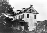
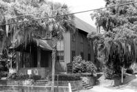
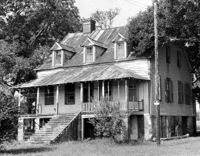
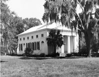
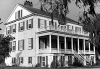
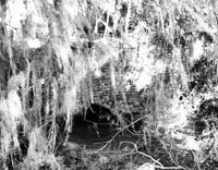
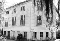
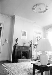
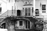
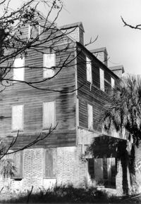
Seaside Plantation (Locksley Hall), off of Cypress Bottom Road. View of SE (Front and Side) elevation. Edisto Island, S.C.;8" x 10" B/W photo. Box 11, Folder 2-3-12. One copy.
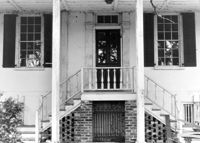
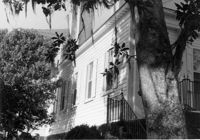
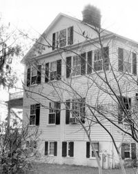
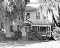
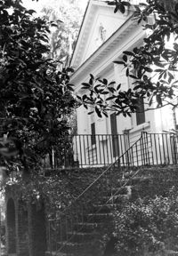
Seaside Plantation (Locksley Hall), off of Cypress Bottom Road. Detail View of South (Front) elevation. Edisto Island, S.C.;8" x 10" B/W photo. Box 11, Folder 2-3-12. One copy.
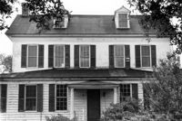
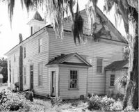
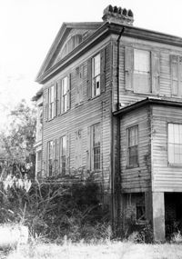
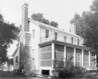
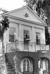
Seaside Plantation (Locksley Hall), off of Cypress Bottom Road. View of North (Rear) elevation. Edisto Island, S.C.;8" x 10" B/W photo. Box 11, Folder 2-3-12. One copy.
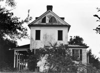
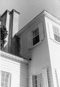
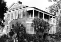
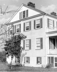
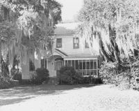
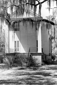
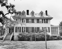
Seaside Plantation (Locksley Hall), off of Cypress Bottom Road. View of East (Side) elevation. Edisto Island, S.C.;8" x 10" B/W photo. Box 11, Folder 2-3-12. One copy.
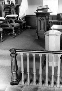
St. Andrews Episcopal Church (Mount Pleasant), 440 Whilden Street. View of SE (Front and Side) elevation. Mount Pleasant, S.C.;6.5" x 10" B/W photo. Box 13, Folder 2-8-18. One copy.
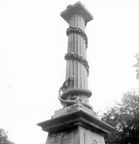
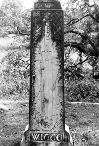
Magnolia Cemetery, Huguenin Avenue and Algonquin Road. Monument of Colonel William Washington. Detail View of column. South elevation. Charleston, S.C.;8" x 8" B/W photo. Box 5, Folder 2-1-3. Three copies.
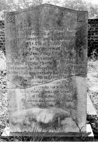
Colonel William Washington Cemetery. Tombstone of Colonel William Washington (1810) and Jane Riley Elliott - View of Rear. Ravenel, S.C.;10" x 6.5" B/W photo. Box 16, Folder 2-11-11. Two copies.
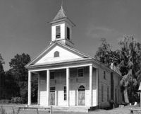
Edisto Island Presbyterian Church, S.C. Hwy. 174. View of NE (Front and Side) elevation. Edisto Island, S.C.;8" x 10" B/W photo. Box 10, Folder 2-3-7. One copy.
Edisto Island Baptist Church, S.C. Hwy. 174. View of NW (Rear and Side) elevation. Edisto Island, S.C.;8" x 10" B/W photo. Box 10, Folder 2-3-6. One copy.
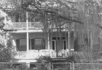
Peter's Point Plantation, off S.C. Hwy 174 on County Road 764 (Peters Point Road). View of North (Side and Front) elevation. Edisto Island, S.C.;6.5" x 10" B/W photo. Box 11, Folder 2-3-17. Two copies.
Peter's Point Plantation, off S.C. Hwy 174 on County Road 764 (Peters Point Road). View of West (Side and Rear) elevation. Edisto Island, S.C.;10" x 6.5" B/W photo. Box 11, Folder 2-3-17. One copy.
Windsor Plantation (Little Edisto Plantation, Ashwood Plantation), S.C. Hwy. 174. View of NE (Front and Side) elevation. Edisto Island, S.C.;6.5" x 10" B/W photo. Box 11, Folder 2-3-18. One copy.
Windsor Plantation (Little Edisto Plantation, Ashwood Plantation), S.C. Hwy. 174. View of NE (Side and Front) elevation. Edisto Island, S.C.;10" x 8" B/W photo. Box 11, Folder 2-3-18. One copy.
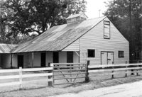
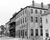
Boone Hall Plantation, Oak Avenue. Stable - View of SW (Front and Side) elevation. Mount Pleasant, S.C.;6.5" x 10" B/W photo. Box 10, Folder 2-2-5. One copy.
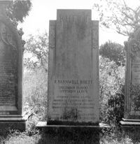
Magnolia Cemetery, Huguenin Avenue and Algonquin Road. Tombstone of R. Barnwell Rhett. View of ESE elevation. Charleston, S.C.;8" x 8" B/W photo. Box 5, Folder 2-1-3. One copy.
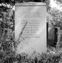
Magnolia Cemetery, Huguenin Avenue and Algonquin Road. Hunley Monument. View of North elevation. Charleston, S.C.;8" x 8" B/W photo. Box 5, Folder 2-1-3. One copy.
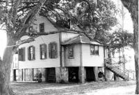
Oak Grove Plantation, Leadenwah Drive. View of NE (Side and Front) elevation. Wadmalaw Island, S.C.;8" x 10" B/W photo. Box 17, Folder 2-14-3. One copy.
Rockville Historic District - Morse-Fripp House (Stanley F. Morse House, Charles E. Fripp House), Sea Island Yacht Club Road. View of South (Front) elevation. Wadmalaw Island, S.C.;8" x 10" B/W photo. Box 17, Folder 2-14-11. One copy.
Rockville Historic District - Morse-Fripp House (Stanley F. Morse House, Charles E. Fripp House), Sea Island Yacht Club Road. View of South (Front) elevation. Wadmalaw Island, S.C.;8" x 10" B/W photo. Box 17, Folder 2-14-11. One copy.
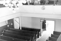
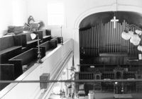
Rockville Historic District - Rockville Presbyterian Church, 2479 Sea Island Yacht Club Road. View of NW (Rear and Side) elevation. Wadmalaw Island, S.C.;6.5" x 10" B/W photo. Box 17, Folder 2-14-10. Two copies.
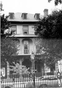
Rockville Historic District - Mary A. Whaley House, Maybank Highway. View of North (Front) elevation. Wadmalaw Island, S.C.;6.5" x 10" (and 8" x 10") B/W photo. Box 17, Folder 2-14-12. Two copies.
Rockville Historic District - Rockville Presbyterian Church, 2479 Sea Island Yacht Club Road. View of South (Front) elevation. Wadmalaw Island, S.C.;10" x 6.5" B/W photo. Box 17, Folder 2-14-10. One copy.
Edisto Island Baptist Church, S.C. Hwy. 174. View of NE (Front and Side) elevation. Edisto Island, S.C.;8" x 10" B/W photo. Box 10, Folder 2-3-6. One copy.
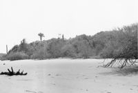
Folly Island Staging Area (Battery Green, U.S. Coast Guard Loran Station, Folly North Site), Address restricted. View facing WSW. Folly Beach, S.C.;8" x 10" B/W photo. Box 17, Folder 2-16-1. One copy.
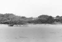
Folly Island Staging Area (Battery Green, U.S. Coast Guard Loran Station, Folly North Site), Address restricted. View facing NW. Folly Beach, S.C.;8" x 10" B/W photo. Box 17, Folder 2-16-1. One copy.
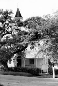
Mount Pleasant Presbyterian Church (Trinity Methodist Church, Hibben Methodist Church, Mount Pleasant Seventh Day Adventist Church), corner of Hibben and Bennet Streets. View of East (Front) elevation. Mount Pleasant, S.C.;10" x 6.5" B/W photo. Box 13, Folder 2-8-2. One copy.
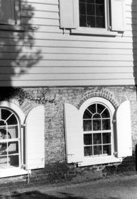
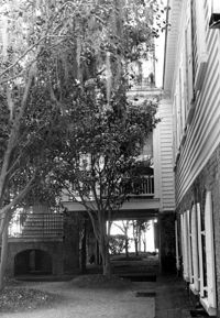
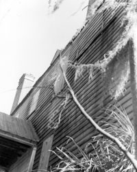
Arnoldus Vander Horst House (Kiawah House), Mansion Court. Detail View of clapboard, South (Front) elevation. Kiawah Island, S.C.;10" x 8" B/W photo. Box 12, Folder 2-6-1. One copy.
Arnoldus Vander Horst House (Kiawah House), Mansion Court. View of NW (Side and Rear) elevation. Kiawah Island, S.C.;10" x 6.5" B/W photo. Box 12, Folder 2-6-1. One copy.
Ashley Hall Plantation, address restricted. Indian Mound - View of Side elevation. Charleston, S.C.;8" x 10" B/W photo. Box 13, Folder 2-9-1. One copy.