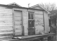
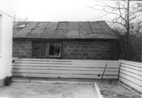
Wooden structure (shed or garage?) (rear view) on site affected by the construction of Interstate 26 (I-26). Address: 23 Jacobs Court. Surveyor notations on back of photo: "Dkt.: 10.517. Property owner: Furman G. Owens. Tract: 60-B. Station: 40+00 Lt. Northbound Lane, 5960+40 Lt. - Line 6. Date: March 5, 1963. In R/W - Bought." [See collection description for explanation of surveyor notations.]
Structures on site affected by the construction of Interstate 26 (I-26). Address: 20? Poinsett Street. Surveyor notations on back of photo: "Dkt.: 10.503. Property owner: B.W. Donnell, Est. Tract: 101. Station: 5921+00 Lt. Date: Feb. 20, 1963. In R/W - Bought." [See collection description for explanation of surveyor notations.]
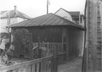
Structure (shed?) on site affected by the construction of Interstate 26 (I-26). Address: within the range of 20-32 Brigade Street. Surveyor notations on back of photo: "Dkt.: 10.503. Property owner: Gussie Feldman. Tract: 41. Station: 5903+92 Lt. Date: Feb. 19, 1963. In R/W - Bought." [See collection description for explanation of surveyor notations.]
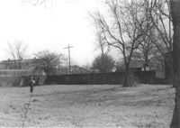
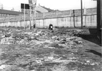
Lot on site affected by the construction of Interstate 26 (I-26). Address: 1204 King Street. Surveyor notations on back of photo: "Dkt.: 10.503. Property owner: Francis Hartnett. Tract: 24. Station: 5897+10 Rt. & Lt. Date: Feb. 19, 1963. In R/W - Bought." [See collection description for explanation of surveyor notations.]
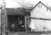
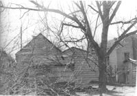
Structure on site affected by the construction of Interstate 26 (I-26). Address: 4 Maple Street. Surveyor notations on back of photo: "Dkt.: 10.503. Property owner: Frank Donnelly, et al. Tract: 48. Station: 5906+10 Lt. Date: Feb. 19, 1963. In R/W - Bought." [See collection description for explanation of surveyor notations.]
Lot on site affected by the construction of the Crosstown. Address: 1 Lee Street. Surveyor notations on back of photo: "Dkt.: 10.518. Property owner: Ada Hamilton. Tract: 67. Station: 52+05 Lt. N.B. lane Route 17. Date: Mar. 7, 1963." [See collection description for explanation of surveyor notations.]
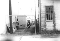
Lot between buildings, on site affected by the construction of Interstate 26 (I-26). Address: 35 Poinsett Street. Buses in background. Surveyor notations on back of photo: "Dkt.: 10.503. Property owner: S.C. Electric & Gas Co. [Tract number not indicated.] Station: 5922+50 Lt. Date: Feb. 20, 1963. Proximity." [See collection description for explanation of surveyor notations.]
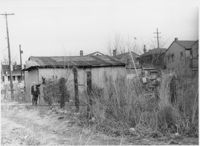
Structures (rear view) on site affected by the construction of Interstate 26 (I-26). Address: 18 Addison Street. Surveyor notations on back of photo: "Dkt.: 10.503. Property owner: Hessie Alston. Tract: 93. Station: 5918+75 Lt. Date: Feb. 20, 1963. In R/W - Bought." [See collection description for explanation of surveyor notations.]
Lot on site affected by the construction of the Crosstown. Address: 51 Aiken Street. Surveyor notations on back of photo: "Dkt.: 10.518. Property owner: Julia M. Pritchard. Tract: 52. Station: 46+50 Rt. N.B. lane Route 17. Date: Mar. 7, 1963. In R/W - Bought." [See collection description for explanation of surveyor notations.]
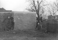
Part of a brick structure on lot, on site affected by the construction of Interstate 26 (I-26). Address: 1129 Meeting Street (rear). Surveyor notations on back of photo: "Dkt.: 10.503. Property owner: Coca Cola Bottling Co. Tract: 28. Station: 5899+05 Lt. Date: Feb. 19, 1963. Owner cleared R/W." [See collection description for explanation of surveyor notations.]