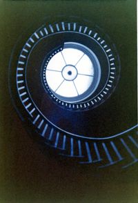
Lowndes Grove Plantation, 260 St. Margaret Street. Main House - Interior View. Detail of Flying Staircase, from ground, looking up. Charleston, S.C. NOTE: Print severely faded, color digitally restored.;5" x 3.5" Color photo. Box 8, Folder 2-1-148. One copy.
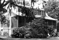
Lowndes Grove Plantation, 260 St. Margaret Street. Main House - View of 2nd Floor Porch, NW (Front and Side) elevation. Charleston, S.C. NOTE: Print severely faded, color digitally restored.;3.5" x 5" Color photo. Box 8, Folder 2-1-148. One copy.
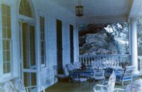
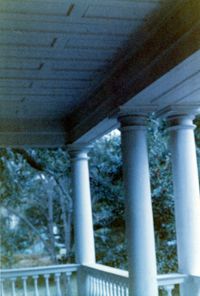
Lowndes Grove Plantation, 260 St. Margaret Street. Main House - Detail View of 2nd Floor Porch, SW elevation. Charleston, S.C. NOTE: Print severely faded, color digitally restored.;5" x 3.5" Color photo. Box 8, Folder 2-1-148. One copy.
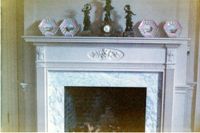
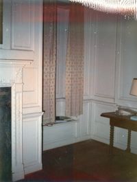
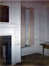
Lowndes Grove Plantation, 260 St. Margaret Street. Main House - Interior View. Detail of Mantle. Charleston, S.C. NOTE: Print severely faded, color digitally restored.;3.5" x 5" Color photo. Box 8, Folder 2-1-148. One copy.
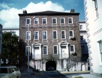
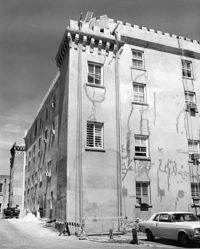
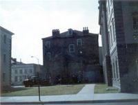
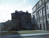
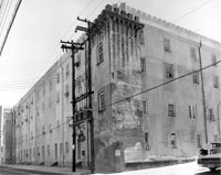
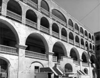
Old Citadel (South Carolina State Arsenal, Embassy Suites Hotel), 337 Meeting Street. View of SW (Front and Side) elevation. Charleston, S.C.;10" x 8" B/W photo. Box 5, Folder 2-1-5. One copy.
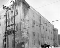
Old Citadel (South Carolina State Arsenal, Embassy Suites Hotel), 337 Meeting Street. View of NW (Side and Rear) elevation. Charleston, S.C.;8" x 10" B/W photo. Box 5, Folder 2-1-5. One copy.
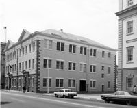
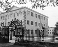
Charleston County Courthouse, 77 Meeting Street. View of NE (Side and Front) elevation. Charleston, S.C.;8" x 10" B/W photo. Box 5, Folder 2-1-8. One copy.
Old Citadel (South Carolina State Arsenal, Embassy Suites Hotel), 337 Meeting Street. View of NW (Side and Rear) elevation. Charleston, S.C.;8" x 10" B/W photo. Box 5, Folder 2-1-5. One copy.
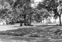
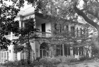
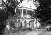
Lowndes Grove Plantation, 260 St. Margaret Street. Main House - View of SW (Side and Rear) elevation. Charleston, S.C.;6.5" x 10" B/W photo. Box 8, Folder 2-1-148. One copy.
Old Citadel (South Carolina State Arsenal, Embassy Suites Hotel), 337 Meeting Street. View of Interior Courtyard. Charleston, S.C.;8" x 10" B/W photo. Box 5, Folder 2-1-5. One copy.
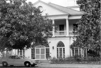
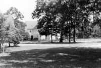
Lowndes Grove Plantation, 260 St. Margaret Street. Main House - View of North (Front) elevation. Charleston, S.C.;6.5" x 10" B/W photo. Box 8, Folder 2-1-148. One copy.
Charleston County Courthouse, 77 Meeting Street. View from Washington Square Park - NE (Front and Side) elevation. Charleston, S.C.;8" x 10" B/W photo. Box 5, Folder 2-1-8. One copy.
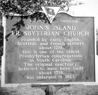
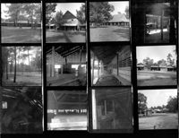
Johns Island Presbyterian Church, 2550 Bohicket Road. Church and Educational Building - View of Front and Side elevation (from street). Johns Island, S.C.;6.5" x 10" B/W photo. Box 12, Folder 2-5-4. One copy.
Johns Island Presbyterian Church, 2550 Bohicket Road. Church and Educational Building - View of Front and Side elevation (from street). Johns Island, S.C.;6.5" x 10" B/W photo. Box 12, Folder 2-5-4. One copy.
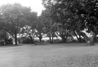
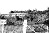
Lowndes Grove Plantation, 260 St. Margaret Street. View of Entry Gate and Ashley River, SW elevation. Charleston, S.C.;6.5" x 10" B/W photo. Box 8, Folder 2-1-148. One copy.
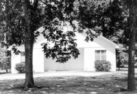
Johns Island Presbyterian Church, 2550 Bohicket Road. Education Building - Front elevation. Johns Island, S.C.;6.5" x 10" B/W photo. Box 12, Folder 2-5-4. One copy.
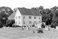
Johns Island Presbyterian Church, 2550 Bohicket Road. Cemetery and Church - Rear and Side elevation. Johns Island, S.C.;6.5" x 10" B/W photo. Box 12, Folder 2-5-4. One copy.
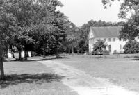
Johns Island Presbyterian Church, 2550 Bohicket Road. Education Building and Church - South elevation. Johns Island, S.C.;6.5" x 10" B/W photo. Box 12, Folder 2-5-4. One copy.
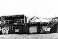
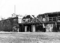
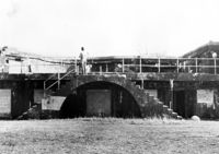
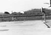
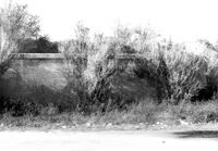
Battery Thomson, 2013 I'on Avenue. View of Armaments Section, North (Front) elevation. Sullivans Island, S.C.;6.5" x 10" B/W photo. Box 16, Folder 2-13-7. One copy.
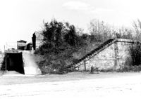
Battery Thomson, 2013 I'on Avenue. View of Gun Platform, North (Front) elevation. Sullivans Island, S.C.;6.5" x 10" B/W photo. Box 16, Folder 2-13-7. One copy.
Lowndes Grove Plantation, 260 St. Margaret Street. Main House - View of NW (Front and Side) elevation. Charleston, S.C.;6.5" x 10" B/W photo. Box 8, Folder 2-1-148. One copy.
Lowndes Grove Plantation, 260 St. Margaret Street. Main House - View of NE (Front and Side) elevation. Charleston, S.C.;6.5" x 10" B/W photo. Box 8, Folder 2-1-148. One copy.
Lowndes Grove Plantation, 260 St. Margaret Street. Kitchen House - View of North (Front) elevation. Charleston, S.C.;10" x 6.5" B/W photo. Box 8, Folder 2-1-148. One copy.
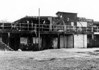
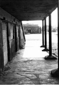
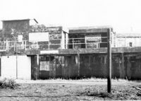
Battery Gadsden (Charleston County Public Library, Edgar Allen Poe Branch), 1921 I'on Avenue. View of East and Middle Wings, South (Rear) elevation. Sullivans Island, S.C.;6.5" x 10" B/W photo. Box 16, Folder 2-13-6. One copy.
Battery Gadsden (Charleston County Public Library, Edgar Allen Poe Branch), 1921 I'on Avenue. View of East Wing, South (Rear) elevation. Sullivans Island, S.C.;6.5" x 10" B/W photo. Box 16, Folder 2-13-6. One copy.
Battery Thomson, 2013 I'on Avenue. View of Observation Post, North (Front) elevation. Sullivans Island, S.C.;6.5" x 10" B/W photo. Box 16, Folder 2-13-7. One copy.
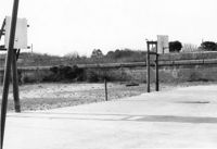
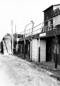
Battery Thomson, 2013 I'on Avenue. View of North (Front) elevation, looking West. Sullivans Island, S.C.;10" x 6.5" B/W photo. Box 16, Folder 2-13-7. One copy.
Battery Thomson, 2013 I'on Avenue. View of North (Front) elevation, looking East. Sullivans Island, S.C.;10" x 6.5" B/W photo. Box 16, Folder 2-13-7. One copy.
Battery Thomson, 2013 I'on Avenue. View of North (Front) elevation, looking West. Sullivans Island, S.C.;6.5" x 10" B/W photo. Box 16, Folder 2-13-7. One copy.
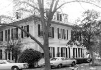
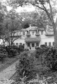
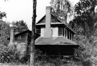
William Cain House - Main House. View of East (Side) elevation. Pinopolis Historic District North. Pinopolis, S.C.;6.5" x 9.5" B/W photo. Box 4, Folder 1-10-1 (III). One copy.