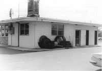
Rear (corner view) of building (a pizza restaurant), on site affected by the construction of Interstate 26 (I-26). Surveyor notations on back of photo: "Dkt.: 10.480. Property owner: G.S. Carter, Sr. Tract: 162. Station: 5679+50 Rt. Date: May 30, 1961. In R/W - Bought." [See collection description for explanation of surveyor notations.]
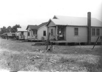
Three houses (rear view) on site affected by the construction of Interstate 26 (I-26). Surveyor notations on back of photo: "Dkt.: 10.480. Property owner: G.S. Carter, Sr. Tract: 162. Station: 5677+55 to 5678+75 Rt. & Lt. CL. Date: May 30, 1961. In R/W - Bought." [See collection description for explanation of surveyor notations.]
House on site affected by the construction of Interstate 26 (I-26). Building address number 31. Surveyor notations on back of photo: "Dkt.: 10.480. Property owner: John A. & Mrs. Sarah H. Meyer. Tract: 293. Station: 5747+85 Lt. Date: May 30, 1961. Proximity." [See collection description for explanation of surveyor notations.]
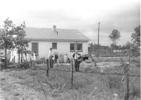
Backyard lot on site affected by the construction of Interstate 26 (I-26). House (corner view, rear) in background. Surveyor notations on back of photo: "Dkt.: 10.480. Property owner: Jennie B. Henson, et al. Tract: 73. Station: 5517+20 Rt. Date: May 2, 1961. Proximity." [See collection description for explanation of surveyor notations.]
Shed on site affected by the construction of Interstate 26 (I-26). Pepsi-Cola, Camel [cigarettes] signs on front. Surveyor notations on back of photo: "Dkt.: 10.480. Property owner: Central McMillan, et al. Tract: 38. Station: 5507+90 Rt. Date: May 2, 1961. In R/W - Bought." [See collection description for explanation of surveyor notations.]
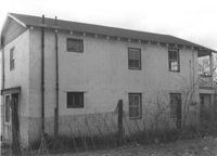
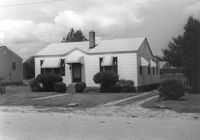
House (corner view, rear) on site affected by the construction of Interstate 26 (I-26). 7 Wood Street. Surveyor notations on back of photo: "Dkt.: 10.503. Property owner: Janie Washington. Tract: 34. Station: 5901+00 Lt. Date: Feb. 19, 1963. In R/W - Bought." [See collection description for explanation of surveyor notations.]
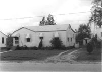
House on site affected by the construction of Interstate 26 (I-26). Building address number 213. Surveyor notations on back of photo: "Dkt.: 10.480. Property owner: J. Lester Goff. Tract: 143. Station: 5659+70 Rt. Date: May 2, 1961. In R/W - Bought." [See collection description for explanation of surveyor notations.]
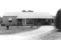
House on site affected by the construction of Interstate 26 (I-26). Garage/shed at end of driveway. Surveyor notations on back of photo: "Dkt.: 10.480. Property owner: C.W. Floyd. Tract: 136. Station: 5655+30 Rt. Date: May 2, 1961. In R/W - Bought." [See collection description for explanation of surveyor notations.]
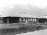
House on site affected by the construction of Interstate 26 (I-26). Building address number 25. Surveyor notations on back of photo: "Dkt.: 10.480. Property owner: Lynn C. Davis, et al. Tract: 155. Station: 5668+00 Rt. Date: In R/W - Bought." [See collection description for explanation of surveyor notations.]
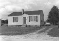
House on site affected by the construction of Interstate 26 (I-26). Building address number 215. Surveyor notations on back of photo: "Dkt.: 10.480. Property owner: W.G. Cox. Tract: 144. Station: 5660+00 Rt. Date: May 2, 1961. In R/W - Bought." [See collection description for explanation of surveyor notations.]
Limit your search
SCDOT Photographs: Properties in the Right-of-Way✖[remove]2,276