Search
« Previous |
201 - 210 of 1,158
|
Next »
Search Results
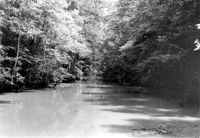
Date:
1976-06-06
Description:
Old Santee Canal. Moncks Corner, SC.;6.5" x 9.5" B/W photo. Box 2, Folder 1-8-2. One copy.
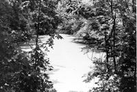
Date:
1976-06-06
Description:
Old Santee Canal. Moncks Corner, SC.;6.5" x 9.5" B/W photo. Box 2, Folder 1-8-2. One copy.
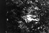
Date:
1976-06-06
Description:
Old Santee Canal. Moncks Corner, SC.;6.5" x 9.5" B/W photo. Box 2, Folder 1-8-2. One copy.
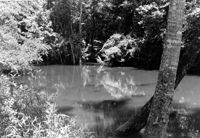
Date:
1976-06-06
Description:
Old Santee Canal. View of the canal beside the historical marker. Moncks Corner, SC.;6.5" x 9.5" B/W photo. Box 2, Folder 1-8-2. One copy.
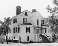
Date:
1971-05-25
Description:
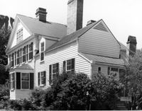
Gippy Plantation, Dairy Farm Road. View of North (Front) elevation. Moncks Corner, SC.;8" x 10" B/W photo. Box 2, Folder 1-8-4. One copy.
Date:
1971-05-25
Description:
Gippy Plantation, Dairy Farm Road. View of SW (Side and Rear) elevation. Moncks Corner, SC.;8" x 10" B/W photo. Box 2, Folder 1-8-4. One copy.
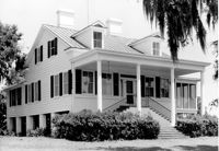
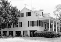
Date:
1971-05-24
Description:
Stony Landing Plantation, East of U.S. Hwy. 52 and Riverwood Drive, along the Cooper River. View of Front elevation. Moncks Corner, SC.;6.5" x 9.5" B/W photo. Box 2, Folder 1-8-5. One copy.
Date:
1971-05-24
Description:
Stony Landing Plantation, East of U.S. Hwy. 52 and Riverwood Drive, along the Cooper River. View of Side and Front elevation. Moncks Corner, SC.;6.5" x 9.5" B/W photo. Box 2, Folder 1-8-5. One copy.
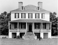
Date:
1971-05-25
Description:
Lewisfield Plantation, 444 Lewisfield Plantation Road. View of NW (Front) elevation. Moncks Corner, SC.;8" x 10" B/W photo. Box 2, Folder 1-8-6. One copy.
Date:
1971-05-25
Description:
Lewisfield Plantation, 444 Lewisfield Plantation Road. View of South (Rear and Side) elevation. Moncks Corner, SC.;8" x 10" B/W photo. Box 2, Folder 1-8-6. One copy.