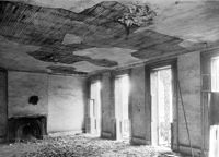
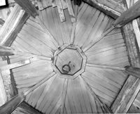
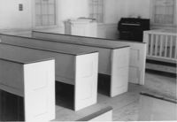
Dock Street Theater, 135 Church Street. Interior View - Ballroom. View before restoration, NE elevation. Charleston, S.C.;6.5" x 10" B/W photo. Box 6, Folder 2-1-32. One copy.
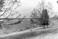
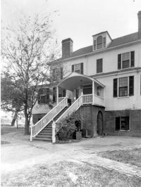
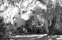
Marshlands Plantation, Fort Sumter Drive. Main House - View of NW (Rear and Side) elevation. James Island, S.C.;3" x 5" B/W photo. Box 11, Folder 2-4-3. One copy.
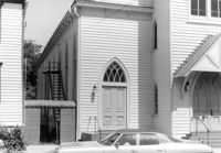
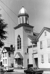
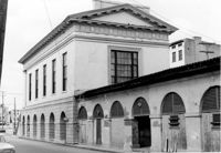
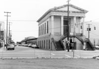
Central Baptist Church, 26 Radcliffe Street. View of SE (Side and Front) elevation. Charleston, S.C.;6.5" x 10" B/W photo. Box 9, Folder 2-1-156. One copy.
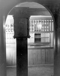
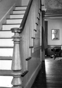
Seaside Plantation (Locksley Hall), off of Cypress Bottom Road. Interior View - 1st Floor, Front Hall. South elevation. Edisto Island, S.C.;5" x 7" B/W photo. Box 11, Folder 2-3-12. One copy.
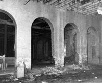
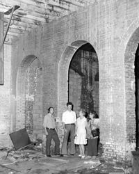
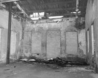
S.C. Railroad Car Shop (AAA Downtown Storage), 44 Line Street. Interior View showing damage to brick arches. Charleston, S.C.;8" x 10" B/W photo. Box 18, Folder: Charleston: 44 Line Street, South Carolina Car Shop. One copy.
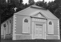
St. James Church, Goose Creek; Vestry Lane (off of Snake River Road, S.C. State Road 208). View of Front and Side elevation. Goose Creek, SC.;6.5" x 9.5" B/W photo. Box 2, Folder 1-5-1. One copy.
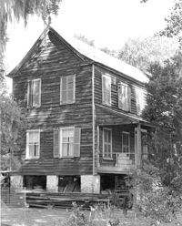
Marshlands Plantation, Fort Sumter Drive. Main House - View of NW (Rear) elevation. James Island, S.C.;10" x 8" B/W photo. Box 11, Folder 2-4-3. One copy.
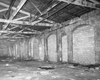
S.C. Railroad Car Shop (AAA Downtown Storage), 44 Line Street. Interior View. Charleston, S.C.;10" x 8" B/W photo. Box 18, Folder: Charleston: 44 Line Street, South Carolina Car Shop. Two copies.
S.C. Railroad Car Shop (AAA Downtown Storage), 44 Line Street. Interior View. Charleston, S.C.;8" x 10" B/W photo. Box 18, Folder: Charleston: 44 Line Street, South Carolina Car Shop. One copy.
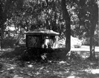
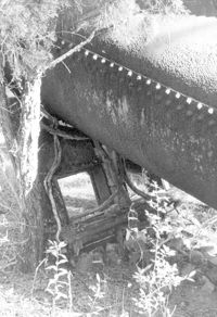
Fairlawn Plantation (Hugh Rose Plantation), Off of Guerins Bridge Road, adjacent to the Francis Marion National Forest. Detail View of Steam Engine for Rice Mill.;6.5" x 10" B/W photo. Box 19, Folder: Charleston County: Christ Church: Fairlawn Plantation. One copy.
Central Baptist Church, 26 Radcliffe Street. View of SW (Front and Side) elevation. Charleston, S.C.;10" x 6.5" B/W photo. Box 9, Folder 2-1-156. One copy.
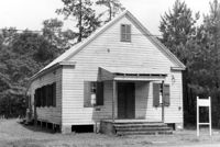
Old Lincolnville Town Hall (Williams Graded School), near intersection of East Randolph Street and East Pinckney Street. View of South (Front) elevation. Lincolnville, S.C.;6.5" x 10" B/W photo. Box 17, Folder 2-15-2. Two copies.
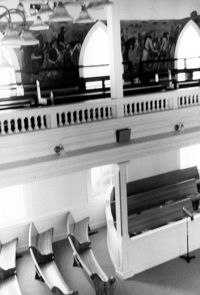
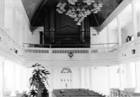
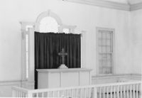
Central Baptist Church, 26 Radcliffe Street. Interior View - Balcony and Pews. NE (Rear and Side) elevation. Charleston, S.C.;10" x 6.5" B/W photo. Box 9, Folder 2-1-156. One copy.
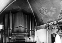
Central Baptist Church, 26 Radcliffe Street. Interior View - Organ and Side. NE (Rear and Side) elevation. Charleston, S.C.;6.5" x 10" B/W photo. Box 9, Folder 2-1-156. One copy.
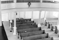
Central Baptist Church, 26 Radcliffe Street. Interior View - Side and Rear. NE (Rear and Side) elevation. Charleston, S.C.;10" x 6.5" B/W photo. Box 9, Folder 2-1-156. One copy.
S.C. Railroad Car Shop (AAA Downtown Storage), 44 Line Street. Interior View - Unidentified Detail. Charleston, S.C.;8" x 10" B/W photo. Box 18, Folder: Charleston: 44 Line Street, South Carolina Car Shop. One copy.
Carolus Drayton more commonly known as Charles Drayton I (1743-1820). Concerns day-to-day management of Drayton plantations, (particularly Drayton Hall and Jehossee), focusing on crops, livestock, labor, and the movement of these between estates.
"Plantation Book, Drayton Hall" describes the division of labor among slaves, crops grown, and provisions supplied to laborers, from January through June, 1844.
Church of the Redeemer (Pineville Chapel), Matilda Circle. Detail View of Window Sash and Shutter Dog - SE (Front) elevation. Pineville Historic District. Pineville, SC.;6.5" x 9.5" B/W photo. Box 3, Folder 1-9-1 (I). One copy.
Church of the Redeemer (Pineville Chapel), Matilda Circle. Interior View - Detail of Chancel. SSE (Front and Side) elevation. Pineville Historic District. Pineville, SC.;6.5" x 9.5" B/W photo. Box 3, Folder 1-9-1 (I). One copy.
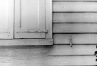
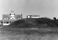
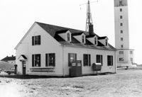
U.S. Coast Guard Historical District, I'on Avenue. Garage - View of South (Side) elevation. Sullivans Island, S.C.;6.5" x 10" (and 3.5" x 5") B/W photo. Box 16, Folder 2-13-1. Two copies.
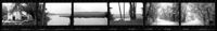
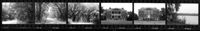
Ashley River Historic District (Highway 61 Historical District). Contact Sheet 6 - Views of Ashley Hall Plantation, Old St. Andrews Parish Church, and Ashley River Road. Charleston, S.C.;1" x 9" B/W photo. Box 20, Folder: Miscellaneous Photos: Scanned Contact Sheets. One copy.
U.S. Coast Guard Historical District, I'on Avenue. Bunker - View of South (Rear) elevation. Sullivans Island, S.C.;6.5" x 10" (and 3.5" x 5") B/W photo. Box 16, Folder 2-13-1. Two copies.
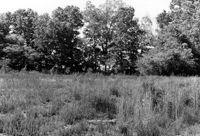
Stono River Rebellion Site (Cato's Rebellion Site), North Side of U.S. Highway 17, west of the Wallace River. View looking North. Hollywood, S.C.;6.5" x 10" B/W photo. Box 16, Folder 2-11-16. One copy.
Ashley River Historic District (Highway 61 Historical District). Contact Sheet 6 - Views of Drayton Hall and Ashley River Road. Charleston, S.C.;1" x 9" B/W photo. Box 20, Folder: Miscellaneous Photos: Scanned Contact Sheets. One copy.
Rockville Historic District - Julia Evelina Whaley House (Marc Tolbert House), Grace Chapel Road. View of SE (Side and Front) elevation. House destroyed by fire in 1984. Wadmalaw Island, S.C.;10" x 8" B/W photo. Box 20, Folder: Charleston County: Wadmalaw Island: Julia Evelina Whaley House. Five copies.
Church of the Redeemer (Pineville Chapel), Matilda Circle. Interior View - Detail of Column and Molding on Balcony. West (Rear) elevation. Pineville Historic District. Pineville, SC.;9.5" x 6.5" B/W photo. Box 3, Folder 1-9-1 (I). One copy.
U.S. Coast Guard Historical District, I'on Avenue. Garage - View of NE (Side and Rear) elevation. Sullivans Island, S.C.;6.5" x 10" (and 3.5" x 5") B/W photo. Box 16, Folder 2-13-1. Two copies.
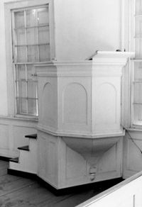
Church of the Redeemer (Pineville Chapel), Matilda Circle. Interior View - Detail of Pulpit. SSE (Front and Side) elevation. Pineville Historic District. Pineville, SC.;9.5" x 6.5" B/W photo. Box 3, Folder 1-9-1 (I). One copy.
Church of the Redeemer (Pineville Chapel), Matilda Circle. Interior View - Detail of Pews. NNE (Side and Rear) elevation. Pineville Historic District. Pineville, SC.;6.5" x 9.5" B/W photo. Box 3, Folder 1-9-1 (I). One copy.
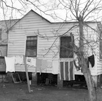
Unidentified House (ca. post-1922) - Contributory to Historic District. View of Front elevation. McClellanville Historic District. McClellanville, S.C.;6.5" x 10" B/W photo. Box 14, Folder 2-10-5. One copy.
Unidentified House (ca. post-1922) - Contributory to Historic District. View of Front elevation. McClellanville Historic District. McClellanville, S.C.;6.5" x 10" B/W photo. Box 14, Folder 2-10-5. One copy.
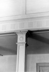
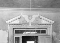
Barnwell House (Prospect Hill Plantation), Sugar Hill Road. Interior View - Detail of Architrave. Hollywood, S.C.;8" x 10" B/W photo. Box 16, Folder 2-11-5. One copy.
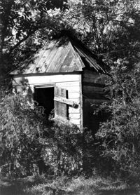
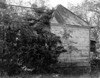
Barnwell House (Prospect Hill Plantation), Sugar Hill Road. Outbuilding - View of Side elevation. Hollywood, S.C.;10" x 8" B/W photo. Box 16, Folder 2-11-5. One copy.
Barnwell House (Prospect Hill Plantation), Sugar Hill Road. Outbuilding - View of Side elevation. Hollywood, S.C.;10" x 8" B/W photo. Box 16, Folder 2-11-5. One copy.
Barnwell House (Prospect Hill Plantation), Sugar Hill Road. Outbuilding - View of Side elevation. Hollywood, S.C.;8" x 10" B/W photo. Box 16, Folder 2-11-5. One copy.
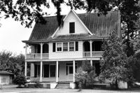
Sarah J. Stanland Graham House (ca. 1900), S. Pinckney Street. View of Front elevation. McClellanville Historic District. McClellanville, S.C.;6.5" x 10" B/W photo. Box 14, Folder 2-10-5. One copy.